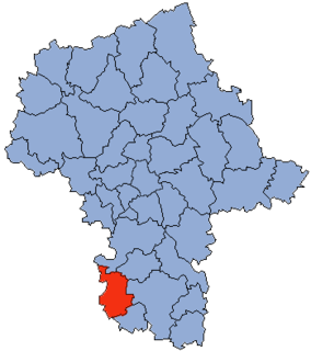
Gmina Przysucha is an urban-rural gmina in Przysucha County, Masovian Voivodeship, in east-central Poland. Its seat is the town of Przysucha, which lies approximately 98 kilometres (61 mi) south of Warsaw.
Gmina Przytyk is a rural gmina in Radom County, Masovian Voivodeship, in east-central Poland. Its seat is the village of Przytyk, which lies approximately 20 kilometres (12 mi) west of Radom and 84 km (52 mi) south of Warsaw.

Kaleń is a village in the administrative district of Gmina Wieniawa, within Przysucha County, Masovian Voivodeship, in east-central Poland. It lies approximately 6 kilometres (4 mi) north-east of Wieniawa, 17 km (11 mi) east of Przysucha, and 92 km (57 mi) south of Warsaw.

Kamień Mały is a village in the administrative district of Gmina Wieniawa, within Przysucha County, Masovian Voivodeship, in east-central Poland. It lies approximately 4 kilometres (2 mi) west of Wieniawa, 10 km (6 mi) east of Przysucha, and 95 km (59 mi) south of Warsaw.

Komorów is a village in the administrative district of Gmina Wieniawa, within Przysucha County, Masovian Voivodeship, in east-central Poland. It lies approximately 5 kilometres (3 mi) west of Wieniawa, 9 km (6 mi) east of Przysucha, and 95 km (59 mi) south of Warsaw.

Koryciska is a village in the administrative district of Gmina Wieniawa, within Przysucha County, Masovian Voivodeship, in east-central Poland. It lies approximately 3 kilometres (2 mi) south-east of Wieniawa, 16 km (10 mi) east of Przysucha, and 97 km (60 mi) south of Warsaw.

Romualdów is a village in the administrative district of Gmina Wieniawa, within Przysucha County, Masovian Voivodeship, in east-central Poland. It lies approximately 7 kilometres (4 mi) north-west of Wieniawa, 8 km (5 mi) north-east of Przysucha, and 93 km (58 mi) south of Warsaw.

Ryków is a village in the administrative district of Gmina Wieniawa, within Przysucha County, Masovian Voivodeship, in east-central Poland. It lies approximately 4 kilometres (2 mi) south of Wieniawa, 13 km (8 mi) east of Przysucha, and 100 km (62 mi) south of Warsaw.

Sokolniki Mokre is a village in the administrative district of Gmina Wieniawa, within Przysucha County, Masovian Voivodeship, in east-central Poland. It lies approximately 3 kilometres (2 mi) west of Wieniawa, 11 km (7 mi) east of Przysucha, and 96 km (60 mi) south of Warsaw.

Sokolniki Suche is a village in the administrative district of Gmina Wieniawa, within Przysucha County, Masovian Voivodeship, in east-central Poland. It lies approximately 3 kilometres (2 mi) north-west of Wieniawa, 12 km (7 mi) east of Przysucha, and 94 km (58 mi) south of Warsaw.

Wieniawa is a village in Przysucha County, Masovian Voivodeship, in east-central Poland. It is the seat of the gmina called Gmina Wieniawa. It lies approximately 13 kilometres (8 mi) east of Przysucha and 96 km (60 mi) south of Warsaw.

Zadąbrów is a village in the administrative district of Gmina Wieniawa, within Przysucha County, Masovian Voivodeship, in east-central Poland. It lies approximately 9 kilometres (6 mi) north-east of Wieniawa, 20 km (12 mi) east of Przysucha, and 90 km (56 mi) south of Warsaw.

Zagórze is a village in the administrative district of Gmina Wieniawa, within Przysucha County, Masovian Voivodeship, in east-central Poland. It lies approximately 6 kilometres (4 mi) north-west of Wieniawa, 9 km (6 mi) north-east of Przysucha, and 93 km (58 mi) south of Warsaw.

Żuków is a village in the administrative district of Gmina Wieniawa, within Przysucha County, Masovian Voivodeship, in east-central Poland. It lies approximately 4 kilometres (2 mi) south-west of Wieniawa, 10 km (6 mi) east of Przysucha, and 98 km (61 mi) south of Warsaw.

Plec is a village in the administrative district of Gmina Wieniawa, within Przysucha County, Masovian Voivodeship, in east-central Poland. It lies approximately 6 kilometres (4 mi) north of Wieniawa, 14 km (9 mi) north-east of Przysucha, and 90 km (56 mi) south of Warsaw.


