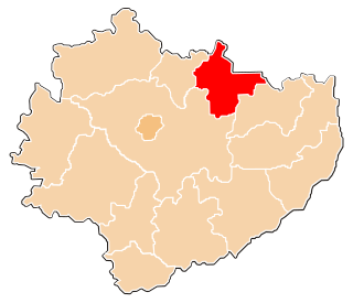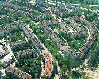
Starachowice County is a unit of territorial administration and local government (powiat) in Świętokrzyskie Voivodeship, south-central Poland. It came into being on January 1, 1999, as a result of the Polish local government reforms passed in 1998. Its administrative seat and largest town is Starachowice, which lies 37 kilometres (23 mi) north-east of the regional capital Kielce. The only other town in the county is Wąchock, lying 5 km (3 mi) north-west of Starachowice.

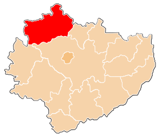
Końskie County is a unit of territorial administration and local government (powiat) in Świętokrzyskie Voivodeship, central Poland. It came into being on January 1, 1999, as a result of the Polish local government reforms passed in 1998. Its administrative seat and largest town is Końskie, which lies 38 kilometres (24 mi) north of the regional capital Kielce. The only other town in the county is Stąporków, lying 11 km (7 mi) south-east of Końskie.

Skarżysko County is a unit of territorial administration and local government (powiat) in Świętokrzyskie Voivodeship, south-central Poland. It came into being on January 1, 1999, as a result of the Polish local government reforms passed in 1998. Its administrative seat and largest town is Skarżysko-Kamienna, which lies 34 kilometres (21 mi) north-east of the regional capital Kielce. The only other town in the county is Suchedniów, lying 10 km (6 mi) south-west of Skarżysko-Kamienna.
Gmina Brześć Kujawski is an urban-rural gmina in Włocławek County, Kuyavian-Pomeranian Voivodeship, in north-central Poland. Its seat is the town of Brześć Kujawski, which lies approximately 12 kilometres (7 mi) south-west of Włocławek and 52 km (32 mi) south of Toruń.
Gmina Frampol is an urban-rural gmina in Biłgoraj County, Lublin Voivodeship, in eastern Poland. Its seat is the town of Frampol, which lies approximately 16 kilometres (10 mi) north of Biłgoraj and 64 km (40 mi) south of the regional capital Lublin.
Gmina Bychawa is an urban-rural gmina in Lublin County, Lublin Voivodeship, in eastern Poland. Its seat is the town of Bychawa, which lies approximately 26 kilometres (16 mi) south of the regional capital Lublin.
Gmina Warta is an urban-rural gmina in Sieradz County, Łódź Voivodeship, in central Poland. Its seat is the town of Warta, which lies approximately 14 kilometres (9 mi) north-west of Sieradz and 59 km (37 mi) west of the regional capital Łódź.
Gmina Szadek is an urban-rural gmina in Zduńska Wola County, Łódź Voivodeship, in central Poland. Its seat is the town of Szadek, which lies approximately 12 kilometres (7 mi) north of Zduńska Wola and 35 km (22 mi) west of the regional capital Łódź.
Gmina Niepołomice is an urban-rural gmina in Wieliczka County, Lesser Poland Voivodeship, in southern Poland. Its seat is the town of Niepołomice, which lies approximately 12 kilometres (7 mi) north-east of Wieliczka and 21 km (13 mi) east of the regional capital Kraków.
Gmina Warka is an urban-rural gmina in Grójec County, Masovian Voivodeship, in east-central Poland. Its seat is the town of Warka, which lies approximately 25 kilometres (16 mi) east of Grójec and 50 km (31 mi) south of Warsaw.
Gmina Wieniawa is a rural gmina in Przysucha County, Masovian Voivodeship, in east-central Poland. Its seat is the village of Wieniawa, which lies approximately 13 kilometres (8 mi) east of Przysucha and 96 km (60 mi) south of Warsaw.
Gmina Jastrząb is a rural gmina in Szydłowiec County, Masovian Voivodeship, in east-central Poland. Its seat is the village of Jastrząb, which lies approximately 8 kilometres (5 mi) east of Szydłowiec and 108 km (67 mi) south of Warsaw.
Gmina Mirów is a rural gmina in Szydłowiec County, Masovian Voivodeship, in east-central Poland. Its seat is the village of Mirów, which lies approximately 13 kilometres (8 mi) south-east of Szydłowiec and 115 km (71 mi) south of Warsaw.
Gmina Mielec is a rural gmina in Mielec County, Subcarpathian Voivodeship, in south-eastern Poland. Its seat is the town of Mielec, although the town is not part of the territory of the gmina.
Gmina Skarżysko Kościelne is a rural gmina in Skarżysko County, Świętokrzyskie Voivodeship, in south-central Poland. Its seat is the village of Skarżysko Kościelne, which lies approximately 3 kilometres (2 mi) north of Skarżysko-Kamienna and 36 km (22 mi) north-east of the regional capital Kielce.
Gmina Suchedniów is an urban-rural gmina in Skarżysko County, Świętokrzyskie Voivodeship, in south-central Poland. Its seat is the town of Suchedniów, which lies approximately 10 kilometres (6 mi) south-west of Skarżysko-Kamienna and 25 km (16 mi) north-east of the regional capital Kielce.
Gmina Wąchock is an urban-rural gmina in Starachowice County, Świętokrzyskie Voivodeship, in south-central Poland. Its seat is the town of Wąchock, which lies approximately 5 kilometres (3 mi) north-west of Starachowice and 35 km (22 mi) north-east of the regional capital Kielce.


