Related Research Articles

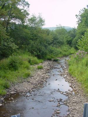
Pineia is a former municipality in Elis, West Greece, Greece. Since the 2011 local government reform it is part of the municipality Ilida, of which it is a municipal unit. The municipal unit has an area of 148.572 km2. Its seat of administration was in the village Simopoulo. Pineia is named after the river Pineios, which forms its northern border. The area is hilly and sparsely populated. It is about 20 km east of Amaliada, 25 km northeast of Pyrgos and 45 km southwest of Patras.
Kampos is a community in the municipal unit of Pineia, Elis, Greece. It is on the southeastern shore of the Pineios reservoir, 2 km northwest of Efyra, 4 km northeast of Keramidia, 7 km northwest of Simopoulo and 15 km northeast of Amaliada.

Foloi is a village and a former municipality in Elis, West Greece, Greece. Since the 2011 local government reform it is part of the municipality Archaia Olympia, of which it is a municipal unit. The municipal unit has an area of 174.202 km2. The seat of the municipality was in the village Lalas, in the southern part of the municipal unit. The village Foloi is situated in the northwestern part. Foloi is situated in a mountainous, sparsely populated area. The Foloi oak forest is located in the municipal unit. Foloi is located about 15 km northeast of Olympia, 30 km east of Pyrgos and 55 km south of Patras. It borders on Arcadia to the east, across the river Erymanthus.

Northern Manitoba is a geographic and cultural region of the Canadian province of Manitoba. Originally encompassing a small square around the Red River Colony, the province was extended north to the 60th parallel in 1912. The region's specific boundaries vary, as "northern" communities are considered to share certain social and geographic characteristics, regardless of latitude.
Grassy Lick Run is a 7.1-mile-long (11.4 km) tributary stream of the North River, itself a tributary of the Cacapon River, making it a part of the Potomac River and Chesapeake Bay watersheds. Grassy Lick Run flows south through the community of Kirby.

Amfilochia is a town and a municipality in the northwestern part of Aetolia-Acarnania in Greece, on the site of ancient Amfilochia. Under the Ottoman Empire, it was known as Karvasaras.

Pyllini is a former municipality in Aetolia-Acarnania, West Greece, Greece. Since the 2011 local government reform it is part of the municipality Nafpaktia, of which it is a municipal unit. The municipal unit has an area of 123.966 km2. Population 857 (2011). The seat of the municipality was in Simos.
Avia is a village and a former municipality in Messenia, Peloponnese, Greece. Since the 2011 local government reform it is part of the municipality West Mani, of which it is a municipal unit. The municipal unit has an area of 179.828 km2. In 2011 its population was 281 for the village, 611 for the community and 2,246 for the municipal unit. The seat of the municipality was in Kampos. Avia is a popular tourist destination. It also has a large olive production. Avia is situated on the east coast of the Messenian Gulf, southeast of Kalamata, southwest of Sparta and northwest of Kardamyli.
Dafni, part of the municipal unit of Tsotyli, is a small town located in the far west of the Kozani regional unit, itself in the Greek region of Macedonia.
Ragged Point Beach is an unincorporated community in Westmoreland County, in the U. S. state of Virginia.
Chmielniki is a village in the administrative district of Gmina Suchowola, within Sokółka County, Podlaskie Voivodeship, in north-eastern Poland. It lies approximately 9 kilometres (6 mi) north of Suchowola, 37 km (23 mi) north-west of Sokółka, and 60 km (37 mi) north of the regional capital Białystok.

Kandila is a village and a community in the municipal unit of Levidi, Arcadia, Greece. It is situated on the southern slope of the Oligyrtos mountain, at about 800 m elevation. In 2011, it had a population of 690 for the village and 714 for the community, which includes the village Diakopi. Kandila is near the tripoint of Arcadia, Corinthia and Argolis. It is 5 km southwest of Skoteini (Argolis), 12 km northeast of Levidi and 29 km north of Tripoli. The Greek National Road 66 passes through the village.

Villapizzone is a district ("quartiere") of Milan, Italy. It belongs to the Zone 8, located north of the city centre. It was an autonomous comune until 1869.
Baxter Preserve is an area of open space in North Salem, New York, United States. It consists of two segments, Baxter South and Baxter North. The preserve has become very popular in the region since being donated.
Cunningham is an unincorporated community in Fayette County, in the U.S. state of Ohio.
Klondike is an unincorporated community in southern St. Charles County, in the U.S. state of Missouri.

Bahçe station is a railway station in Turkey. It is located at 37°12′04″N36°34′42″E in Bahçe ilçe (district) of Osmaniye Province.
Kampos was a town of ancient Thrace, inhabited during Byzantine times.
Tom Corwin is an unincorporated community in Coal Township, Jackson County, Ohio, United States. It is located southwest of Wellston on Ohio State Route 788, at 39°05′56″N82°34′42″W.
References
- ↑ "Απογραφή Πληθυσμού - Κατοικιών 2011. ΜΟΝΙΜΟΣ Πληθυσμός" (in Greek). Hellenic Statistical Authority.
Coordinates: 37°34′42″N25°8′55″E / 37.57833°N 25.14861°E
| | This South Aegean location article is a stub. You can help Wikipedia by expanding it. |