Ramanathapuram, also known as Ramnad, is a town and a municipality in Ramanathapuram district in the Indian state of Tamil Nadu. It is the administrative headquarters of Ramanathapuram district and the second largest town in Ramanathapuram district.
Paramakudi, also Paramagudi, is the largest town in the district of Ramanathapuram in Tamil Nadu, with a population of over 95,579.
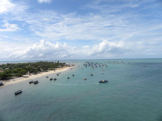
Ramanathapuram District, also known as Ramnad District, is one of the 38 districts an administrative districts of Tamil Nadu state in southern India. The old Ramanathapuram District consists of Present day Virudhunagar and Sivagangai districts, it touches the Western ghats and bordered with the state of Kerala and east by Bay of Bengal. It was the largest district on that time. The town of Ramanathapuram is the district headquarters. Ramanthapuram District has an area of 4,123 km2. It is bounded on the north by Sivaganga District, on the northeast by Pudukkottai District, on the east by the Palk Strait, on the south by the Gulf of Mannar, on the west by Thoothukudi District, and on the northwest by Virudhunagar District. The district contains the Pamban Bridge, an east–west chain of low islands and shallow reefs that extend between India and the island nation of Sri Lanka, and separate the Palk Strait from the Gulf of Mannar. The Palk Strait is navigable only by shallow-draft vessels. As of 2011, Ramanathapuram district had a population of 1,353,445 with a sex-ratio of 983 females for every 1,000 males. The district is home to the pilgrimage center of Rameswaram.
Manjur is a village in Bogalur block, Paramakudi Taluk, Ramanathapuram district, Tamil Nadu.
Ramanathapuram Lok Sabha constituency is one of the 39 Lok Sabha (parliamentary) constituencies in Tamil Nadu, a state in southern India.
Chitrangudi Bird Sanctuary locally known as "Chitrangudi Kanmoli" is a .4763 km2 (0.1839 sq mi) Protected area declared in 1989 and a part of Chitrangudi village, Mudukulathur Taluk, Ramanathapuram District, Tamil Nadu, India. It is adjacent to Kanjirankulam Bird Sanctuary. It is notable as a nesting site for several migratory heron species that roost in the prominent growth of Babul trees there. International name: Chitragudi and Kanjirankulam Bird Sanctuary, IBA Code: IN261, Criteria: A1, A4i. The sanctuary has been designated as a protected Ramsar site since 2021.

Erwadi is a village in Ramanathapuram District, Tamil Nadu, a state in South India. It belongs to Kilakarai Taluk and town panchayat. The village is the location of the grave and shrine of Qutbus Sultan Syed Ibrahim Shaheed Badusha, the previous ruler of Medina. Erwadi also belongs to Kadaladi assembly constituency, which is a part of Ramanathapuram. However, after the delimitations in 2009, Erwadi has been joined to the Ramanathapuram assembly constituency. Although a small town, Erwadi is the second largest contributor for the revenue of Ramanthapuram District.

Paramakudi is a state assembly constituency in Ramanathapuram district in Tamil Nadu. It is a Scheduled Caste reserved constituency. It is a component of Ramanathapuram Lok sabha constituency. It is one of the 234 State Legislative Assembly Constituencies in Tamil Nadu, in India.
Paramakudi taluk is a taluk of Ramanathapuram district of the Indian state of Tamil Nadu. See Paramakudi for more information.
Theriruveli is a village in the Ramanathapuram district of Tamil Nadu state in southern India. It is located near uthrakosamangai and belongs to the Mudukulathur Legislative Constituency. The economy is largely based on agriculture and sheep raising, and remittances from residents who have travelled abroad.
Muthuvijayapuram is a small village/hamlet located in Mudukulathur Block Ramanathapuram district of Tamil Nadu state in India. .It comes under Pirabakaloor Panchayat. It's located 25 km towards west from District headquarters Ramanathapuram.525 km from State capital chennai
Meesal is a village in the Mudukulathur taluk of Ramanathapuram district of Tamil Nadu, India.
Veeravanoor is a village in Ramanathapuram District in the Indian state of Tamil Nadu.
Paramakudi block is a revenue block in the Ramanathapuram district of Tamil Nadu, India. It has a total of 39 panchayat villages.
Parthibanur is a panchayath in Ramanathapuram district, Tamil Nadu in southern India belonging to Paramakudi Taluk, away from 61 km from Madurai and 54 km from District headquarters (Ramanathapuram). Parthibanur also belongs to Paramakudi Assembly constituency which is a part of Ramanathapuram. Although a small town, and it is located in the centre of the three main towns such as Paramakudi, Manamadurai and Kamuthi.
Appanur, is a village in the Kadaladi Taluk of Ramanathapuram District in Tamil Nadu, India. It is located between Mudukulathur and Sayalgudi, on the State Highway 29 (SH29).
Sathanur may refer to several places in India:
Konthagan Perungarai is a small village near Manamadurai Town [[Paramakudi taluk, Ramanathapuram District, Tamil Nadu|, India, Village principle occupation is agriculture. The village surrounding is approximately 2.5 km.1000 people live in the area. Students study at Paramakudi & Ramanathapuram &Parthibanur&Manamadurai & Sivagangai schools and colleges.
Parukkaikudi is a village in the Ramanathapuram district of the Indian state of Tamil Nadu.
Pirappan Valasai is a village in Mandapam block in Ramanathapuram District of Tamil Nadu, India.
