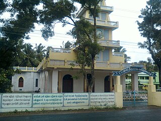
Puthunagaram is a town and gram panchayat in the Palakkad district, state of Kerala, India.

Athipattu is a census town in Chennai in Thiruvallur district in the state of Tamil Nadu, India. The neighbourhood is served by Athipattu railway station of the Chennai Suburban Railway network. it is a suburb in northern part of Chennai.

Bharveli is a census town in Balaghat district in the state of Madhya Pradesh, India.

Choornikkara is a census town in Aluva in Ernakulam District in Kerala, India.

Devarshola is a panchayat town in The Nilgiris district in the state of Tamil Nadu, India.

Dhampur is a city and a municipal board in Bijnor district in the state of Uttar Pradesh, India. It is located at 29.51°N 78.50°E, and lies in Northern India.

Dhariawad is a census town in Pratapgarh district (Rajasthan) in the state of Rajasthan, India. It is the administrative headquarters for Dhariawad Tehsil.

Ezhudesam is a town panchayat in Kanniyakumari district in the state of Tamil Nadu, India.

Ghorsala is a census town in Raghunathganj I CD Block in Jangipur subdivision of Murshidabad district in the Indian state of West Bengal.

Kallukoottam is a panchayat town in Kanniyakumari district in the Indian state of Tamil Nadu.

Nallur (Nalloor) is a panchayat town in Kanniyakumari district in the Indian state of Tamil Nadu.

Pappakurichi is a census town in Tiruchirappalli district in the Indian state of Tamil Nadu. It was merged with the Tiruchirappalli Corporation in 2011.

Paschim Punropara is a census town in Suti II CD Block in Jangipur subdivision of Murshidabad district in the Indian state of West Bengal.

Peerkankaranai is a neighborhood in Southern part of the metropolitan city of Chennai in the Indian state of Tamil Nadu.

Sayalgudi is a town panchayat in Ramanathapuram district of Tamil Nadu State in India.

Thevaram is a town in Theni district in the Indian state of Tamil Nadu. Thevaram is located in Tamil Nadu near on border of Kerala at the Eastern side foot-hill of the Western Ghats. It is connected with State Highway SH100.

Thiruporur is a panchayat town in Chengalpattu district in the Indian state of Tamil Nadu. The Thiruporur Kandaswamy temple is situated in the center of the town. There is a large temple tank in the vicinity of the temple. Thiruporur is located on Old Mahabalipuram Road and is flanked by Kelambakkam on one side and Alathur Pharmaceutical Industrial Estate on the other side, both of which are also on Old Mahabalipuram Road.

Jafarabad is a town and nagar panchayat in Jaunpur district in the Indian state of Uttar Pradesh.

Kangan is a town in Ganderbal district, of Jammu and Kashmir, India. It is one of the tehsils in Ganderbal District. It is situated across the Nallah Sindh and spread over a 50-km-long gorge valley, with population of 1,20,934 and literacy rate of 52.8% and sex ratio 868 per thousand males. It is one of the beautiful places surrounded by various picnic spots like Sonamarg and Naranag. It is believed that the place embraces its name with the fact that it is surrounded by mountains in all sides, gives it a ring shape, which is called in Hindi kangan.

Kerur is a City in Bagalkot district in Karnataka, which located on NH 218. It has an average elevation of 617 meters (2024 feet). It's a birthplace of Jagadish Shettar, a former Chief Minister of Karnataka. Kerur is a Town Panchayat city in district of Bagalkot, Karnataka. The Kerur city is divided into 16 wards for which elections are held every five years. The Kerur Town Panchayat has population of 19,731 of which 9,929 are males while 9,802 are females as per report released by Census India 2011.


