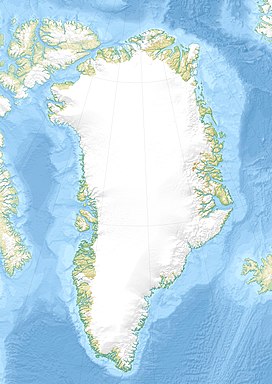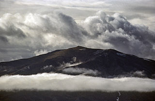
Andrée Land is a peninsula in King Christian X Land, East Greenland that is bounded by Kejser Franz Joseph Fjord, Isfjord and Geologfjord.
Nuussuaq Peninsula is a mainland peninsula in northwestern Greenland, located at the northern end of Upernavik Archipelago, approximately 70 km (43 mi) to the south of Melville Bay. It is much smaller than its namesake in western Greenland.
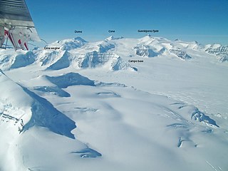
The Watkins Range is Greenland's highest mountain range. It is located in King Christian IX Land, Sermersooq municipality.
Napasorsuaq Fjord or Napasorsuup Kangerlua is a fjord of the King Frederick VI Coast in the Sermersooq municipality, southeastern Greenland.
Anorituup Kangerlua, also known as Anoritoq or Anortek Fjord, is a fjord in King Frederick VI Coast, southern Greenland.
Iluileq is a fjord in the King Frederick VI Coast, Kujalleq municipality, southern Greenland.
Kangerluluk, meaning 'the awful fjord', is a fjord in the King Frederick VI Coast, Kujalleq municipality, southern Greenland.
Avaqqat Kangerluat, also known as Avarqqat Kangerluat, Avaqqat Kangerlua and Puiagtoq Fjord, is a fjord in the King Frederick VI Coast, Kujalleq municipality, southern Greenland.
Igutsaat Fjord, also known as Igutsait Fjord, is a fjord in the King Frederick VI Coast, Kujalleq municipality, southern Greenland.
Sikuijivitteq, also known as Kangerdlugsuatsiak, is a fjord of the King Frederick VI Coast in the Kujalleq municipality, southeastern Greenland. The name 'Mogens Heinesen' is based on Magnus Heinason, a 16th-century Faroese naval hero.

Sehested Fjord ) is a fjord of the King Frederick VI Coast in the Sermersooq municipality, southeastern Greenland.

Mount Paatusoq, also known as 'Mount Patuersoq', is the highest mountain in the Kujalleq municipality, SE Greenland.

Odinland, also Odinsland in the Defense Mapping Agency Greenland Navigation charts, is a peninsula in the King Frederick VI Coast, southeastern Greenland. It is a part of the Sermersooq municipality.

The Lemon Range or Lemon Mountains is a mountain range in King Christian IX Land, eastern Greenland. Administratively this range is part of the Sermersooq Municipality.
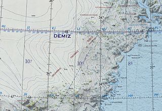
The Crown Prince Frederik Range is a large mountain range in King Christian IX Land, eastern Greenland. Administratively this range is part of the Sermersooq Municipality.
The Graah Mountains are a mountain range in southeastern Greenland. Administratively this range is part of the Kujalleq municipality.

The Lilloise Range or Lilloise Mountains is a mountain range in King Christian IX Land, eastern Greenland. Administratively this range is part of the Sermersooq Municipality.

The Daly Range or Daly Mountains is a mountain range in Peary Land, Northern Greenland. Administratively this range is part of the Northeast Greenland National Park.
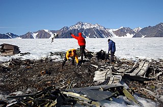
The Wiedemann Range is a mountain range in King Christian IX Land, eastern Greenland. Administratively this range is part of the Sermersooq Municipality.
