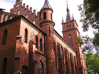
Bojary is a village in the administrative district of Gmina Podedwórze, within Parczew County, Lublin Voivodeship, in eastern Poland. It lies approximately 5 kilometres (3 mi) east of Podedwórze, 29 km (18 mi) east of Parczew, and 68 km (42 mi) north-east of the regional capital Lublin.

Grabówka is a village in the administrative district of Gmina Podedwórze, within Parczew County, Lublin Voivodeship, in eastern Poland. It lies approximately 5 kilometres (3 mi) east of Podedwórze, 29 km (18 mi) east of Parczew, and 69 km (43 mi) north-east of the regional capital Lublin.

Hołowno is a village in the administrative district of Gmina Podedwórze, within Parczew County, Lublin Voivodeship, in eastern Poland. It lies approximately 5 kilometres (3 mi) south of Podedwórze, 24 km (15 mi) east of Parczew, and 63 km (39 mi) north-east of the regional capital Lublin.

Mosty is a village in the administrative district of Gmina Podedwórze, within Parczew County, Lublin Voivodeship, in eastern Poland. It lies approximately 7 kilometres (4 mi) south-east of Podedwórze, 29 km (18 mi) east of Parczew, and 67 km (42 mi) north-east of the regional capital Lublin.

Opole is a village in the administrative district of Gmina Podedwórze, within Parczew County, Lublin Voivodeship, in eastern Poland. It lies approximately 2 kilometres (1 mi) east of Podedwórze, 26 km (16 mi) east of Parczew, and 67 km (42 mi) north-east of the regional capital Lublin.

Podedwórze is a village in Parczew County, Lublin Voivodeship, in eastern Poland. It is the seat of the gmina called Gmina Podedwórze. It lies approximately 24 kilometres (15 mi) east of Parczew and 66 km (41 mi) north-east of the regional capital Lublin.

Rusiły is a village in the administrative district of Gmina Podedwórze, within Parczew County, Lublin Voivodeship, in eastern Poland. It lies approximately 2 kilometres (1 mi) north-east of Podedwórze, 26 km (16 mi) east of Parczew, and 68 km (42 mi) north-east of the regional capital Lublin.

Zaliszcze is a village in the administrative district of Gmina Podedwórze, within Parczew County, Lublin Voivodeship, in eastern Poland. It lies approximately 6 kilometres (4 mi) south-west of Podedwórze, 20 km (12 mi) east of Parczew, and 61 km (38 mi) north-east of the regional capital Lublin.

Antopol is a village in the administrative district of Gmina Podedwórze, within Parczew County, Lublin Voivodeship, in eastern Poland. It lies approximately 5 kilometres (3 mi) south-east of Podedwórze, 26 km (16 mi) east of Parczew, and 65 km (40 mi) north-east of the regional capital Lublin.

Piechy is a village in the administrative district of Gmina Podedwórze, within Parczew County, Lublin Voivodeship, in eastern Poland. It lies approximately 4 kilometres (2 mi) south-east of Podedwórze, 27 km (17 mi) east of Parczew, and 67 km (42 mi) north-east of the regional capital Lublin.

Gmina Jabłoń is a rural gmina in Parczew County, Lublin Voivodeship, in eastern Poland. Its seat is the village of Jabłoń, which lies approximately 18 kilometres (11 mi) north-east of Parczew and 63 km (39 mi) north-east of the regional capital Lublin.

Gmina Dębowa Kłoda is a rural gmina in Parczew County, Lublin Voivodeship, in eastern Poland. Its seat is the village of Dębowa Kłoda, which lies approximately 12 kilometres (7 mi) east of Parczew and 50 km (31 mi) north-east of the regional capital Lublin.

Bednarzówka is a village in the administrative district of Gmina Dębowa Kłoda, within Parczew County, Lublin Voivodeship, in eastern Poland. It lies approximately 3 kilometres (2 mi) north-east of Dębowa Kłoda, 13 km (8 mi) east of Parczew, and 53 km (33 mi) north-east of the regional capital Lublin.

Kodeniec is a village in the administrative district of Gmina Dębowa Kłoda, within Parczew County, Lublin Voivodeship, in eastern Poland. It lies approximately 8 kilometres (5 mi) east of Dębowa Kłoda, 19 km (12 mi) east of Parczew, and 56 km (35 mi) north-east of the regional capital Lublin.

Lubiczyn is a village in the administrative district of Gmina Dębowa Kłoda, within Parczew County, Lublin Voivodeship, in eastern Poland. It lies approximately 5 kilometres (3 mi) east of Dębowa Kłoda, 16 km (10 mi) east of Parczew, and 55 km (34 mi) north-east of the regional capital Lublin.

Pachole is a village in the administrative district of Gmina Dębowa Kłoda, within Parczew County, Lublin Voivodeship, in eastern Poland. It lies approximately 8 kilometres (5 mi) north-east of Dębowa Kłoda, 18 km (11 mi) east of Parczew, and 58 km (36 mi) north-east of the regional capital Lublin.

Żmiarki is a village in the administrative district of Gmina Dębowa Kłoda, within Parczew County, Lublin Voivodeship, in eastern Poland. It lies approximately 12 km (7 mi) east of Parczew and 50 km (31 mi) north-east of the regional capital Lublin.

Zaniówka is a village in the administrative district of Gmina Parczew, within Parczew County, Lublin Voivodeship, in eastern Poland. It lies approximately 10 kilometres (6 mi) east of Parczew and 56 km (35 mi) north-east of the regional capital Lublin.

Nowe Mosty is a village in the administrative district of Gmina Podedwórze, within Parczew County, Lublin Voivodeship, in eastern Poland. It lies approximately 7 kilometres (4 mi) south-east of Podedwórze, 30 km (19 mi) east of Parczew, and 68 km (42 mi) north-east of the regional capital Lublin.


