
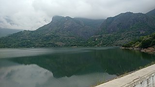
Coimbatore, also known as Kovai or Covai, is one of the major metropolitan cities in the Indian state of Tamil Nadu. It is located on the banks of the Noyyal River and surrounded by the Western Ghats. Coimbatore is the second largest city in Tamil Nadu after Chennai and the 16th largest urban agglomeration in India as per the census 2011. It is administered by the Coimbatore Municipal Corporation and is the administrative capital of Coimbatore District. In 1981 Coimbatore formed as third municipal corporation in Tamil Nadu after Chennai and Madurai. Podanur Junction is the oldest Railway station in Coimbatore City. The city is one of the largest exporters of Jewellery, Wet grinders, Poultry and Auto Components; the "Coimbatore Wet Grinder" and the "Kovai Cora Cotton" are recognised as Geographical Indications by the Government of India. Being a hub of textile industry in South India, the city is sometimes referred to as the "Manchester of South India". It was ranked the 7th best city in India in the Ease of Living index 2020.

Erode District is one of the 38 districts in the state of Tamil Nadu in India. It was the largest district by area in the state before the formation of Tirupur District in 2009. The headquarters of the district is Erode. It is divided into two revenue divisions, Erode and Gobichettipalayam, and is further subdivided into 10 taluks. Erode District was a part of Coimbatore District before its division into two on 17 September 1979. It covers an area of 5,722 square kilometres (2,209 sq mi), and as of 2011, had a population of 2,251,744.

Park College of Engineering and Technology is a college of engineering situated in Kaniyur, 15 kilometres (9.3 mi) from the Coimbatore International Airport, in Tamil Nadu, India. It is affiliated to Anna University, Chennai, which is the top 5th university of India and approved by All India Council for Technical Education. The college has been accorded ISO 9002 Certificate.

Palani (Tamil: [paɻani], is a town and a taluk headquarters in Dindigul district of the western part of Tamil Nadu state in India. It is located about 106 kilometres south-east of Coimbatore and 122 kilometres north-west of Madurai, 67 kilometres from Kodaikanal. The Palani Murugan Temple or Arulmigu Dhandayuthapani Swamy Temple, dedicated to Lord Murugan is situated on a hill overlooking the town. The temple is visited by more than 7 million pilgrims each year. As of 2011, the town had a population of 126,751 which makes it the second largest town in the district after Dindigul.

Coimbatore district is one of the 38 districts in the state of Tamil Nadu in India. Coimbatore is the administrative headquarters of the district. It is one of the most industrialized districts and a major textile, industrial, commercial, educational, information technology, healthcare and manufacturing hub of Tamil Nadu. The region is bounded by Tiruppur district in the east, Nilgiris district in the north, Erode district in the north-east, Palakkad district, Idukki district and small parts of Thrissur district and Ernakulam district of neighboring state of Kerala in the west and south respectively. As of 2011, Coimbatore district had a population of 3,458,045 with a sex-ratio of 1,000 and literacy rate of 84%.
Pollachi is a town and a taluk headquarters in Coimbatore district, Tamil Nadu state, India. Located about 40 km to the south of Coimbatore, it is the second largest town in the district after Coimbatore. Pollachi is a popular Marketplace for jaggery, vegetables and cattle. As of 2011, the town had a population of 90,180.

Annur is a town panchayat and taluk headquarters of Annur Taluk of coimbatore district. It is a suburb of Coimbatore city located north-east about 30 kilometres from the center of the city. Nearest airport is Coimbatore International Airport, which is about 27 kilometres and the nearest railway station is Mettupalayam, which is about 21 kilometres away. Other cities/towns nearby Annur are Mettupalayam, which is 21 kilometres away in the west, Avanashi, which is 18 kilometres away in the east and Punjai Puliampatti, which is about 18 kilometres in the north. Annur has police station with Karumathampatti sub division.

Dharapuram officially Tharaapuram is a town in Tirupur district in the Indian state of Tamil Nadu. Dharapuram is one of the oldest towns in Tamil Nadu and was the capital of Kongu Nadu under the Cheras, Western Ganga Dynasty and later Kongu Cholas, at which time it was known as Vanchipuri. Amaravathi River flows through the town. As of 2011, the town had a population of 67,007. Dharapuram Municipality is promoted 1st grade municipality on 6 May 1983 Dharapuram was Part of Coimbatore district in the beginning and later it moves to Erode district up to 2009. Dharapuram Town is situated along the banks of River Amaravathi, located in between 10 degree 45 minutes northern latitude and 77 degree 31 minutes eastern latitude with an extent of 7.02 km2. It is a small agricultural marketing centre for a large rural hinterland in the Tirupur District. The town is 50 km towards of the District Headquarters Tirupur, 75 km towards the Erode and 72 km towards the industrial town Coimbatore. The nearest airport is Coimbatore International Airport located 70 km from Dharapuram. Dharapuram was the capital of Noyyal South District before the formation of Coimbatore District.

Oddanchatram is a town in Dindigul district in the Indian state of Tamil Nadu. Oddanchatram is a region in the southwest of Tamil Nadu. The Town was carved out of Madurai District in 1985. Oddanchatram is also famous for vegetable and cattle market. As of 2011, the town had a population of 30,064. It is known as vegetable city of Tamil Nadu. Oddanchatram vegetable market is the largest supplying of vegetables in Tamilnadu and Kerala. Agriculture is the major economic support for the town.
Karumathampatti is a Municipality in the Coimbatore district in the state of Tamil Nadu, India. It is one of the most developing suburb in Coimbatore about 25 km away from the city centre. It is situated in between NH544 which connects the city of Coimbatore with Salem – Erode – Tirupur and also in between the State Highway 165 connects Annur – Kamanaikenpalayam. Nearby places are Somanur-3 km, Avinashi-10 km, Tirupur-20 km, Sulur-15 km, Annur-16 km. Coimbatore -27,Mettupalayam-38,Palladam-19. Karumathampatti lies near the junction of two major roads, NH544(Coimbatore – Salem) and Karumathampatti – Annur road.
Mettupalayam is a town in the Coimbatore district in the Indian state of Tamil Nadu. Mettupalayam is the second largest town in the Coimbatore District. Mettupalayam is located to the North of the Coimbatore city on the way to Ooty. Mettupalayam is located in the foothills of Nilgiri hills. Situated at North of Coimbatore and South of Ooty. As of 2011, the town had a population of 66,595. It is gateway for the Nilgiri ghats from South. Mettupalayam Railway Station only Railway Station still operates Steam Engine Train from Mettupalayam to Ooty.

Udumalai, also known as Udumalaipettai and Udumalpet, is a town in Tiruppur district in the Indian state of Tamil Nadu. Udumalaipettai is located 535 km south west from the state capital, Chennai and 72 km away from Coimbatore, the second largest city in the state.
Kaniyur is a suburb of palani which is also a town panchayat in Tirupur District in the Indian state of Tamil Nadu. Kaniyur is also called Dravida Iyakkathin Thotti. It is one of the 'K' villages located near to [Udmelpettai].
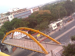
Peelamedu is a major commercial centre and residential locality in the Eastern part of the city of Coimbatore in Tamil Nadu, India. It is governed by Coimbatore City Municipal Corporation since 1981. The growth of Peelamedu during the last decade can be cited due to the growth of the IT sector in Coimbatore. The rapid growth of Peelamedu as a commercial and residential hub could be attributed to its geographical advantage in terms of the connectivity to other parts of the city. It acts as an important hub connecting the rapidly growing business class Information Technology corridor. The Peelamedu area stretches from Nava India to the Coimbatore International Airport near SITRA, encompassing major educational institutions, hospitals, and Industries.

Tiruppur District is one of the 38 districts of the Indian state of Tamil Nadu, formed in 22 February 2009. Dharapuram was the largest taluk by area in the district. The district is well-developed and industrialized. The Tiruppur banian industry, the cotton market, Kangeyam bull and Uthukkuli butter, among other things, provide for a vibrant economy. The city of Tiruppur is the administrative headquarters for the district. As of 2011, the district had a population of 2,479,052 with a sex-ratio of 989 females for every 1,000 males.
K. A. Mathiazhagan was an Indian politician and Co-Founder of the Dravida Munnetra Kazhagam (DMK). He served as the Finance Minister, Minister of Food, Revenue and Commercial Taxes in the Tamil Nadu government and Speaker of the Tamil Nadu Legislative Assembly.
Sulur taluk is a taluk of Coimbatore district of the Indian state of Tamil Nadu. The headquarters is the town of Sulur. This revenue block consist of 41 revenue villages.
Malumichampatti is a residential village in the Coimbatore-South taluk, Coimbatore district, Tamil Nadu, India. It is along the National Highway 209. It is a village panchayat and belongs to Kinathukadavu Legislative constituency.
Townhall is the core part of the city of Coimbatore in Tamil Nadu, India. It is the largest and the major commercial hub in the city with locations such as Oppanakara Street, Raja Street, Ukkadam, VH Road and NH Road. The locality derives its name from the Victoria Town Hall, Coimbatore. It is centrally located in the city.
Somayampalayam is a census town and a suburb in Coimbatore district in the Indian state of Tamil Nadu.

