
The Harz is a highland area in northern Germany. It has the highest elevations for that region, and its rugged terrain extends across parts of Lower Saxony, Saxony-Anhalt, and Thuringia. The name Harz derives from the Middle High German word Hardt or Hart. The name Hercynia derives from a Celtic name and could refer to other mountain forests, but has also been applied to the geology of the Harz. The Brocken is the highest summit in the Harz with an elevation of 1,141.1 metres (3,744 ft) above sea level. The Wurmberg is the highest peak located entirely within the state of Lower Saxony.
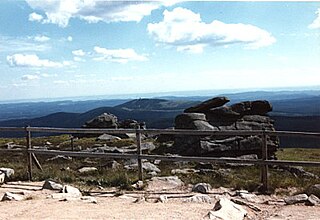
Harz National Park is a nature reserve in the German federal states of Lower Saxony and Saxony-Anhalt. It comprises portions of the western Harz mountain range, extending from Herzberg and Bad Lauterberg at the southern edge to Bad Harzburg and Ilsenburg on the northern slopes. 95% of the area is covered with forests, mainly with spruce and beech woods, including several bogs, granite rocks and creeks. The park is part of the Natura 2000 network of the European Union.

The Wurmberg Gondola Lift is a monocable gondola lift with a length of 1.7 miles (2.7 km), built in 1963, leading from the Braunlage tourist resort within the Harz mountain range on the top of the 3,185 feet (971 m) high Wurmberg mountain.
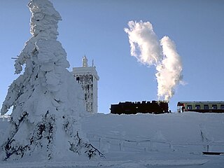
The Brocken Railway is one of three tourist metre gauge railways which together with the Harz Railway and Selke Valley Railway form the Harz Narrow Gauge Railways railway network in the Harz mountain range of Germany.
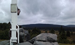
The Langenberg rises on the state border between North Rhine-Westphalia and Hesse in Germany and, at 843.2 m above sea level (NN), is the highest peak in the Rothaar mountain range, as well as the highest point in the North Rhine-Westphalia and also in the north of Germany outside the Harz Mountains.

The Zeterklippen are a striking rock formation or tor on the 930-metre-high Renneckenberg mountain, overlooking the Ilse valley in the Harz mountains in Germany. The Renneckenberg is an eastern sub-peak of the Brocken. The rocks themselves lie at a height of about 830 metres (2,720 ft) above sea level. They can be reached from the Molkenhausstern after about 2.5 km. The track initially runs uphill through dense spruce forest until the view opens out towards the Hohnekamm and down to Wernigerode. Then the route branches off to the right onto a steep, 0.5 km, path and, after about 200 m, a gentler 0.4 km path leads to the Große Zeterklippe. Immediately below this highest of the rocks is a mountain hut that dates to the time when a botanical garden had been laid out here as a replacement for the inaccessible Brockengarten.

The Heinrichshöhe is a subsidiary peak of the highest mountain in the Harz, the Brocken, and, at 1,040 m above NN, it is the second summit in the Harz Mountains.

The Schalke is a mountain, 762 m above sea level (NN), in the Upper Harz in the German state of Lower Saxony. It lies in Goslar district north of Clausthal-Zellerfeld and west of Schulenberg.

The Kahle Klippe is a rock formation in the High Harz in central Germany on the eastern slope of the Brocken above the valley of the Ecker.
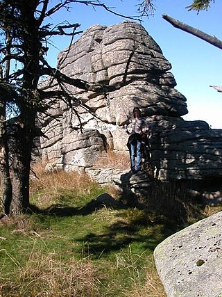
The Hirschhorn Rocks are a natural monument in the Harz National Park in central Germany.
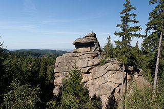
The Ottofels, named after Prince Otto of Stolberg-Wernigerode, is a tor and natural monument near Wernigerode in the Harz mountains of central Germany.
The Braakberg is a 645.5 metre high mountain in the Harz in central Germany, in the unincorporated area of Harz in the district of Göttingen in the state of Lower Saxony.

The Bremen Hut in the Harz Mountains is a refuge hut and shelter in that part of the Harz National Park lying within the borough of Ilsenburg (Harz) in Harz district in the German state of Saxony-Anhalt.

The Ilsestein is a prominent granite rock formation near the town of Ilsenburg in the Harz mountains of central Germany. Offering a scenic view over the Ilse valley to the Brocken massif, the highest mountain of the range, it is today a popular tourist destination.
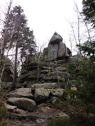
The Ahrensklint or Ahrentsklint in the Harz Mountains is a granite rock formation, 822.4 m above sea level (NN), on the Erdbeerkopf in Harz district in the German state of Saxony-Anhalt.
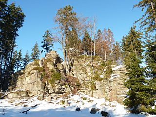
The Scherstorklippen is a granite tor in the Harz Mountains of central Germany. It is located near the village of Schierke in the county of Harz in the state of Saxony-Anhalt. It was formed by the process of spheroidal weathering.
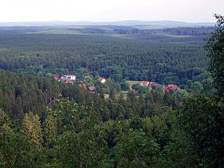
The Barenberg, also called the Bärenberg or Bärenkopf, is a mountain, 695.5 m above sea level (NN), in the Harz Mountains of Germany near the village of Schierke, Harz county, in the state of Saxony-Anhalt.
The Kapitelsberg in the Harz Mountains of Germany is a hill, 535.7 m above sea level (NN), near the village of Tanne in the county of Harz, Saxony-Anhalt.
The Heibeeksköpfe in the Harz Mountains of central Germany are a double summit with a maximum height of 465.2 m above sea level (NN), near Bad Lauterberg in the unincorporated area of Harz in the district of Göttingen in Lower Saxony.
The Dehnenkopf in the Harz Mountains of central Germany is a summit about 775 m above sea level (NN) near Torfhaus in the unincorporated area of Harz in the county of Goslar in Lower Saxony.


