The Kyrgyz people are a Turkic ethnic group native to Central Asia, primarily Kyrgyzstan.

Karakol, formerly Przhevalsk, is the fourth largest city in Kyrgyzstan, near the eastern tip of Lake Issyk-Kul in Kyrgyzstan, about 150 kilometres (93 mi) from the Kyrgyzstan-China border and 380 kilometres (240 mi) from the capital Bishkek. It is the administrative capital of Issyk-Kul Region. Its area is 44 square kilometres (17 sq mi), and its resident population was 66,294 in 2009. To the north, on highway A363, is Tyup and to the southwest Jeti-Ögüz resort.

Issyk-Kul is an endorheic lake in the northern Tian Shan mountains in eastern Kyrgyzstan. It is the seventh deepest lake in the world, the tenth largest lake in the world by volume, and the second largest saline lake after the Caspian Sea. Issyk-Kul means "warm lake" in the Kyrgyz language; although it is surrounded by snow-capped peaks, it never freezes.

Torugart Pass is a mountain pass in the Tian Shan mountain range near the border between the Naryn Province of Kyrgyzstan and the Xinjiang Autonomous Region of China. It is one of two border crossings between Kyrgyzstan and China, the other being Irkeshtam, some 165 km (103 mi) to the southwest.
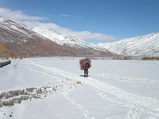
Wakhan or "the Wakhan" is a rugged, mountainous part of the Pamir, Hindu Kush and Karakoram regions of Afghanistan. Wakhan District is a district in Badakshan Province.

The Chu is a river in northern Kyrgyzstan and southern Kazakhstan. Of its total length of approximately 1 067 kilometres, the first 115 kilometres are in Kyrgyzystan, then for 221 kilometres the river is the border between Kyrgyzystan and Kazakhstan, and the last 731 kilometres are in Kazakhstan. It is one of the longest rivers in Kyrgyzstan and in Kazakhstan.

Balykchy is a town at the western end of Lake Issyk-Kul in Kyrgyzstan, at an elevation of about 1,900 metres. Its area is 38 square kilometres (15 sq mi), and its resident population was 42,875 in 2009. A major industrial and transport centre during the Soviet era, it lost most of its economic base after the collapse of the Soviet Union and the closure of virtually all of its industrial facilities.
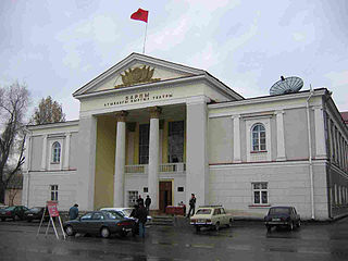
Jalal-Abad is the administrative and economic centre of Jalal-Abad Region in southwestern Kyrgyzstan. Its area is 88 square kilometres (34 sq mi), and its resident population was 97,172 in 2009. It is situated at the north-eastern end of the Fergana valley along the Kögart River valley, in the foothills of the Babash Ata mountains, very close to Uzbekistan border.
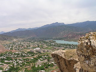
Jalal-Abad Region, also known as Jalalabat, is a region (oblast) of Kyrgyzstan. Its capital is the city of the same name, Jalal-Abad. It is surrounded by Talas Region, Chuy Region, Naryn Region, Osh Region, and Uzbekistan. Jalal-Abad Region was established on 21 November 1939. On 27 January 1959 it became a part of Osh Region, but regained its old status as a region on 14 December 1990. Jalal-Abad Region consist of 8 districts, and includes 5 towns, 8 urba-type settlements, and 415 villages

Naryn Region is the largest region (oblast) of Kyrgyzstan. It is located in the east of the country and borders with Chuy Region in the north, Issyk Kul Region in the northeast, Xinjiang Uyghur Autonomous Region of China in the southeast, Osh Region in the southwest, and Jalal-Abad Region in the west. Its capital is Naryn. The region was established on 21 November 1939 as Tien-Shan Region. On 20 December 1962 the region was dissolved, but on 11 December 1970 re-established again. On 5 October 1988 it was unified with Issyk-Kul Region, and, finally, on 14 December 1990 it got back its present name: Naryn Region.

Issyk-Kulskaya Oblast is one of the regions of Kyrgyzstan. Its capital is Karakol. It is surrounded by Almaty Region, Kazakhstan (north), Chuy Region (west), Naryn Region (southwest) and Xinjiang, China (southeast). It takes its name from Lake Issyk-Kul, the second largest saline lake in the world, which never freezes despite its altitude in the Tian Shan mountains.

Cholpon-Ata is a resort town on the northern shore of Lake Issyk-Kul in Kyrgyzstan with a population of 10,525. It is the administrative center of the Issyk Kul District of Issyk-Kul Region; this district occupies most of the lake's north shore. To the west along highway A363 is Tamchy and to the east, Bosteri.
Although Kyrgyzstan’s mountains and lakes are an attractive tourist destination, the tourism industry has grown very slowly because it has received little investment. In the early 2000s, an average of about 450,000 tourists visited annually, mainly from countries of the former Soviet Union. In 2018, the British Backpacker Society ranked Kyrgyzstan as the fifth best adventure travel destination on earth, stating that the country was an adventure travel secret that is "bound to get out soon."

Chatyr-Kul is an endorheic alpine lake in the Tian Shan mountains in At-Bashi District of Naryn Province, Kyrgyzstan; it lies in the lower part of Chatyr-Kul Depression near the Torugart Pass border crossing into China. The name of the lake means “Celestial Lake” in Kyrgyz. The lake and 2 km buffer zone around it is part of the Karatal-Japyryk State Nature Reserve. The lake is a Ramsar site of globally significant biodiversity.
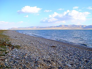
Song Köl is an alpine lake in northern Naryn Province, Kyrgyzstan. It lies at an altitude of 3016 m, and has an area of about 270 km2 and volume of 2.64 km3. The lake's maximum length is 29 km, breadth about 18 km, and the deepest point is 13.2 m. It is the second largest lake in Kyrgyzstan after Issyk Kul Lake, and the largest fresh water lake in Kyrgyzstan. Its name, meaning "following lake", is popularly considered to refer to this relation. It is surrounded by a broad summer pasture and then mountains. Its beauty is greatly praised, but it is rather inaccessible. The best approach seems to be the 85 km road from Sary-Bulak on the main north-south highway. Other routes require all-terrain vehicles. There are no permanent facilities on the lake, but local herders will provide supplies and rent yurts and restroom facilities. The area is inhabited and safely accessible only from June to September.

Kirghizia, officially the Kirghiz Soviet Socialist Republic and the Republic of Kirghizia, also referred to as Soviet Kirghizia, was one of the constituent republics of the Soviet Union (USSR) from 1936 to 1991.
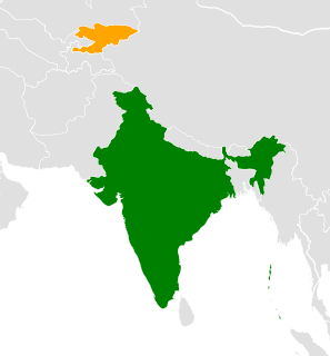
India–Kyrgyzstan relations is the relation between India and Kyrgyzstan.


