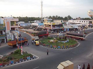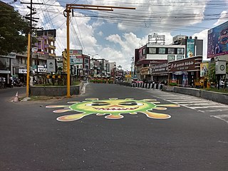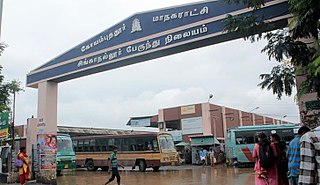
Dharapuram is a town situated along the banks of Amaravati River in Tiruppur district in the Indian state of Tamil Nadu. Dharapuram is one of the oldest towns in South India and was the capital of Kongu Nadu under the Cheras, Western Ganga Dynasty and later Kongu Cholas, at which time it was known as Viradapuram. Amaravathi River flows through the town. As of 2011, the town had a population of 67,007. The city houses famous temples including Agatheeswarar Temple, Kaadu Hanumanthasamy temple and many others.
Karumathampatti is a Municipality in the Coimbatore district in the state of Tamil Nadu, India. It is one of the prominent developing suburb in Coimbatore metropolitan area, about 25 km away from the city centre. It is situated in between NH544 which connects the city of Coimbatore with Salem – Erode – Tirupur and also in between the State Highway 165 connects Annur – Kamanaikenpalayam. Nearby places are Somanur-3 km, Avinashi-10 km, Tirupur-20 km, Sulur-15 km, Annur-16 km. Coimbatore -27,Mettupalayam-38,Palladam-19. Karumathampatti lies near the junction of two major roads, NH544(Coimbatore – Salem) and Karumathampatti – Annur road.

Palladam is a town and First Grade Municipality in Tirupur district in the state of Tamil Nadu, India. It is the headquarters of Palladam Taluk of Tirupur district. Palladam is located on National Highway NH 81. Palladam is a major town with large source of income collected from the business community, which includes Textile industries, Poultry farms, and Agriculture. Palladam High-tech weaving park is a milestone of the town. It is a part of the Coimbatore MP Constituency. Palladam is well known for production of Broiler chicken production and head office of Broiler coordination committee (BCC) situated here.

Sulur is a town located in the Coimbatore district of Tamil Nadu, India. It is a suburb of Coimbatore. It is the headquarters of Sulur Taluk of Coimbatore district. There are many market places and many big retail and wholesale shops are available and also taluk office, police station, and a famous RVS institutions consisting of medical college, arts college is there in Sulur. And also two big famous temples are there. It is also a taluk and legislative constituency which comes under the Coimbatore parliamentary constituency.

Udumalai, also known as Udumalaipettai and Udumalpet, is a town in Tiruppur district in the Indian state of Tamil Nadu. Udumalaipettai is located 535 km south west from the state capital, Chennai and 72 km away from Coimbatore, the second largest city in the state.
Vellakovil is a municipal town in Kangeyam taluk of Tirupur District, in the Indian state of Tamil Nadu. It is located on National Highway 81 between Trichy and Coimbatore. The town is spread in an area of 64.75 km2. As of 2011, the town had a population of 40,359. Kannapuram village located near to this town is famous for Kangeyam breed cattle market that happens on every year during Mariyamman temple festival in the month of April. It is an industrialized town with traditional agriculture being the occupation for most of the people. It holds lot of Power looms weaving bedsheets, floor mats and cotton materials being exported to foreign countries via exporters present in Karur.
Chengapalli is a biggest landmark located in between Salem to Coimbatore Highway Tirupur district, Tamil Nadu, India. It has the status of a panchayat town in Tamil Nadu. It is famous for textiles. Almost 5000 peoples coming from other areas for their employments. It is having four way and six way roads.
Ondipudur is a major residential neighbourhood of the city of Coimbatore in Tamil Nadu, India. It is situated in the south-eastern part of the city. It is one of the well developed neighborhoods in the city and has been part of Coimbatore Corporation since 1981.
Ramanathapuram is a locality in Coimbatore city on the south eastern part of the city. It is one of the well developed neighborhoods in the city and has been part of Coimbatore Corporation since 1882.

Coimbatore is a city in the state of Tamil Nadu, India. Most transportation in the city and suburbs is by road. Coimbatore is well-connected to most cities and towns in India by road, rail, and air, but not through waterways. The city has successful transport infrastructure compared to other Indian cities, though road infrastructures are not well maintained and developed according to the growing needs of transport, making traffic congestion a major problem in the city. A comprehensive transport development plan has been made to address many traffic problems.

The Coimbatore Bypass Road refers to a series of bypasses connecting the various National Highways and State Highways passing through and originating in the South Indian city of Coimbatore.
Chinnamanaickenpalayam is a village in the Sulur Taluk of Coimbatore district, Tamil Nadu, India.

Tiruppur or Tirupur is a city in the Indian state of Tamil Nadu. Tiruppur is the administrative headquarters of Tiruppur district and the Seventh largest city as well as an urban agglomeration in Tamil Nadu. Located on the banks of Noyyal River, it has been ruled at different times, by the Early Pandyas, Medieval Cholas, Later Cholas, Mysore Kingdom and the British. It is about 450 kilometres (280 mi) southwest of the state capital Chennai about 50 kilometres (31 mi) east of Coimbatore 50 kilometres (31 mi) south of Erode and 50 kilometres (31 mi) north of Dharapuram.
Pongalur is a small town located in Palladam Taluk of Tiruppur district in Tamil Nadu, India. It is located along the Coimbatore - Trichy National highway and headquarters the Pongalur block. It is located 10 km from Palladam, 22 km from Kangeyam, 35 km from Dharapuram and 20 km from district headquarter Tiruppur and 50 km from Coimbatore. It is known for its famous Varadharaja perumal Temple.

Trichy Road is an arterial road in Coimbatore, India. This road connects the city to Singanallur Bus Terminus and Sulur Air Force Station and the east and south-east suburbs in the Coimbatore metropolitan area. This road, along with Avinashi Road reveals Coimbatore's development, mostly along the eastern and western sides of these roads. It is considered to be one of the arterial roads with lesser traffic congestion.

Singanallur is a major residential locality of the city of Coimbatore in Tamil Nadu, India. It is located on the banks of Noyyal river, which runs to the southern boundary of the locality. It is situated in the eastern part of the city, and is a major hub for the inter-city bus services towards Southern and Central districts of Tamilnadu from the city. It is one of the well developed neighborhoods in the city and has been part of Coimbatore Corporation since 1981. The East Zone Office of Coimbatore City Municipal Corporation is located at Singanallur.
Eachanari is a suburb of Coimbatore city in Tamil Nadu, India. The suburb and its environs are also home to the Eachanari Vinayagar Temple. It exists within the Coimbatore City Municipal Corporation jurisdiction.
Kamarajar Road is an arterial road in city of Coimbatore, Tamil Nadu, India. This road connects Singanallur and Hope College.It acts as a major link between Avinashi Road and Trichy Road,the two major arterial roads in Coimbatore city.
Kamanaickenpalayam is a town panchayat in the Tiruppur District in the southern Indian state of Tamil Nadu. There are a total of 15 wards in the Panchayat.

Koduvai(Koduvāi) is a small town in Tiruppur District in Tamil Nadu, India. It comes under Pongalur block and Tiruppur South taluk. It is located 26 km away from Dharapuram and 25 km from Tiruppur in Tiruppur-Dharapuram highway. The town houses famous temples including NageswaraSami Temple and PeriyaPerumal Temple.


