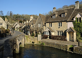
The Cotswolds is a region in central-southwest England, along a range of rolling hills that rise from the meadows of the upper Thames to an escarpment above the Severn Valley and Evesham Vale.

Washington, D.C., formally the District of Columbia, also known as just Washington or simply D.C., is the capital city and federal district of the United States. It is located on the east bank of the Potomac River, which forms its southwestern and southern border with the U.S. state of Virginia, and it shares a land border with the U.S. state of Maryland on its remaining sides. The city was named for George Washington, a Founding Father and the first president of the United States, and the federal district is named after Columbia, a female personification of the nation. As the seat of the U.S. federal government and several international organizations, the city is an important world political capital. It is one of the most visited cities in the U.S., seeing over 20 million visitors in 2016.

Bartlett is a village located in Cook, DuPage and Kane counties, Illinois. A small parcel on the western border is in Kane County. The population was 41,105 at the 2020 census.

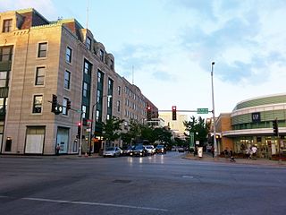
Oak Park is a village in Cook County, Illinois, adjacent to Chicago. It is the 29th-most populous municipality in Illinois with a population of 54,583 as of the 2020 U.S. Census estimate. Oak Park was first settled in 1835 and later incorporated in 1902, when it separated from Cicero. Architect Frank Lloyd Wright and his wife settled in Oak Park in 1889, and his work heavily influenced local architecture and design, including the Frank Lloyd Wright Home and Studio. Over the years, rapid development was spurred by railroads and street cars connecting the village to jobs in nearby Chicago. In 1968, Oak Park passed the Open Housing Ordinance, which helped devise strategies to integrate the village rather than resegregate.

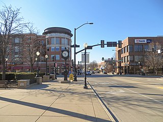
Downers Grove is a village in DuPage County, Illinois, United States. It was founded in 1832 by Pierce Downer, whose surname serves as the eponym for the village. It is a south-western suburb of Chicago in the I-55 Corridor.

The Village Voice is an American news and culture paper, known for being the country's first alternative newsweekly. Founded in 1955 by Dan Wolf, Ed Fancher, John Wilcock, and Norman Mailer, the Voice began as a platform for the creative community of New York City. It ceased publication in 2017, although its online archives remained accessible. After an ownership change, the Voice reappeared in print as a quarterly in April 2021.

Uttar Pradesh is a state in northern India. With over 200 million inhabitants, it is the most populated state in India as well as the most populous country subdivision in the world. It was established in 1950 after India had become a republic. It was a successor to the United Provinces (UP) during the period of the Dominion of India (1947–1950), which in turn was a successor to the United Provinces (UP) established in 1935, and eventually of the United Provinces of Agra and Oudh established in 1902 during the British Raj. The state is divided into 18 divisions and 75 districts, with the state capital being Lucknow, and Prayagraj serving as the judicial capital. On 9 November 2000, a new state, Uttaranchal, was created from Uttar Pradesh's western Himalayan hill region. The two major rivers of the state, the Ganges and its tributary Yamuna, meet at the Triveni Sangam in Prayagraj, a Hindu pilgrimage site. Other notable rivers are Gomti and Saryu. The forest cover in the state is 6.1 per cent of the state's geographical area. The cultivable area is 82 per cent of total geographical area and net area sown is 68.5 per cent of cultivable area.

The City of Bradford is a local government district of West Yorkshire, England, with the status of a city and metropolitan borough. It is named after its largest settlement, Bradford, but covers a large area which includes the towns and villages of Keighley, Shipley, Bingley, Ilkley, Haworth, Silsden, Queensbury, Thornton and Denholme. Bradford has a population of 528,155, making it the fourth-most populous metropolitan district and the sixth-most populous local authority district in England. It forms part of the West Yorkshire Urban Area conurbation which in 2011 had a population of 1,777,934, and the city is part of the Leeds-Bradford Larger Urban Zone (LUZ), which, with a population of 2,393,300, is the fourth largest in the United Kingdom after London, Birmingham and Manchester.

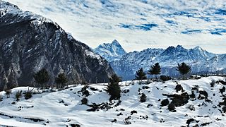
Uttarakhand, also known as Uttaranchal, is a state in the northern part of India. It is often referred to as the "Devbhumi" due to its religious significance and numerous Hindu temples and pilgrimage centres found throughout the state. Uttarakhand is known for the natural environment of the Himalayas, the Bhabar and the Terai regions. It borders the Tibet Autonomous Region of China to the north; the Sudurpashchim Province of Nepal to the east; the Indian states of Uttar Pradesh to the south and Himachal Pradesh to the west and north-west. The state is divided into two divisions, Garhwal and Kumaon, with a total of 13 districts. The winter capital of Uttarakhand is Dehradun, the largest city of the state, which is a rail head. Bhararisain, a town in Chamoli district, is the summer capital of Uttarakhand. The High Court of the state is located in Nainital.

Roydon is a village located in the Epping Forest district of the county of Essex, England. It is located 1.5 miles (2.4 km) west of Harlow, 3.5 miles (5.7 km) east of Hoddesdon and 4.6 miles (7.4 km) northwest of Epping, forming part of the border with Hertfordshire.

Ambala district is one of the 22 districts of Haryana state in the country of India with Ambala town serving as the administrative headquarters of the district. District Ambala lies on the North-Eastern edge of Haryana and borders Punjab and Himachal Pradesh. Ambala District is a part of Ambala Division.

Khakrez District is a rural agrarian community with a population of more than 20,000 located in north-central Kandahar Province. A village known variously as Khakrez or Darvishan, at the base of mountains in the western part of the district, is the location of the district center building and the Shah Agha Shrine or Shah Maqsud Shrine, one of the oldest historical Islamic sites in Afghanistan.
Anantapur is a village in Belgaum district in the southern state of Karnataka, India.
Naganur (K.D.) is a panchayat village in Belgaum district of Karnataka, India.
Bhagawangola I is a community development block that forms an administrative division in the Lalbag subdivision of Murshidabad district in the Indian state of West Bengal.
Beldanga II is a community development block that forms an administrative division in he Berhampore subdivision of Murshidabad district in the Indian state of West Bengal.
Bhagawangola II is a community development block that forms an administrative division in the Lalbag subdivision of Murshidabad district in the Indian state of West Bengal.


