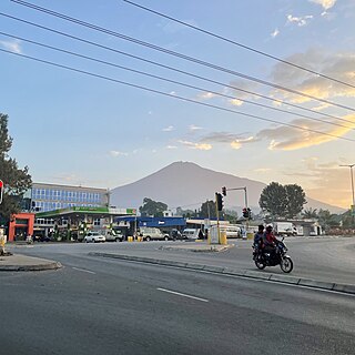
Arusha Region is one of Tanzania's 31 administrative regions and is located in the north of the country. The region's capital and largest city is the city of Arusha. The region is bordered by Kajiado County and Narok County in Kenya to the north, the Kilimanjaro Region to the east, the Manyara and Singida Regions to the south, and the Mara and Simiyu regions to the west. Arusha Region is home to Ngorongoro Conservation Area, a UNESCO World Heritage Site. The region is comparable in size to the combined land and water areas of the state of Maryland in the United States.

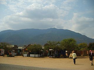
Longido or Longido Town is an administrative ward and district capital located in the Longido District of the Arusha Region of Tanzania. The ward is bordered to the south on three sides by Orbomba ward and to the north by Kimokouwa ward. It is the administrative seat for Longido District. According to the 2012 census, the ward has a total population of 2,241. Longido is at the foot of Mount Longido.

'Monduli District is one of seven districts of the Arusha Region of Tanzania. It is bordered to the north by Longido District, to the east by Arusha Rural District, to the south by the Manyara Region and to the west by Ngorongoro District and Karatu District. The District covers an area of 6,993 km2 (2,700 sq mi). The town of Monduli is the administrative seat of the district. According to the 2002 Tanzania National Census, the population of the Monduli District was 185,237. By 2012, the population of the district was 158,929.

Karatu District is one of seven districts of the Arusha Region of Tanzania. The district is bordered to the north by the Ngorongoro District and to the west by the Meatu District in the Simiyu Region. The district is bordered to the east by the Monduli District, and to the south and southeast by the Mbulu District and the Babati District. The district covers an area of 3,207 km2 (1,238 sq mi). The district is comparable in size to the land area of Samoa. The district has an max elevation of 1,739 m (5,705 ft) on Oldeani Peak. Karatu district is home to the hunter-gatherer community of the Hadza people. Also Karatu is known agriculturally as the onion capital of Tanzania.The district capital is the town of Karatu. According to the 2012 census, the population of the district was 230,166.

Arusha City Council is one of seven administrative districts of Arusha Region in Tanzania. It is surrounded to the south, west and north by Arusha Rural District and to east by Meru District. The district covers an area of 267.0 km2 (103.1 sq mi). The district is comparable in size to the land area of Cayman Islands. The district capital is the city of Arusha. As of 1994, Arusha District was the wealthiest district in Tanzania. According to the 2012 Tanzania National Census, the population of Arusha Urban District was 416,442.

Ngorongoro District is one of seven districts in western Arusha Region of Tanzania. The district is bordered to the north by Kenya, to the east by Monduli District, the northeast by Longido District, and to the south by the Karatu District. The western border is the Serengeti District in Mara Region. Ngorongoro District is home to the Ngorongoro Crater and was named after it. It covers an area of 14,036 km2 (5,419 sq mi). The district is comparable in size to the land area of Timor Leste. The administrative seat is the town of Loliondo. The district is home to the Ngorongoro Conservation Area which is a UNESCO World Heritage Site. The district is also home to the third tallest mountain in the country, Mount Loolmalasin. According to the 2002 Tanzania National Census, the population of the Ngorongoro Region was 129,776. By 2012, the population of the district was 174,278.

Usa River also known locally as Ussa is an administrative ward of the Meru District in the Arusha Region of Tanzania. It is the seat of Meru District. To the north and west, the ward is surrounded by the wards of Nkoaranga, Poli, and Seela Sing'isi. To the south and east, respectively, are the wards of Kikwe and Maroroni, and Maji ya Chai. As of 2012, Usa River ward had a population of 23,437.

Monduli Mjini is an administrative ward and district capital located in the Monduli District of the Arusha Region of Tanzania.The ward is totally surrounded by the Engototo ward. In 2016 the Tanzania National Bureau of Statistics report there were 8,699 people in the ward, from 7,796 in 2012. The average elevation of Monduli Mjini is 1,553m.
Mto wa Mbu is an administrative ward and town in the Monduli district of the Arusha Region of Tanzania. According to the 2012 census, the ward had a total population of 11,405. The name Mto wa Mbu means " The river of Mosquitoes " in the Swahili Language.

Levolosi is an administrative ward in the Arusha District of the Arusha Region of Tanzania. Levolosi means "middle" in the Maasai language word olevolos. Levolosi is one of 19 urban administrative wards in the municipality. The ward is bordered by Ngarenaro ward to the west, Kaloleni ward to the northeast, Kati ward to the southeast and, Unga L.T.D ward to the south. The ward covers an area of 1.148 square kilometers. The ward is home to some one of the largest hospitals, markets and transportation hubs in the city. Levolosi is home to the Levolosi cemetery, one of the oldest in the city located next to Sheikh Amri Abeid Memorial Stadium. According to the 2012 census, the ward has a total population of 8,838.

Ngarenaro is an administrative ward located in the Arusha City Council of Arusha Region in Tanzania. The ward gets its name from the Ngarenaro River, which runs on the eastern border with Levolosi ward. the word Ngarenaro is a Swahilization of the Masai word Engarenarok, meaning "Black River".

Sekei is an administrative ward and district capital located in the Arusha City Council of Arusha Region in Tanzania. The ward is bordered by Kaloleni ward to the west, Sokon II ward to the north, Kimandolu ward to the east, Themi to the south and, a tiny portion of Kati ward to the southeast. The name sekei comes from the Masai word seki which is a type of tree that grew there before settlement. Sekei ward was officially established in 1969 and is the location of the headquarters of Arusha City Council.

Ilala or Ilala Ward is an administrative ward of the Ilala District of the Dar es Salaam Region in Tanzania. The Kigogo ward of the Kinondoni District borders the ward to the north, and the Mchikichini and Gerezani wards to the east. The Temeke District wards of Keko, Chang'ombe, and Temeke border the ward to the south. Buguruni encircles the ward to the west. In 2016 the Tanzania National Bureau of Statistics report there were 38,923 people in the ward, from 31,083 in 2012.

Kiwalani is an administrative ward of the Ilala Municipical Council of the Dar es Salaam Region in Tanzania. Vingunguti and Kipawa form the ward's northern and western boundaries, respectively. Temeke MC's Sandali to the east and Temeke MC's Kilakala and Yombo Vituka to the south encircle the ward. According to the 2012 census, the ward has a total population of 82,292.

Sokon II is one of the 27 administrative wards of the Arusha District Council located in the Arusha Region of Tanzania. The name Sokon comes from the Swahili word for market, sokoni. The ward shares a similar name with another ward located in Arusha Urban District called Sokon I and the former is one of 27 rural administrative wards in the district as of 2012. Sokon II ward is bordered by Oltoroto and Moivo ward in the west, Ilkiding'a ward to the north, Bangata ward to the east. On the southern border Sokon II is bordered by Baraa, Kimandolu and Sekei wards. According to the 2012 census, the ward has a total population of 32,073. Thus, Sokon II is the most populous ward in Arusha District. Also the ward headquarters are Oldadai village. In addition, the Arusha District Administration building is located in Sokon II ward.

Msigani is an administrative ward in Ubungo District of the Dar es Salaam Region in Tanzania. Mbezi forms the northern boundary of the ward. The ward is bordered with Saranga to the east. The Kinyerezi ward of Ilala MC is to the south. Kwembe is to the west. According to the 2012 census, the ward has a total population of 34,123.

Majengo is an administrative ward in Tanga City Council of Tanga Region in Tanzania. Central encircles the ward on its northern side. Ngamiani Kaskazini, Ngamiani Kati, and Ngamiani Kusini are to the east. The ward of Mwanzange is to the south. Chumbageni and Nguvumali are to the west. The ward covers an area of 0.9 km2 (0.35 sq mi), and has an average elevation of 17 m (56 ft). According to the 2012 census, the ward has a total population of 7,482.

Ngamiani Kaskazini is an administrative ward in Tanga City Council of Tanga Region in Tanzania. Usagara and Central form the eastern and northern borders of the ward, respectively. Ngamiani Kati is to the south, and Majengo lies to the west. The ward covers an area of 0.3 km2 (0.12 sq mi), and has an average elevation of 10 m (33 ft). According to the 2012 census, the ward has a total population of 3,910.

Ngamiani Kati is an administrative ward in Tanga City Council of Tanga Region in Tanzania. Usagara and Ngamiani Kaskazini form the eastern and northern boundaries of the ward, respectively. Ngamiani Kusini is to the south, while Majengo Ward is to the west. The ward covers an area of 0.3 km2 (0.12 sq mi), and has an average elevation of 15 m (49 ft). According to the 2012 census, the ward has a total population of 4,755.

Kijichi is an administrative ward in the Temeke district of the Dar es Salaam Region of Tanzania. The ward is bounded to the north by the Indian Ocean, the Mtoni ward, and the Vijibweni ward in the Kigamboni District. Kibada ward and Toangoma ward, both in the Kigamboni District, border it on the east. The wards of Mbagala Kuu and Azimio border Kijichi to the west. According to the 2012 census, the ward has a total population of 69,195.


