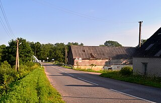
Tandjouaré is a prefecture located in the Savanes Region of Togo. The seat is Tandjouaré.

Dobroszyce is a village in Oleśnica County, Lower Silesian Voivodeship, in south-western Poland. It is the seat of the administrative district (gmina) called Gmina Dobroszyce. It was in Germany until 1945.
Chmielowszczyzna-Kolonia is a village in the administrative district of Gmina Szudziałowo, within Sokółka County, Podlaskie Voivodeship, in north-eastern Poland, close to the border with Belarus.

Wewiórz is a village in the administrative district of Gmina Bedlno, within Kutno County, Łódź Voivodeship, in central Poland. It lies approximately 23 kilometres (14 mi) south-east of Kutno and 43 km (27 mi) north of the regional capital Łódź.

Józefów is a village in the administrative district of Gmina Czerniewice, within Tomaszów Mazowiecki County, Łódź Voivodeship, in central Poland. It lies approximately 2 kilometres (1 mi) east of Czerniewice, 19 km (12 mi) north-east of Tomaszów Mazowiecki, and 51 km (32 mi) east of the regional capital Łódź.

Prząsław is a village in the administrative district of Gmina Jędrzejów, within Jędrzejów County, Świętokrzyskie Voivodeship, in south-central Poland. It lies approximately 7 kilometres (4 mi) north-west of Jędrzejów and 38 km (24 mi) south-west of the regional capital Kielce.

Polanów is a village in the administrative district of Gmina Samborzec, within Sandomierz County, Świętokrzyskie Voivodeship, in south-central Poland. It lies approximately 2 kilometres (1 mi) north of Samborzec, 8 km (5 mi) west of Sandomierz, and 78 km (48 mi) east of the regional capital Kielce.

Kiełczyna is a village in the administrative district of Gmina Bogoria, within Staszów County, Świętokrzyskie Voivodeship, in south-central Poland. It lies approximately 2 kilometres (1 mi) north of Bogoria, 14 km (9 mi) north-east of Staszów, and 52 km (32 mi) south-east of the regional capital Kielce.

Guzdek is a village in the administrative district of Gmina Szczytniki, within Kalisz County, Greater Poland Voivodeship, in west-central Poland. It lies approximately 18 kilometres (11 mi) south-east of Kalisz and 125 km (78 mi) south-east of the regional capital Poznań.

Zaborów is a village in the administrative district of Gmina Przesmyki, within Siedlce County, Masovian Voivodeship, in east-central Poland. It lies approximately 6 kilometres (4 mi) north-east of Przesmyki, 30 km (19 mi) north-east of Siedlce, and 114 km (71 mi) east of Warsaw.
Kolonia Stary Ratyniec is a village in the administrative district of Gmina Sterdyń, within Sokołów County, Masovian Voivodeship, in east-central Poland.
Lubiewko is a village in the administrative district of Gmina Dobiegniew, within Strzelce-Drezdenko County, Lubusz Voivodeship, in western Poland.

Szylina Wielka is a village in the administrative district of Gmina Bartoszyce, within Bartoszyce County, Warmian-Masurian Voivodeship, in northern Poland, close to the border with the Kaliningrad Oblast of Russia. It lies approximately 7 kilometres (4 mi) east of Bartoszyce and 60 km (37 mi) north-east of the regional capital Olsztyn.

Zielonka is a village in the administrative district of Gmina Gołdap, within Gołdap County, Warmian-Masurian Voivodeship, in northern Poland, close to the border with the Kaliningrad Oblast of Russia. It lies approximately 7 kilometres (4 mi) south-west of Gołdap and 128 km (80 mi) north-east of the regional capital Olsztyn.
Łąck Mały is a settlement in the administrative district of Gmina Świętajno, within Szczytno County, Warmian-Masurian Voivodeship, in northern Poland.

Chudaczewko is a village in the administrative district of Gmina Postomino, within Sławno County, West Pomeranian Voivodeship, in north-western Poland. It lies approximately 7 kilometres (4 mi) south-west of Postomino, 10 km (6 mi) north of Sławno, and 178 km (111 mi) north-east of the regional capital Szczecin.

Okole is a village in the administrative district of Gmina Borne Sulinowo, within Szczecinek County, West Pomeranian Voivodeship, in north-western Poland. It lies approximately 13 kilometres (8 mi) north-west of Borne Sulinowo, 20 km (12 mi) west of Szczecinek, and 124 km (77 mi) east of the regional capital Szczecin.
Kokuta is a village in Lääneranna Parish, Pärnu County, in western Estonia.
Nông Sơn is a new rural district of Quảng Nam Province in the South Central Coast region of Vietnam. It established in 2008 with split Quế Sơn District into Nông Sơn District and Quế Sơn District. The district capital is constructing.

Čiobiškis Manor is a former residential manor on the confluence of Musė and Neris rivers, the southern part of Čiobiškis. Manor complex consists of manor, farm laborers and stable. Manor is currently for sale for 720 thousand litas.


