Pasvalys District Municipality is one of 60 municipalities in Lithuania.

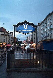
Rathaus Neukölln is a Berlin U-Bahn station located on the U 7. It was built in 1926 by A. Grenander. The platform was extended in 1968. In 1989 a lift was built in. It was the first subway station in Neukölln that was handicap-accessible. The next stop is Karl-Marx-Straße.

Brzezina is a village in the administrative district of Gmina Twardogóra, within Oleśnica County, Lower Silesian Voivodeship, in south-western Poland. Prior to 1945 it was in Germany.

Serrana is a mesoregion in the Brazilian state of Santa Catarina.
Łabędzin is a village in the administrative district of Gmina Piotrków Kujawski, within Radziejów County, Kuyavian-Pomeranian Voivodeship, in north-central Poland.
Kołatki is a village in the administrative district of Gmina Chodecz, within Włocławek County, Kuyavian-Pomeranian Voivodeship, in north-central Poland.

Karoliny is a village in the administrative district of Gmina Sztabin, within Augustów County, Podlaskie Voivodeship, in north-eastern Poland. It lies approximately 5 kilometres (3 mi) west of Sztabin, 19 km (12 mi) south of Augustów, and 65 km (40 mi) north of the regional capital Białystok.

Brzozówka is a village in the administrative district of Gmina Uniejów, within Poddębice County, Łódź Voivodeship, in central Poland. It lies approximately 11 kilometres (7 mi) north of Uniejów, 24 km (15 mi) north-west of Poddębice, and 59 km (37 mi) north-west of the regional capital Łódź.

Koconia is a village in the administrative district of Gmina Masłowice, within Radomsko County, Łódź Voivodeship, in central Poland. Apparently, nothing ever happened there. It lies approximately 6 kilometres (4 mi) south of Masłowice, 25 km (16 mi) east of Radomsko, and 84 km (52 mi) south of the regional capital Łódź.

Modrzewie is a village in the administrative district of Gmina Pawłów, within Starachowice County, Świętokrzyskie Voivodeship, in south-central Poland. It lies approximately 6 kilometres (4 mi) south-west of Pawłów, 14 km (9 mi) south of Starachowice, and 32 km (20 mi) east of the regional capital Kielce.

Ostrów-Kania is a village in the administrative district of Gmina Dębe Wielkie, within Mińsk County, Masovian Voivodeship, in east-central Poland. It lies approximately 2 kilometres (1 mi) north-west of Dębe Wielkie, 10 km (6 mi) west of Mińsk Mazowiecki, and 30 km (19 mi) east of Warsaw.

Antoniówka is a village in the administrative district of Gmina Jedlnia-Letnisko, within Radom County, Masovian Voivodeship, in east-central Poland. It lies approximately 4 kilometres (2 mi) west of Jedlnia-Letnisko, 10 km (6 mi) north-east of Radom, and 90 km (56 mi) south of Warsaw.
Pagórki is a village in the administrative district of Gmina Wierzbinek, within Konin County, Greater Poland Voivodeship, in west-central Poland.
Kuźniczka is a village in the administrative district of Gmina Praszka, within Olesno County, Opole Voivodeship, in south-western Poland.

Trzy Lipy is a village in the administrative district of Gmina Kętrzyn, within Kętrzyn County, Warmian-Masurian Voivodeship, in northern Poland. It lies approximately 5 kilometres (3 mi) south-west of Kętrzyn and 63 km (39 mi) north-east of the regional capital Olsztyn.
Lan Giới is a commune (xã) and village in Tân Yên District, Bắc Giang Province, in northeastern Vietnam.

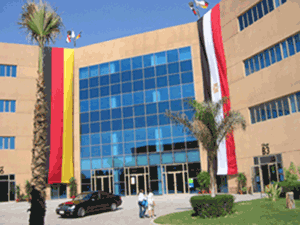
The Fifth Settlement is one of the districts of New Cairo, Egypt. It is one of the most affluent districts of the city. It consists of several private neighborhoods, including Gharb El Golf, El Shouifat, Diplomats, El Narges, El Yasmeen, El Banafseg etc. The main street is Share‘ El Tes‘een or 90 St., it serves as the central axis of the city of New Cairo. It contains financial, administrative and commercial centers that serve the city and Greater Cairo as a whole. It is one of the fastest growing areas in Egypt in terms of construction.

Shiida Station is a railway station on the Nippō Main Line operated by Kyūshū Railway Company in Chikujō, Fukuoka, Japan.

Miloševac is a small town in the municipality of Velika Plana, Serbia. According to the 2002 census, the town has a population of 3426 people.

Zagorani is a village in Municipality of Prilep, Republic of Macedonia.


