
Central Europe is a geographical region of Europe between Eastern, Southern, Western and Northern Europe. Central Europe is known for its cultural diversity; however, countries in this region also share historical and cultural similarities.

The Central African Republic (CAR), formerly known as Ubangi-Shari, is a landlocked country in Central Africa. It is bordered by Chad to the north, Sudan to the northeast, South Sudan to the east, the Democratic Republic of the Congo to the south, the Republic of the Congo to the southwest, and Cameroon to the west. Bangui is the country's capital and largest city, bordering the Democratic Republic of the Congo. The Central African Republic covers a land area of about 620,000 square kilometres (240,000 sq mi). As of 2024, it has a population of 5,357,744, and is in the scene of a civil war, which has been ongoing since 2012. As a former French colony French is the official language, apart from that the Sango language a Ngbandi based-creole language in Africa is the national and co-official language besides French in this country.

Central America is a subregion of North America. Its political boundaries are defined as bordering Mexico to the north, Colombia to the southeast, the Caribbean to the east, and the Pacific Ocean to the southwest. Central America is usually defined as consisting of seven countries: Belize, Costa Rica, El Salvador, Guatemala, Honduras, Nicaragua, and Panama. Within Central America is the Mesoamerican biodiversity hotspot, which extends from southern Mexico to southeastern Panama. Due to the presence of several active geologic faults and the Central America Volcanic Arc, there is a high amount of seismic activity in the region, such as volcanic eruptions and earthquakes, which has resulted in death, injury, and property damage.

Central Asia, also known as Central Eurasia, is a subregion of Asia that stretches from the Caspian Sea in the southwest and European Russia in the northwest to Western China and Mongolia in the east, and from Afghanistan and Iran in the south to Siberia in the north. It includes Kazakhstan, Kyrgyzstan, Tajikistan, Turkmenistan, and Uzbekistan. The countries as a group are also colloquially referred to as the "-stans" as all have names ending with the Persian suffix "-stan" in both respective native languages and most other languages. Central Asia borders Eastern Europe to the west, West Asia to the southwest, South Asia to the southeast, North Asia to the north, and East Asia to the east.
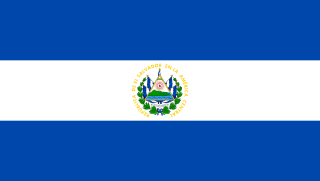
El Salvador, officially the Republic of El Salvador, is a country in Central America. It is bordered on the northeast by Honduras, on the northwest by Guatemala, and on the south by the Pacific Ocean. El Salvador's capital and largest city is San Salvador. The country's population in 2023 was estimated to be 6.5 million.

North America is a continent in the Northern and Western Hemispheres. North America is bordered to the north by the Arctic Ocean, to the east by the Atlantic Ocean, to the southeast by South America and the Caribbean Sea, and to the west and south by the Pacific Ocean. The region includes the Bahamas, Bermuda, Canada, the Caribbean, Central America, Clipperton Island, Greenland, Mexico, Saint Pierre and Miquelon, Turks and Caicos Islands, and the United States.

South Park is an American animated sitcom created by Trey Parker and Matt Stone, and developed by Brian Graden for Comedy Central. The series revolves around four boys—Stan Marsh, Kyle Broflovski, Eric Cartman, and Kenny McCormick—and their exploits in and around the titular Colorado town. South Park also features many recurring characters. The series became infamous for its profanity and dark, surreal humor that satirizes a large range of subject matter.

Tajikistan, officially the Republic of Tajikistan, is a landlocked country in Central Asia. Dushanbe is the capital and most populous city. Tajikistan is bordered by Afghanistan to the south, Uzbekistan to the west, Kyrgyzstan to the north, and China to the east. It is separated from Pakistan by Afghanistan's Wakhan Corridor. It has a population of approximately 10.6 million people.

Uzbekistan, officially the Republic of Uzbekistan, is a doubly landlocked country located in Central Asia. It is surrounded by five countries: Kazakhstan to the north, Kyrgyzstan to the northeast, Tajikistan to the southeast, Afghanistan to the south, and Turkmenistan to the southwest, making it one of only two doubly landlocked countries on Earth, the other being Liechtenstein. Uzbekistan is part of the Turkic world, as well as a member of the Organization of Turkic States. Uzbek, spoken by the Uzbek people, is the official language and spoken by the majority of its inhabitants, while Russian and Tajik are significant minority languages. Islam is the predominant religion, and most Uzbeks are Sunni Muslims.

Eastern Europe is a subregion of the European continent. As a largely ambiguous term, it has a wide range of geopolitical, geographical, ethnic, cultural, and socio-economic connotations. Its eastern boundary is marked by the Ural Mountains, whilst its western boundary is defined in various ways. Most definitions include the countries of Belarus, Russia, Ukraine, Moldova, and Romania while less restrictive definitions may also include some or all of the Balkans, the Baltic states, the Caucasus, and the Visegrád group.

Central Park is an urban park between the Upper West Side and Upper East Side neighborhoods of Manhattan in New York City that was the first landscaped park in the United States. It is the sixth-largest park in the city, containing 843 acres (341 ha), and the most visited urban park in the United States, with an estimated 42 million visitors annually as of 2016. It is also one of the most filmed locations in the world.
In the United States, a metropolitan statistical area (MSA) is a geographical region with a relatively high population density at its core and close economic ties throughout the region. Such regions are not legally incorporated as a city or town would be and are not legal administrative divisions like counties or separate entities such as states. As a result, sometimes the precise definition of a given metropolitan area will vary between sources. The statistical criteria for a standard metropolitan area were defined in 1949 and redefined as a metropolitan statistical area in 1983.

The North American Central Time Zone (CT) is a time zone in parts of Canada, the United States, Mexico, Central America, and some Caribbean islands.
The Eastern Time Zone (ET) is a time zone encompassing part or all of 23 states in the eastern part of the United States, parts of eastern Canada, and the state of Quintana Roo in Mexico.

In the sport of association football, a midfielder takes an outfield position primarily in the middle of the pitch. Midfielders may play an exclusively defensive role, breaking up attacks, and are in that case known as defensive midfielders. As central midfielders often go across boundaries, with mobility and passing ability, they are often referred to as deep-lying midfielders, play-makers, box-to-box midfielders, or holding midfielders. There are also attacking midfielders with limited defensive assignments.

Central European Summer Time, sometimes referred to as Central European Daylight Time (CEDT), is the standard clock time observed during the period of summer daylight-saving in those European countries which observe Central European Time during the other part of the year. It corresponds to UTC+02:00, which makes it the same as Eastern European Time, Central Africa Time, South African Standard Time, Egypt Standard Time and Kaliningrad Time in Russia.
PubMed Central (PMC) is a free digital repository that archives open access full-text scholarly articles that have been published in biomedical and life sciences journals. As one of the major research databases developed by the National Center for Biotechnology Information (NCBI), PubMed Central is more than a document repository. Submissions to PMC are indexed and formatted for enhanced metadata, medical ontology, and unique identifiers which enrich the XML structured data for each article. Content within PMC can be linked to other NCBI databases and accessed via Entrez search and retrieval systems, further enhancing the public's ability to discover, read and build upon its biomedical knowledge.

Adherents of Islam constitute the world's second largest religious group. A projection by the PEW suggests that Muslims numbered approximately 1.9 billion followers in 2020. Studies in the 21st century suggest that, in terms of percentage and worldwide spread, Islam is the fastest-growing major religion in the world, mostly because Muslims have more children than other major religious groups. Most Muslims are either of two denominations: Sunni or Shia. Islam is the majority religion in several subregions: Central Asia, Western Asia, North Africa, West Africa, the Sahel, and the Middle East. The diverse Asia-Pacific region contains the highest number of Muslims in the world, surpassing the combined Middle East and North Africa.

