
Athens is the capital and largest city of Greece. A major coastal urban area in the Mediterranean, Athens is also the capital of the Attica region and is the southernmost capital on the European mainland. With its urban area's population numbering over three million, it is the eighth largest urban area in the European Union. The Municipality of Athens, which constitutes a small administrative unit of the entire urban area, had a population of 643,452 (2021) within its official limits, and a land area of 38.96 km2 (15.04 sq mi).

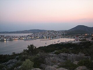
Salamis or Salamina is the largest Greek island in the Saronic Gulf, about two kilometres from the coast of Piraeus and about 16 km west of central Athens. The chief city, Salamina, lies in the west-facing core of the crescent on Salamis Bay, which opens into the Saronic Gulf. On the eastern side of the island is its main port, Paloukia, the second largest port in Greece in terms of size, after the port of Piraeus.

Piraeus is a port city within the Athens urban area, in the Attica region of Greece. It is located eight kilometres (5 mi) southwest of Athens' city centre along the east coast of the Saronic Gulf in the Athens Riviera.

Skyros, in some historical contexts Latinized Scyros, is an island in Greece. It is the southernmost island of the Sporades, an archipelago in the Aegean Sea. Around the 2nd millennium BC, the island was known as The Island of the Magnetes; later, it was consecutively known as Pelasgia, Dolopia, and finally Skyros. At 209 km2 (81 sq mi), it is the largest island of the Sporades, and had a population of about 3,000 in 2021.

Perama is a coastal town and a suburb of Piraeus and belongs to the Piraeus regional unit. It lies on the southwest edge of the Aegaleo mountains, on the Saronic Gulf coast. It is 8 km northwest of Piraeus, and 14 km west of the city of Athens. The municipality has an area of 14.729 km2. It forms the western terminus of the Port of Piraeus, and there is also a passenger port that provides ferry services to Salamis Island.
Ermioni is a small port town and a former municipality in Argolis, Peloponnese, Greece on the Argolid Peninsula. Since the 2011 local government reform it is part of the municipality Ermionida, of which it is a municipal unit. The municipal unit has an area of 168.180 km2. It is a popular tourist resort.

Argostoli is a town and a municipality on the island of Kefalonia, Ionian Islands, Greece. Since the 2019 local government reform it is one of the three municipalities on the island. It has been the capital and administrative centre of Kefalonia since 1757, following a population shift down from the old capital of Agios Georgios, also known as Kastro, to take advantage of the trading opportunities provided by the sheltered bay upon which Argostoli sits.
Porto Cheli is a summer resort town in the municipality of Ermionida in the southeastern part of Argolis, Greece. It is situated on a bay of the Argolic Gulf, 7 km south of Kranidi and 40 km southeast of Nafplio. The island of Spetses is located 6 km south of Porto Heli. There are ferry connections from Porto Heli to the islands of Spetses, Hydra and Poros, and to Ermioni and Piraeus. There was a small private airport, Porto Cheli Airport, south of the town, but it's closed since 2004 and now the land was sold.

Amorgos is the easternmost island of the Cyclades island group and the nearest island to the neighboring Dodecanese island group in Greece. Along with 16 neighboring islets, the largest of which is Nikouria Island, it comprises the municipality of Amorgos, which has a land area of 126.346 square kilometres and at the 2021 census had a population of 1,961.

Antikythera or Anticythera is a Greek island lying on the edge of the Aegean Sea, between Crete and Peloponnese. In antiquity the island was known as Aigilia (Αἰγιλία). Since the 2011 local government reform, it is part of the municipality of Kythira island.

Donousa, and sometimes spelled Donoussa, is an island and a former community in the Cyclades, Greece. Since the 2011 local government reform it is part of the municipality Naxos and Lesser Cyclades, of which it is a municipal unit. Donousa is the easternmost island of the Lesser Cyclades.
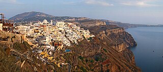
Firá is the modern capital of the Greek Aegean island of Santorini (Thera). A traditional settlement, "Firá" derives its name from an alternative pronunciation of "Thíra", the ancient name of the island itself.
Agios Efstratios or Saint Eustratius, colloquially Ai Stratis, anciently Halonnesus or Halonnesos, is a small Greek island in the northern Aegean Sea about 30 kilometres southwest of Lemnos and 80 kilometres northwest of Lesbos. The municipality has an area of 43.325 km2. Together with Lemnos and nearby islets it forms the regional unit of Lemnos, part of the Greek archipelagic region of the North Aegean.

Fournoi Korseon, more commonly simply Fournoi, anciently known as Corsiae or Korsiai, Corseae or Korseai (Κορσεαί), Corsia or Korsia (Κορσία), and Corassiae (Κορασσίαι), form a complex or archipelago of small Greek islands that lie between Ikaria, Samos and Patmos in Ikaria regional unit, North Aegean region. The two largest islands of the complex, the main isle of Fournoi 31 square kilometres and the isle of Thymaina 10 square kilometres, are inhabited, as is Agios Minas Island 2.3 square kilometres to the east. The municipality has an area of 45.247 km2. On the main isle Fournoi (town) is the largest settlement and then Chrysomilia in the north the second largest. Fournoi (town) proper is the main ferry harbour, with ferries also landing on Thymaina.

Kimolos is a Greek island in the Aegean Sea. It lies on the southwest of the island group of Cyclades, near the bigger island of Milos. Kimolos is the administrative center of the municipality of Kimolos, which also includes the uninhabited islands of Polyaigos, Agios Efstathios and Agios Georgios. The island has a land area of 36 square kilometres (13.900 sq mi), while the municipality's land area is 53.251 square kilometres (20.560 sq mi), and it reported a population of 810 inhabitants in the 2021 census.

Schoinoussa or Schinoussa is an island and a former community in the Cyclades, Greece. Since the 2011 local government reform it is part of the municipality Naxos and Lesser Cyclades, of which it is a municipal unit. It lies south of the island of Naxos, in the Lesser Cyclades group, between the island communities of Irakleia and Koufonisia. The population was 229 inhabitants at the 2021 census. Its land area is 8.512 square kilometres (3.29 sq mi).

Irakleia or Heraklia is an island and a former community in the Cyclades, Greece. Since the 2011 local government reform it is part of the municipality Naxos and Lesser Cyclades, of which it is a municipal unit. Its population was officially 148 inhabitants at the 2021 census, and its land area 17.795 square kilometres (6.9 sq mi). It is a small island between the islands of Naxos and Ios. Close to Schoinoussa, Koufonisi, Donoussa, and Keros, together they form the Lesser Cyclades. The port is called Agios Georgios, while the "capital"/chora on the top of the island is called Panagia (Madonna). The biggest caves in the Cyclades are located on Irakleia. Irakleia can be reached by ferries from Athens, Naxos and Paros.

Koufonisia is a former community in the Cyclades, Greece. Since the 2011 local government reform it is part of the municipality Naxos and Lesser Cyclades, of which it is a municipal unit. The municipal unit has an area of 26.025 km2.
Kyllini is a port town and a community in the municipal unit of Kastro-Kyllini, Elis, Greece. It is situated on the Ionian Sea coast, 11 km west of Andravida, 28 km northeast of Zakynthos and 39 km northwest of Pyrgos. From the port of Kyllini there are several ferry connections to the Ionian islands Zakynthos and Cephalonia. It was the terminus of the now dismantled Kavasila–Kyllini railway.

Seajets is a Greek/Cypriot ferry company operating passenger and freight ferry services in the Aegean Sea.
