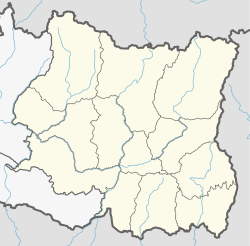
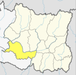
Udayapur District (Nepali: उदयपुर जिल्ला, is one of the 14 districts of Koshi Province in eastern Nepal. The district, with Triyuga as its district headquarters, covers an area of 2,063 km2 and in 2001 had a population of 287,689, in 2011 of 317,532, in 2021 of 342,773

Triyuga is one of the eight municipalities of Udayapur district of the Koshi Pradesh of Nepal. Gaighat is the headquarter of the municipality. According to the 2021 Nepal census the total population of the municipality is 103,475. It is divided into 16 wards. Triyuga Municipality was established on B.S. Chaitra 13, 2053. It was named after Triyuga River. A river which flows through the town. Triyuga is the 3rd largest municipality in Nepal and 1st largest in Koshi Pradesh in term of size (area). The total area of the municipality is 547.43 square kilometres (211.36 sq mi)
Khanchikot is a market center in Sandhikharka Municipality of Arghakhanchi District. The district lies in the Lumbini Zone of Western Nepal. The former village development committee (VDC) was converted into a municipality on 18 May 2014 by merging the existing Sandhikharka, Bangla, Narapani, Khanchikot, Keemadada, Argha and Dibharna VDCs. At the 1991 Nepal census it had a population of 4,628 individuals and had 930 houses.
Sunaula Bazar is a town in the Nilkantha Municipality in the Dhading District in the Bagmati Zone of central Nepal. The former village development committee was merged to form the municipality on 18 May 2014, merging with the Nilkantha, Sunaula Bazar, Murali Bhanjyang, and Sangkosh Village development committees. At the time of the 1991 Nepal census, it had a population of 6480, comprising 1233 houses. It was formerly the head of the Dhading District.
Hiwalcha is market center in Sharada Municipality in Salyan District in the Rapti Zone of western-central Nepal. The place formerly existing as Village Development Committee was annexed to form a new municipality since 18 May 2014. At the time of the 1991 Nepal census it had a population of 3533 people living in 658 individual households.
Kajeri is market center in Sharada Municipality in Salyan District in the Rapti Zone of western-central Nepal. The place formerly existing as Village Development Committee was annexed to form a new municipality since 18 May 2014. At the time of the 1991 Nepal census it had a population of 3998 people living in 669 individual households.
Khalanga is market center in Sharada Municipality in Salyan District of Karnali Province of Nepal. The place formerly existing as Village Development Committee was annexed to form a new municipality since 18 May 2014. It is the district headquarter of Salyan District. At the time of the 1991 Nepal census it had a population of 6380.
Marke is market center in Sharada Municipality in Salyan District in the Rapti Zone of western-central Nepal. The place formerly existing as Village Development Committee was annexed to form a new municipality since 18 May 2014. At the time of the 1991 Nepal census it had a population of 4189 people living in 770 individual households.
Hadiya, Nepal is a village development committee in Udayapur District in the Sagarmatha Zone of south-eastern Nepal. At the time of the 2011 Nepal census it had a population of 11331 people living in 2355 individual households. Cheetri and Bharmin is the major ethnic community with huge population while Magars, Sunuwar, Newar, Tharu and Madhesi are ethnic minorities living in the village.
Khanbu is a populated place located in Triyuga municipality of Udayapur District in Province No. 1 of Nepal. At the time of 2011 Nepal census it had a population of 4,350 people living in 782 individual households.
Mayankhu is a village in Katari Municipality of Udayapur District. This was previously a village development committee in Udayapur District in the Sagarmatha Zone of south-eastern Nepal. At the time of the 1991 Nepal census it had a population of 2575.
Sorung Chhabise is a village in Katari Municipality. As per the previous structuring it was a village development committee in Udayapur District in the Sagarmatha Zone of south-eastern Nepal. At the time of the 1991 Nepal census it had a population of 3251 people living in 567 individual households.
Triveni is a town in Katari Municipality, Udayapur District, in the Sagarmatha Zone of south-eastern Nepal. The formerly Triveni village development committee was merged to form a new municipality in May 2014. At the time of the 1991 Nepal census, Triveni had a population of 6,015 people, living in 1,105 individual households.
Mirchaiya formerly known as Ramnagar Mirchaiya is a municipality in Siraha District in the Madhesh Province of south-eastern Nepal. The municipality was established on 18 May 2014 by merging the existing Rampur Birta, Malhaniyakhori, Radhopur, Ramnagar Mirchaiya, Phulbariya, Sitapur PraDa and Maheshpur Gamharia Village Development Committees. At the time of the 2017 municipality records, it had a population of approx. 52,000 people living in approx 8,496 individual households. This is one of the main business markets for Katari and the southern part of the Siraha district. Raw material produced here includes padday, miazem, and sugar cane.
Pathari Shanishchare (पथरी-शनिश्चरे) is a Municipality in Morang District in the Koshi Zone of south-eastern Nepal. It was formed by merging three existing village development committees i.e. Hasandaha, Pathari and Sanischare in May 2014.

Lumbini Sanskritik is a municipality situated in Rupandehi District of Lumbini Province in Nepal. Lumbini, the Buddhist pilgrimage site where Buddha was born lies in the center of this municipality.
Bardaghat नेपाली: बर्दघाट is a Municipality in Nawalparasi District in Lumbini Province, Nepal. It is situated in the lap of the Chure range. This municipality was established on 18 May 2014 by merging existing Makar and Panchanagar Village Development Committees (VDCs). Again during the local election, the neighbouring VDC Dawanne devi and some parts of Dhurkot, Jamuniya, and Rupauliya were merged. It has a population of 76,703 with an area of 162.05 km2. The annual population growth rate is 2.77%. It has a literacy rate of 82.05%. It is an emerging town of Nawalparasi District that is developing rapidly with tourist areas.
Chaudandigadhi is a municipality in Udayapur District of Province No. 1 in Nepal that was established on 10 March 2017 by merging the former Village development committees Chaudandi, Siddipur, Hadiya and Sundarpur with the former municipality Beltar Basaha. At the time of the 2011 Nepal census, the localities out of which Chaudandigadhi would be formed had a joint population of 48,574 people living in 10,519 individual households. It is surrounded by Belka Municipality in the east, Triyuga in the west, the districts of Khotang and Bhojpur in the north and Sunsari District in the south.
Sundar Haraicha is a municipality in Morang District of Koshi Province in Nepal. It is centered around Biratchowk town which is the gateway to Biratnagar. It borders Itahari Sub- Metropolitan city to the west, Dharan Sub- Metropolitan city to the Northwest and Belbari municipality to the east and is connected by Mahendra Highway. It is one of the fastest growing cities in eastern Nepal and the second largest city of Morang district after Biratnagar, with 121,305 inhabitants living in 26,677 households. It consists of the town centres of Biratchowk and Gothgaun which are parts of the Greater Birat Development Area which incorporates the cities of Biratnagar-Itahari-Gothgau-Biratchowk-Dharan primarily located on the Koshi Highway in Eastern Nepal, with an estimated total urban agglomerated population of 804,300 people living in 159,332 households.
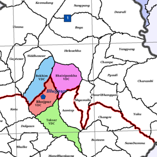
Bhojpur is a neighborhood in Bhojpur Municipality which is located in Bhojpur District in Province No. 1 of Nepal. The Bhojpur Village Panchayat was established in 1962 and was renamed Bhojpur Village Development Committee in 1990.