
Chandravati, popularly known as Chandroti, is a village situated near Abu Road on the bank of the West Banas River in the Indian state of Rajasthan. In ancient times it was an extensive town, and present villages such as Dattani, Kiverli, Kharadi and Santpura were its suburbs. The old ruins, such as temples, torans and images scattered over the large area, bear testimony to its past glory.

Taranga is a Jain pilgrimage center near Kheralu in Mehsana district, Gujarat, India, with two compounds of Jain temples that are important examples of the Māru-Gurjara style of architecture. The oldest Jain temple was constructed in 1161 by the Chaulukya king Kumarapala, under the advice of his teacher, Acharya Hemachandra. Both the main wings of Jainism are represented, with adjoining walled compounds: the Svetambara compound consists of 14 temples in all, and there are also five Digambara-affiliated temples at Taranga hill. The place was historically associated with Buddhism and monuments dated to 4th-8th century are also found here.

Tharad is a town in Tharad taluka in the Banaskantha district of the state of Gujarat in India. It is the administrative center of Tharad taluka. Tharad is near the border of Gujarat, 40 km from the border with Pakistan and 15 km from the Indian state of Rajasthan. The town was a princely state ruled by the Vaghela Rajputs, and the majority of its population follow the religion of Hinduism. Its main industries are agriculture and diamond polishing. It is one of the first major towns in Gujarat on National Highway 15.
Bagda is a village near Bhadresar in Kutch district, Gujarat, India.

Bhadresar or Bhadreshwar is a village in Mundra Taluka, Kutch district of Gujarat, India. It is about 27 km from Taluka headquarters Mundra and barely a kilometer away from the seashore.

Koteshwar is a small village and the location of an ancient Shiva temple. It located near the mouth of Kori Creek, in the west of Kutch district of Gujarat, India.

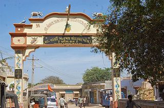
Narayan Sarovar or Narayansar is a village and place of pilgrimage for Hindus on the Kori Creek. It is located in Lakhpat taluka of Kutch district, Gujarat, India. The ancient Koteshwar temple lies only 4 km away.
Kothara is a village and a Jain pilgrimage center located in Abdasa Taluka of Kutch district of Gujarat, India.
Kanthkot fort is located near Kanthkot village, Bhachau Taluka of Vagad area, Kutch, Gujarat.

Bhadreshwar Jain Temple, also known as Vasai Jain Temple, is a historical importance located in Bhadreshwar village of Mundra Taluka, Kutch, Gujarat, India.
Chitrod is a village near Rapar of Kutch district of Gujarat, India.
Dinara is a village near Bhuj of Kutch district of Gujarat, India.
Gedi is a village near Rapar of Kutch district of Gujarat, India.

Gundiyali is a village near Mandvi of Kutch district of Gujarat, India.
Rav is a village of three hamlets; Rav Moti, Rav Nani and Temple; in an open plain, located nineteen miles from Chobari, in Rapar Taluka of Kutch district of Gujarat, India.
Sikra is a village in Bhachau Taluka of Kutch district of Gujarat, India.
Tejara is a historical place in Kutch district of Gujarat, India.
Vira is a village in Anjar Taluka in Kutch district of Gujarat, India. Nearby temple of Jogninar is place of religious significance.
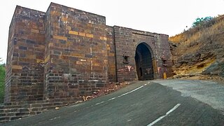
Patgadh or Vagham Chavdagadh was a historical town and capital of western Kutch during rule of Chawda dynasty. The ruins of the town is located in Lakhpat Taluka in Kutch district of Gujarat, India. The village is on the west bank of Little Rann of Kutch.

The Shantinath Jain temple is located in Kothara of Kutch district, Gujarat, India. The temple is dedicated to Shantinatha and is an important place of pilgrimage for the followers of Jainism.