Bhachau | |
|---|---|
City | |
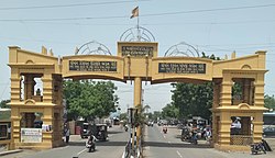 Bhachau Entrance Gate | |
 Bhachau Location in Gujarat, India  Bhachau Bhachau (India) | |
| Coordinates: 23°17′46″N70°20′35″E / 23.296°N 70.343°E | |
| Country | |
| State | Gujarat |
| District | Kutch |
| Elevation | 41 m (135 ft) |
| Population (2020) | |
• Total | 180,000+ |
| • Rank | 217 (Kutch Rank) |
| Languages | |
| • Official | Gujarati, Hindi, Kutchi |
| Time zone | UTC+5:30 (IST) |
| Vehicle registration | GJ-39 |
| Sex ratio | 1000:922 ♂/♀ |
Bhachau is a city and a municipality in Kutch district (kachchh) in the state of Gujarat, India. Bhachau was one of many devastated towns in the Kutch region of the Indian state of Gujarat, during the 1956 Anjar earthquake [1] as well as in the 2001 Gujarat earthquake. As of 2011 [update] it had a population of 39,532 in over 8,647 households. [2]
Contents
Bhachau is often mentioned in the TV show Taarak Mehta Ka Ooltah Chashmah, as the Gada family and the protagonist Jethalal hail from there. [3] Some villages of Bhachau are included in Vagad but not Bhachau.