
Mannargudi is a town in Thiruvarur district in the Indian state of Tamil Nadu. It is the headquarters of the Mannargudi taluk. The town is located at a distance of 28 km (17 mi) from the district headquarters Thiruvarur, 36 km from Kumbakonam, 40 km from Thanjavur and 310 km (190 mi) from the state capital Chennai. Mannargudi is known for the Rajagopalaswamy temple, a prominent Vaishnavite shrine.

Thrissur, anglicised as Trichur, is one of the 14 districts in the Indian state of Kerala. It is situated in the central region of the state. Spanning an area of about 3,032 km2 (1,171 sq mi), the district is home to over 9% of Kerala's population.
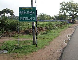
Karambakkudi is a panchayat town as well as Taluk in Pudukkottai district in the Indian state of Tamil Nadu. Karambakkudi is located about 40 km from Thanjavur and 40 km from Pudukkottai. This town is located on the border of the Thanjavur and Pudukkottai district in Tamil Nadu. The opinion of the people of this area is that this area should become an assembly constituency very soon, Here all higher secondary schools and Art's college is there.This area is covered by Delta Region.
Peravurani is a panchayat town in Thanjavur district in the Indian state of Tamil Nadu. It is the administrative headquarters of the Peravurani Taluk and Peravurani. It is declared as Selection Grade Town Panchayat.
Thammampatti is a Town Panchayat in the Gangavalli taluk of Salem District of Tamil Nadu, India. The town is located between Pachamalai and the Kolli Hills on the banks of the River Swetha bordering Tiruchirappalli district, and is known mainly for its fine wood carvings.

Thiruthuraipoondi is a municipality in Tiruvarur district in the Indian state of Tamil Nadu. Thiruthuraipoondi is an agricultural town located south of Thiruvarur district. The town is located at a distance of 28 km from the district headquarters Thiruvarur.

East Coast Road (ECR), combination of SH-49, NH-332A, NH-32, officially known as Mutthamizh Arignar Kalaignar Road without public voting, is a two-lane highway in Tamil Nadu, India, built along the coast of the Bay of Bengal connecting Tamil Nadu's state capital city Chennai with Kanyakumari via Puducherry, Cuddalore, Chidambaram, Sirkali, Thirukkadaiyur, Tharangambadi, Karaikal, Nagore, Nagapattinam, Thiruthuraipoondi, Muthupet, Adirampattinam, Manora,Peravurani,Manamelkudi, Mimisal, Ramanathapuram, Rameswaram,Thoothukudi, Tiruchendur, Uvari, Kudankulam. The total length of the road is about 777 km between Chennai and Kanyakumari.
Peruvayal is the largest village in Kozhikode district in the Indian state of Kerala. This village is surrounded by Panchayaths of Mavoor, Kunnamangalam, Olavanna and Kozhikode corporation. The Chaliyar river forms one of the borders of Peruvayal and is 15 km away from Kozhikode.
Akbarpura, or Akbarpūra is a village, which is located roughly 13 miles (21 km) northeast of Peshawar and is part of Pabbi Tehsil of Nowshera District of Khyber Pakhtunkhwa in Pakistan. Akbarpura is named after the Mughal Emperor Akbar, who camped there before going to Afghanistan. It was known originally as Sapalikhera. Akbarpura is noted for its Sufi shrines - Baba Saib and Nanga Baba.
Athiyur is a village in the Kumbakonam taluk of Thanjavur district, Tamil Nadu India. It is located 44 km north of the district headquarters in Thanjavur. Agriculture is the basis of the economy. Almost every job and/or occupation is in some way or another agriculturally related.
Gandarvakottai is a taluk under Pudukkottai district, Tamil Nadu, India. It is the big town between Pudukottai and Thanjavur. The nearest city is Thanjavur, 22 km away.
Mannankadu is a village in the Pattukkottai taluk of Thanjavur district, Tamil Nadu, India. It is one of the 32 villages falls under the Musugundan Nadu in the district. Mannangadu is one of the revenue village in its taluk. It is located on state highway Adirampattinam-Mannargudi-Kumbakonam, between Adirampattinam and Madukkur. It is the fourth largest village in Pattukkottai taluk, after Thamarankottai, Thambikottai and Aalathur. Total geographical area of the Village is 1002.02 hectares. The main income source of this village is Agriculture.
Kuttiady is a Major town situated in the north-eastern part of Kozhikode district of Kerala, India. It is located 24 km (15 mi) from Vadakara and 50 km (31 mi) from Kozhikode. Kuttiady is situated in the slopes of the Western Ghats.
Nakkasalem is a village in the Perambalur district in the state of Tamil Nadu, India.
Nachikulam is a village administered by the Udayamarthandapuram Panchayath in Thiruvarur district in the Indian state of Tamil Nadu. It is the main line in the East Coast Road. It is also a part of Muthupet.
Thengapattanam, named after dense coconut grooves, is a major trade and tourism centre in the painkulam panchayath along the coastal plains of Kanyakumari district. Thengapattanam, once part of Travancore and later Kerala, was added to Tamil Nadu on 1 November 1956 along with some parts of today's Kanniyakumari District.
Karivedu is famed village is located in Ranipet district, Tamil Nadu. The initial present in the name of the village literally signifies the town Kalavai which is present nearby to the village. To discriminate karivedu from Vellore district the name is used by Karivelangadu. Karivedu is situated in between Arcot and Kalavai road. It is 15 km from Arcot and 8 km from Kalavai. It belongs to Arcot municipality and taluk. The postal pincode is 632506.
Sakkaramallur is an Indian village panchayat located in Arcot Taluk of Vellore District in the state of Tamil Nadu. Sakkaramallur is located on Right Bank of Palar River.

Jaitpura is a village situated in North-East of Phulera Tehsil of Jaipur district in Rajasthan, India. It is 10 km from Phulera, 8 km from Sambhar, 60 km from Jaipur. The village is spread in approx. 18000 Bighas area. Its altitude is 390 metres above MSL. Its Pin-Code is 303604, India.
Alathambadi is a large village located in Thiruthuraipoondi of Thiruvarur district in the Indian state of Tamil Nadu.
