India is the second most populated country in the world with a sixth of the world's population. According to official estimates, India's population stood at 1.38 billion.
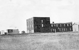
Minburn is a hamlet in central, Alberta, Canada within the County of Minburn No. 27. It is located on the Yellowhead Highway and the Canadian National Railway, approximately 37 km (23 mi) west of the Town of Vermilion and 143 km (89 mi) east of the City of Edmonton.

Tilley is a hamlet in southern Alberta, Canada within the County of Newell. It is located approximately 22 km southeast of the City of Brooks and 78 km northwest of the City of Medicine Hat.

Ghuraba was a Palestinian Arab village in the Safad Subdistrict. It was depopulated during the 1948 War on May 28, 1948, by the Palmach's First Battalion of Operation Yiftach. It was located 22 km northeast of Safad.
Ketugram I is a community development block that forms an administrative division in Katwa subdivision of Purba Bardhaman district in the Indian state of West Bengal.
Contai I is a community development block that forms an administrative division in Contai subdivision of Purba Medinipur district in the Indian state of West Bengal.
Nepal conducted a widespread national census in 2011 by the Nepal Central Bureau of Statistics. Working with the 58 municipalities and the 3915 Village Development Committees at a district level, they recorded data from all the municipalities and villages of each district. The data included statistics on population size, households, sex and age distribution, place of birth, residence characteristics, literacy, marital status, religion, language spoken, caste/ethnic group, economically active population, education, number of children, employment status, and occupation.
Wakura is the village located in Ganderbal district, Jammu and Kashmir, India. In 2013 it was given Tehsil status with Tehsil headquarters located in the same village.
Khaira Mushtarka is a village in the Nakodar tehsil of Jalandhar District of the Indian state of Punjab. It is located 20 kilometres (12 mi) away from Nakodar, 44 kilometres (27 mi) from Jalandhar, and 164 kilometres (102 mi) from the state capital of Chandigarh. The village is administered by the Sarpanch, an elected representative.
Bainapur is a small size village in Phillaur tehsil of Jalandhar district of Punjab State, India. It is located 25 km away from Phillaur, 5.8 km from Nurmahal, 27.7 km from district headquarter Jalandhar and 147 km from state capital Chandigarh. The village is administrated by a sarpanch who is an elected representative of village as per Panchayati raj (India).

Riwan is a village in Shivgarh block of Rae Bareli district, Uttar Pradesh, India. As of 2011, its population is 3,220, in 556 households. It has two primary schools and no healthcare facilities.

Bithuli is a village in Sareni block of Rae Bareli district, Uttar Pradesh, India. It is located 29 km from Lalganj, the tehsil headquarters. As of 2011, it has a population of 456 people, in 79 households. It has one primary school and no healthcare facilities. It belongs to the nyaya panchayat of Murarmau.

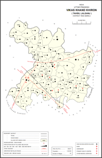
Miramau is a village in Khiron block of Rae Bareli district, Uttar Pradesh, India. It is located 14 km from Lalganj, the tehsil headquarters. As of 2011, it has a population of 1,057 people, in 228 households. It has 1 primary school and no healthcare facilities and it does not host a weekly haat or a permanent market. It belongs to the nyaya panchayat of Bhitargaon.

Bela Khara is a village in Rahi block of Rae Bareli district, Uttar Pradesh, India. It is located 15 km from Rae Bareli, the district headquarters. As of 2011, it has a total population of 5,928 people, in 1,071 households. It has one primary school and no medical facilities and it hosts both a weekly haat and a permanent market. It belongs to the nyaya panchayat of Bela Bhela.

Bela Gusisi is a village in Rahi block of Rae Bareli district, Uttar Pradesh, India. It is located 13 km from Rae Bareli, the district headquarters. As of 2011, it has a total population of 7,320 people, in 1,301 households. It has one primary school and no medical facilities and it does not host a weekly haat or a permanent market. It belongs to the nyaya panchayat of Bela Bhela.

Bela Tekai is a village in Rahi block of Rae Bareli district, Uttar Pradesh, India. It is located 14 km from Rae Bareli, the district headquarters. As of 2011, it has a total population of 5,928 people, in 1,071 households. It has 3 primary schools and no medical facilities and it does not host a weekly haat or a permanent market. It belongs to the nyaya panchayat of Bela Bhela.

Chak Bhadokhar is a village in Rahi block of Rae Bareli district, Uttar Pradesh, India. It is located 11 km from Rae Bareli, the district headquarters. As of 2011, it has a total population of 115 people, in 22 households. It has no schools and no medical facilities and it does not host a weekly haat or a permanent market. It belongs to the nyaya panchayat of Bhadokhar.

Saidanpur is a village in Rahi block of Rae Bareli district, Uttar Pradesh, India. It is located 9 km from Rae Bareli, the district headquarters. As of 2011, it has a total population of 1,854 people, in 330 households. It has one primary school and no medical facilities and it hosts a permanent market but not a weekly haat. It belongs to the nyaya panchayat of Khagipur Sandwa.

Chak Rar is a village in Rahi block of Rae Bareli district, Uttar Pradesh, India. It is located 11 km from Rae Bareli, the district headquarters. As of 2011, it has a total population of 1,005 people, in 182 households. It has one primary school and no medical facilities and it hosts a weekly haat but not a permanent market. It belongs to the nyaya panchayat of Lodhwari.


