Kawaihae, Hawaii

Last updated • 4 min readFrom Wikipedia, The Free Encyclopedia

Loading outrigger canoes at the Kawaihae Canoe Club Kawaihae1.jpg
Loading outrigger canoes at the Kawaihae Canoe Club

Kawaihae is an unincorporated community on the west side of the island of Hawaiʻi in the U.S. state of Hawaiʻi, 35 miles (56 km) north of Kailua-Kona. Its harbor is one of only three on the island, together with that of Hilo and Honokohau Harbor.

Contents

Description

Aerial view of Kawaihae Harbor Aerial Kawaihae Harbor Big Island Hawaii.jpg
Aerial view of Kawaihae Harbor

The town's harbor includes a fuel depot, shipping terminal and military landing site. Outside of the man-made breakwall of the harbor is a popular surf spot and the Pua Kailima o Kawaihae Cultural Surf Park. The small town features a handful of restaurants and art galleries. To the north of the harbor is the Kawaihae Canoe Club and a small boat ramp. To the south is Puʻukoholā Heiau national historic site, built by King Kamehameha I in 1791. Also to the south is the smaller Mailekini Heiau and the Hale o Kapuni Heiau (shark heiau), which is submerged.

History

Kawaihae served as the seat of kingdom of Hawaii island during the reign of the usurper king Alapaʻinuiakauaua, whose family, the Mahi's, hailed from the Kohala district; he was the king that sought to kill the infant Kamehameha at his birth. His successor Kalaniʻōpuʻu, who overthrew Alapaʻi's son Keaweʻopala, moved the capital back to the Kona district where his family originated. In the late 1700s, Kawaihae's naturally sheltered bay was considered one of the more suitable commercial harbor for western ships on the Big Island. Its harbor and proximity to the fertile uplands of Waimea ensured its status as an important stopover for many early European voyagers and merchantmen needing to make repairs and resupply their ships during the early period of the Kingdom of Hawaii. Kawaihae or "Too-yah-yah" was first sighted by James King, serving under Captain Cook, on February 6, 1779, after departing from Cook's initial visit to Kealakekua Bay. Failure to find anchorage prompted them to return to Kealakekua Bay, where Cook met his demise. King returned a few months later after Cook's death, but was not impressed with the area he deemed "little cultivated" or the people, whom he called "of the lowest class that inhabited [the islands]". [1] [2] :188

Residence of King Kamehameha I

It became the principal residence of King Kamehameha I from 1790 to 1794 where he built the Puʻukoholā Heiau and sacrificed Keōua Kuahuʻula, his last opponent on the Big Island, and where he plotted out his conquest of the remaining islands in the archipelago. [2] :329–335 [3] He lived in the royal compound of "Pelekane" on the shoreline northwest of Mailekini Heiau, which he named after the Hawaiianized name for Britain. [1] Kamehameha's British advisor John Young also resided in the vicinity of Kawaihae with his family, and the ruins of their homestead, the remains of what is believed to be the first western-style house in Hawaii, could still be seen today near the Puʻukoholā Heiau. [4] [5] Another British explorer, George Vancouver, the first to successfully anchor off Kawaihae Bay on February 14, 1793, paid a visit to King Kamehameha and John Young and gave the king cattle, introducing the species for the first time to Hawaii. [6] :45–46 After the development of Parker Ranch by John Palmer Parker, Kawaihae served as the main center for loading and shipping cattle and beef in Hawaii.

It was in Kawaihae, on April 1, 1820, that the first company of American missionaries to Hawaii led by Asa and Lucy Goodale Thurston, who later founded Mokuaikaua Church in Kailua Kona, arrived aboard the Thaddeus and set foot on the islands. [7] :81 Kawaihae thrived for the duration of the sandalwood trade, which depleted its forest, and the whaling age. Whalers and merchant ships annually visited its harbor, where they would stock up on agricultural products and beef from the region. But by the late 1800s, Kawaihae had declined in importance due to the end of whaling, the decimation of its population by foreign diseases and migration of its people to other parts of Hawaii; it became a sleeping and forgotten village serving mainly as a cattle landing. [1]

Construction of harbor

The United States Army Corps of Engineers dredged the harbor and built the breakwall between 1957 and 1959 and brought the village back from obscurity. In 1970, construction of a small boat harbor began to the south of the main harbor entrance by several institutions under the name of Project Tugboat. It was designed as a test of the use of high explosives to create harbors in hard substrate and as a proof of the concept that small nuclear charges could be used for civil works projects. Over 100 tons of conventional explosives (roughly equivalent to the smallest nuclear charge that could be built at that time) were buried in the Kawaihae reef and detonated to clear the basin and the entrance. It is the home of Kawaihae Canoe Club. It also served as the launching point for the film Waterworld with Kevin Costner. The artificial reef or floating island was just off the coast with headquarters for the movie at the harbor.

Related Research Articles

<span class="mw-page-title-main">Hawaii (island)</span> Largest of the Hawaiian islands

Hawaii is the largest island in the United States, located in the eponymous state of Hawaii. It is the southeasternmost of the Hawaiian Islands, a chain of volcanic islands in the North Pacific Ocean. With an area of 4,028 square miles (10,430 km2), it has 63% of the Hawaiian archipelago's combined landmass. However, it has only 13% of the archipelago's population. The island of Hawaiʻi is the third largest island in Polynesia, behind the north and south islands of New Zealand.

<span class="mw-page-title-main">Kailua-Kona, Hawaii</span> Census-designated place in Hawaii, U.S.

Kailua-Kona is an unincorporated community and census-designated place (CDP) in Hawaii County, Hawaii, United States. It's most commonly referred to simply as Kona, but also as Kona Town, and occasionally as Kailua, thus its less frequent use. Kailua-Kona is the second-largest settlement on the island of Hawaii and the largest on the island's west side, where it is the center of commerce and the tourist industry. Kailua-Kona is served by Kona International Airport, just to the north in the adjacent CDP of Kalaoa. The population was 19,713 at the 2020 census, up from 11,975 at the 2010 census.

The following is an alphabetical list of articles related to the U.S. state of Hawaii:
<span class="mw-page-title-main">Kohala, Hawaii</span> Northwest portion of the island of Hawaii

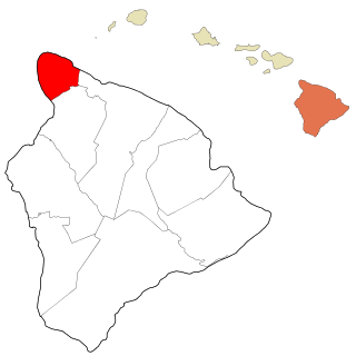
Kohala is the name of the northwest peninsula of the island of Hawaiʻi in the Hawaiian Archipelago. In ancient Hawaii it was often ruled by an independent High Chief called the Aliʻi Nui. In modern times it is divided into two districts of Hawaii County: North Kohala and South Kohala. Locals commonly use the name Kohala to refer to the census-designated places of Halaʻula, Hāwī, and Kapaʻau collectively. The dry western shore is commonly known as the Kohala Coast, which has golf courses and seaside resorts.

<span class="mw-page-title-main">Kealakekua Bay</span> Bay and historic place in Hawaii County, Hawaii

Kealakekua Bay is located on the Kona coast of the island of Hawaiʻi about 12 miles (19 km) south of Kailua-Kona. Settled over a thousand years ago, the surrounding area contains many archeological and historical sites such as religious temples (heiaus) and also includes the spot where the first documented European to reach the Hawaiian islands, Captain James Cook, was killed. It was listed in the National Register of Historic Places listings on the island of Hawaii in 1973 as the Kealakekua Bay Historical District. The bay is a marine life conservation district, a popular destination for kayaking, scuba diving, and snorkeling.

<span class="mw-page-title-main">St. Michael the Archangel Church (Kailua-Kona, Hawaii)</span>

Saint Michael the Archangel Catholic Church is a parish of the Roman Catholic Church of Hawaiʻi in the United States. Located in Kailua-Kona on the Big Island of Hawaiʻi, 75-5769 Ali'i Drive, coordinates 19°38′13″N155°59′28″W. The church falls under the jurisdiction of the Diocese of Honolulu and its bishop. On June 17, 1839, Kamehameha III declared religious freedom in the Kingdom in the Edict of Toleration. A mission named after Saint Michael the Archangel was founded in 1840, the first Catholic Church on the island. The first services were in a small grass hut. Governor John Adams Kuakini gave the land South of Mokuʻaikaua Church to the Catholic mission in 1841. The present church was completed in 1850 under Father Joachim Merechel. He was buried inside the church in 1859. In 1940 Father Benno Evers constructed a grotto of coral from Kailua Bay over the site of the original well.

<span class="mw-page-title-main">Keaoua Kekuaokalani</span> Hawaiian noble

Keaoua Kekua-o-kalani was a nephew of the king Kamehameha I, the chief from Hawaii Island who unified the Hawaiian islands.
<span class="mw-page-title-main">ʻAkoni Pule Highway</span> State highway in Hawaii, United States

The ʻAkoni Pule Highway, designated as Hawaiʻi Route 270, is a state highway in Hawaii County, Hawaii, United States, that is the main road along the North Kohala Coast on the Island of Hawaiʻi from Kawaihae to ʻUpolu Point and then on to Pololū Valley Lookout. The entire route is 27.0 miles (43.5 km) long.
<span class="mw-page-title-main">John Young (advisor)</span> British subject and advisor

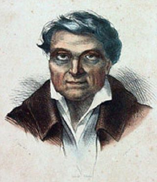
John Young was a British subject who became an important military advisor to Kamehameha I during the formation of the Kingdom of Hawaii. He was left behind by Simon Metcalfe, captain of the American ship Eleanora, and along with a Welshman Isaac Davis, and became a friend and advisor to Kamehameha. Young brought knowledge of naval and land battle strategies to Kamehameha, and became a strong voice on affairs of state for the Hawaiian Kingdom. He played a big role during Hawaii's first contacts with the European powers. He spent the rest of his life in Hawaiʻi. Between 1802 and 1812, John Young ruled as Royal Governor of Hawaii Island while King Kamehameha was away on other islands. He organized the construction of the fort at Honolulu Harbor. The Hawaiians gave him the name ʻOlohana based on Young's typical command "All hands ".

The Hawaiʻi Belt Road is a modern name for the Māmalahoa Highway and consists of Hawaiʻi state Routes 11, 19, and 190 that encircle the Island of Hawaiʻi. The southern section, between Hilo and Kailua-Kona is numbered as Route 11. The section between Hilo and Waimea is Route 19. Between Waimea and Kailua-Kona, the road is split in two: the original "mauka" route and a "makai" Route 19, completed in 1975, which serves as access to the Kona and Kohala Coast resorts. In the Hawaiian language, mauka means "towards the mountain" and makai means "towards the sea". These terms are commonly used in travel directions.
<span class="mw-page-title-main">Puʻukoholā Heiau National Historic Site</span> Historic Place in Hawaii County, Hawaii, United States

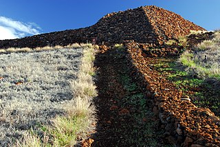
Puʻukoholā Heiau National Historic Site is a United States National Historic Site located on the northwestern coast of the island of Hawaiʻi. The site preserves the National Historic Landmark ruins of the last major Ancient Hawaiian temple, and other historic sites.

<span class="mw-page-title-main">Battle of Mokuohai</span> 1782 battle during the unification of Hawaiʻi

The Battle of Mokuʻōhai, fought in 1782 on the island of Hawaiʻi, was a key battle in the early days of Kamehameha I's wars to conquer the Hawaiian Islands. It was his first major victory, solidifying his leadership over much of the island.

Jane Lahilahi Young Kaʻeo was a Hawaiian high chiefess and a daughter of John Young Olohana, the royal advisor of Kamehameha I.

<span class="mw-page-title-main">Kamakahonu</span> Historic Place in Hawaii County, Hawaii

Kamakahonu, the residence of Kamehameha I, was located at the north end of Kailua Bay in Kailua-Kona on Hawaiʻi Island.

Keaweaheulu Kaluaʻapana was a Hawaiian high chief and maternal great-grandfather of King Kalākaua and Queen Liliʻuokalani. He was among Kamehameha I's council of chiefs and was one of the Five Kona chiefs.

<span class="mw-page-title-main">Keōua Kūʻahuʻula</span> Alii Nui of Kaū

Keōua Kūʻahuʻula was an Aliʻi during the time of the unification of the Kingdom of Hawaiʻi.

<span class="mw-page-title-main">Kaupulehu, Hawaii</span>

Kaʻūpūlehu is the site of a historic settlement on the west coast of Hawaiʻi island, the largest of the Hawaiian Islands. Devastated by a lava flow, the area is now the home of luxury hotels such as the Four Seasons Resort Hualalai.

<span class="mw-page-title-main">Kona District, Hawaii</span> District on the Big Island of Hawaii

Kona is a moku or district on the Big Island of Hawaiʻi in the State of Hawaii, known for its Kona coffee and the Ironman World Championship Triathlon. In the administration of Hawaiʻi County, the moku of Kona is divided into North Kona District and South Kona District. "Kona" sometimes refers to its largest town, Kailua-Kona. Other towns in Kona include Kealakekua, Keauhou, Holualoa, Hōnaunau and Honalo.

Aliʻi Drive is the main street of Kailua-Kona, Island of Hawaii, United States.

References

  1. 1 2 3 Linda Wedel Greene (1993). "Chapter VII: Pu'ukohola Heiau National Historic Site". A Cultural History of Three Traditional Hawaiian Sites on the West Coast of Hawai'i Island. United States Department of the Interior National Park Service Denver Service Center.
  2. 1 2 Abraham Fornander (1880). John F. G. Stokes (ed.). An Account of the Polynesian Race: Its Origins and Migrations, and the Ancient History of the Hawaiian People to the Times of Kamehameha I. Vol. 2. Trübner & Co.
  3. Rod Smith, MRC (2011). Hawaii: A Walker's Guide (Third ed.). Hunter Publishing, Inc. p. 167. ISBN   978-1-58843-228-5.
  4. "John Young Homestead - Puʻukoholā Heiau National Historic Site (U.S. National Park Service)".
  5. John R. K. Clark (1985). Beaches of the Big Island . University of Hawaii Press. pp.  135–138. ISBN   0-8248-0976-9.
  6. Sheldon Dibble (1843). History of the Sandwich Islands. Lahainaluna: Press of the Mission Seminary.
  7. Hiram Bingham I (1855) [1848]. A Residence of Twenty-one Years in the Sandwich Islands (Third ed.). H.D. Goodwin.

20°2′7″N155°49′42″W / 20.03528°N 155.82833°W / 20.03528; -155.82833