Related Research Articles

Chengalpattu, previously known as Chingleput, is a town and the headquarters of Chengalpattu district of the state Tamil Nadu, India. The town is located near to the industrial and IT hub. It is the headquarters of the district and is 56 kilometres (35 mi) away from the state capital, Chennai on the National Highway 45.
Orathy is a village in Madurantakam taluk, Chengalpattu district, Tamil Nadu, India. There are more than 5000 inhabitants.

Chengalpattu is a state assembly constituency in Chengalpattu district, Tamil Nadu, India. Its State Assembly Constituency number is 32. It comprises a portion of Chengalpattu taluk and is a part of the Kancheepuram constituency for national elections to the Parliament of India. It is one of the 234 State Legislative Assembly Constituencies in Tamil Nadu, in India.
Chengalpattu taluk is a taluk of Chengalpattu district of the Indian state of Tamil Nadu. The headquarters of the taluk is the town of Chengalpattu.
Cheyyur taluk is a taluk of Chengalpattu district of the Indian state of Tamil Nadu. The headquarters of the taluk is the town of Cheyyur.
Madurantakam taluk is a taluk of Chengalpattu district of the Indian state of Tamil Nadu. The headquarters of the taluk is the town of Madurantakam. Madurantakam taluk is bounded by Chengalpattu taluk in north, Uthiramerur taluk of Kanchipuram district in West, Thirukklaukkundram Taluk in north east and Tindivanam lauk of Villupuram district in south.

Potheri is a rapidly-growing village locality in the South suburbs of the Metropolitan city Chennai. It is a town that comes under Maraimalai Nagar municipality of Chengalpattu taluk in the Chengalpattu district of Tamil Nadu, India and suburb of Chennai within Chennai Metropolitan Area. It is about 2.5 kilometers from Guduvancheri.The primary educational institutions located in Potheri are SRM Institute of Science and Technology and Valliammai Engineering College.

Tirumani is a suburb of Chennai located south of Chengalpattu.

Irumbuliyur Junction is one of the important junctions in the city of Chennai, India. It is located at Irumbuliyur near Tambaram in Chennai at the intersection of NH 45 with the Chennai Bypass.
Vembakkam is a town panchayat situated in the Tiruvannamalai district of the Indian state of Tamil Nadu. It is located about 20 kilometres (12 mi) from the town of Kanchipuram. It contains a BDO office for many villages around it.
Chunampet is a village in the Cheyyur taluk of Chengalpattu district in Tamil Nadu State of India. It is located 99 kilometres from Chennai and 22 kilometres from Madurantakam on the Madurantakam-Marakkanam road. It was the seat of the zamindar of Chunampet during the colonial era. It is located at the southern edge of the Buckingham Canal.
Pudupakkam is a village near Chennai, India. It is closer to Siruseri SIPCOT. This village comes under Thiruporur taluk of Chengalpattu district in Tamil Nadu. t has reputed Dr. Ambedkar Government Law College. The opening of an IT park in Siruseri, has led to an increase in apartments and villas in the region.

Cheyyur is a state assembly constituency in Tamil Nadu, India, that was formed after constituency delimitation in 2007. Its State Assembly Constituency number is 34. Located in Chengalpattu district, it comprises Cheyyur taluk and a portion of Tirukalukundram taluk. It is included in the Kancheepuram parliamentary constituency for elections to the Parliament of India. It is reserved for candidates from the Scheduled Castes. It is one of the 234 State Legislative Assembly Constituencies in Tamil Nadu in India.
The Acharapakkam block is a revenue block in the Chengalpattu district of Tamil Nadu, India. It has a total of 59 panchayat villages.
The Madurantakam block is a revenue block in the Chengalpattu district of Tamil Nadu, India. It has a total of 58 panchayat villages.

Kovilambakkam is a southern suburb of Chennai, India. It is a village panchayat located in Tambaram taluk, Chengalpattu district in the state of Tamil Nadu, about 26 km from Chennai city center and 12 km from Tambaram. The neighbourhood spans the areas of Sunnambu Kolathur, Chinna Kovilambakkam and Periya Kovilambakkam.
Payanoor or Paiyanoor is a village in Chengalpattu district in the Indian state of Tamil Nadu. It is the nearest area to Mahabalipuram. It is located on Old Mahabalipuram Road.
Kurumpirai is a village in the Cheyyur taluk under Polambakkam postal area of Chengalpattu district, Tamil Nadu, India. It is located 92 kilometres from Chennai and 7 kilometres from Melmaruvathur.
Karumbakkam is a village located in the Chengalpattu taluk of the Kanchipuram district of the Indian state Tamil Nadu. According to the 2011 Census information, the total geographical area of the village is 184.89 hectares (0.714 sq mi), and the total population is 1,330.
Orikkai is a village in Kanchipuram district, Tamil Nadu state, India.
References
12°39′15″N79°34′29″E / 12.6543°N 79.5746°E
| District headquarters | 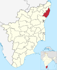 | ||||
|---|---|---|---|---|---|
| Region | |||||
| State | |||||
| Country | |||||
| Revenue administration |
| ||||
| Blocks | |||||
| Municipal corporations | |||||
| Municipalities | |||||
| Cantonment boards | |||||
| Town panchayats | |||||
| Assembly constituencies | |||||
| | This Chengalpattu district location article is a stub. You can help Wikipedia by expanding it. |