Kaława

Last updated
Kaława
Village

Kalawa.jpg

Main road
Poland adm location map.svg
Red pog.svg
Kaława
Coordinates: 52°22′N15°31′E / 52.367°N 15.517°E / 52.367; 15.517
Country Flag of Poland.svg Poland
Voivodeship Lubusz
County Międzyrzecz
Gmina Międzyrzecz

Kaława [kaˈwava] (German : Kalau) is a village in the administrative district of Gmina Międzyrzecz, within Międzyrzecz County, Lubusz Voivodeship, in western Poland. [1]

German language West Germanic language

German is a West Germanic language that is mainly spoken in Central Europe. It is the most widely spoken and official or co-official language in Germany, Austria, Switzerland, South Tyrol (Italy), the German-speaking Community of Belgium, and Liechtenstein. It is also one of the three official languages of Luxembourg and a co-official language in the Opole Voivodeship in Poland. The languages which are most similar to German are the other members of the West Germanic language branch: Afrikaans, Dutch, English, the Frisian languages, Low German/Low Saxon, Luxembourgish, and Yiddish. There are also strong similarities in vocabulary with Danish, Norwegian and Swedish, although those belong to the North Germanic group. German is the second most widely spoken Germanic language, after English.

Village Small clustered human settlement smaller than a town

A village is a clustered human settlement or community, larger than a hamlet but smaller than a town, with a population ranging from a few hundred to a few thousand. Though villages are often located in rural areas, the term urban village is also applied to certain urban neighborhoods. Villages are normally permanent, with fixed dwellings; however, transient villages can occur. Further, the dwellings of a village are fairly close to one another, not scattered broadly over the landscape, as a dispersed settlement.

Gmina Międzyrzecz is an urban-rural gmina in Międzyrzecz County, Lubusz Voivodeship, in western Poland. Its seat is the town of Międzyrzecz, which lies approximately 48 kilometres (30 mi) southeast of Gorzów Wielkopolski and 68 km (42 mi) north of Zielona Góra.

Contents

Geography

The village lies approximately 11 kilometres (7 mi) south-west of Międzyrzecz, 45 km (28 mi) south-east of Gorzów Wielkopolski, and 48 km (30 mi) north of Zielona Góra. It is located on National road 3, a component of European route E65, which today is upgraded as the Expressway S3 bypass road.

Międzyrzecz Place in Lubusz, Poland

Międzyrzecz is a town in western Poland, on the Obra and Paklica river, with 18,310 inhabitants. The capital of Gmina Międzyrzecz and Międzyrzecz County. Since the Local Government Reorganization Act of 1998, it has been situated in Lubusz Voivodeship. From 1975–1998 Międzyrzecz was part of Gorzów Voivodeship. The town limits cover 10.26 square kilometres (3.96 sq mi).

National road 3 (Poland) national road in Poland

National road 3 is a route belonging to the Polish national road network. The highway connects the northwestern and southwestern regions of Poland, running from Świnoujście at the German border to Jakuszyce at the Czech border, traversing through the West Pomeranian, Lubusz and Lower Silesian voivodeships. National road 3 is a component of European highway E65.

European route E65 transcontinental highway in Europe

European route E 65 is a north-south Class-A European route that begins in Malmö, Sweden and ends in Chania, Greece. The road is about 4,400 km (2,700 mi) in length.

History

St Nicholas Church 17958 Kalawa kosciol 1.JPG
St Nicholas Church

The village in Greater Poland near the border with Brandenburg was mentioned in 1257 as a property of the Cistercian abbey of Gościkowo. The Gothic parish church was plundered by the Swedish troops which Field Marshal Arvid Wittenberg led into Poland during the Second Northern War in 1655 and afterwards was rebuilt in a Baroque style.

Duchy of Greater Poland historical Polish province

The Duchy of Greater Poland was a historical Polish province established in 1138 according to the Testament of Bolesław III Krzywousty. It existed during the period of fragmentation of Poland until 1320, centered at Poznań, Gniezno and Kalisz in the Greater Poland region.

Margraviate of Brandenburg major principality of the Holy Roman Empire from 1157 to 1806

The Margraviate of Brandenburg was a major principality of the Holy Roman Empire from 1157 to 1806 that played a pivotal role in the history of Germany and Central Europe.

Cistercians Catholic religious order

The Cistercians, officially the Order of Cistercians, are a Catholic religious order of monks and nuns that branched off from the Benedictines and follow the Rule of Saint Benedict. They are also known as Bernardines, after the highly influential St. Bernard of Clairvaux ; or as White Monks, in reference to the colour of the "cuccula" or white choir robe worn by the Cistercians over their habits, as opposed to the black cuccula worn by Benedictine monks.

In the 1793 Second Partition of Poland the whole region of Greater Poland was annexed by the Kingdom of Prussia and Kalau was incorporated into Kreis Meseritz in 1818. In the 1930s the central parts of the German Festungsfront Oder-Warthe-Bogen military defence (Werkgruppe Scharnhorst) were laid out west of the village, they were overcome by Soviet Red Army forces during the Vistula–Oder Offensive on 29/30 January 1945.

Second Partition of Poland 1793 division of Poland

The 1793 Second Partition of Poland was the second of three partitions that ended the existence of the Polish–Lithuanian Commonwealth by 1795. The second partition occurred in the aftermath of the Polish–Russian War of 1792 and the Targowica Confederation of 1792, and was approved by its territorial beneficiaries, the Russian Empire and the Kingdom of Prussia. The division was ratified by the coerced Polish parliament (Sejm) in 1793 in a short-lived attempt to prevent the inevitable complete annexation of Poland, the Third Partition.

Kingdom of Prussia Former German state (1701–1918)

The Kingdom of Prussia was a German kingdom that constituted the state of Prussia between 1701 and 1918. It was the driving force behind the unification of Germany in 1871 and was the leading state of the German Empire until its dissolution in 1918. Although it took its name from the region called Prussia, it was based in the Margraviate of Brandenburg, where its capital was Berlin.

Kreis Meseritz District in Germany

Kreis Meseritz was a district in Prussia, first in the southern administrative Region of Posen within the Prussian Province of Posen, then within the Province of the Frontier March of Posen-West Prussia and at last as part of the administrative Region of Frankfurt within the Province of Brandenburg. Its former territory presently lies in the eastern part of the Lubuskie Voivodeship, a region of Poland, roughly resembling the extent of the present county Powiat międzyrzecki.

After the implementation of the Oder–Neisse line, Kaława became part of the People's Republic of Poland and the remaining German population was expelled. From 1975–98 the village belonged to Gorzów Voivodeship.

Oder–Neisse line German-Polish border since World War II

The Oder–Neisse line is the basis of the international border between Germany and Poland. It runs mainly along the Oder and Lusatian Neisse rivers and meets the Baltic Sea in the north, just west of the ports of Szczecin and Świnoujście.

Flight and expulsion of Germans from Poland during and after World War II

The flight and expulsion of Germans from Poland was the largest of a series of flights and expulsions of Germans in Europe during and after World War II. The German population fled or was expelled from all regions which are currently within the territorial boundaries of Poland, including the former eastern territories of Germany and parts of pre-war Poland.

Voivodeships of Poland (1975–98)

The voivodeships of Poland from 1975–1998 were created as part of a two-tier method for administering the country and its regions. Between June 1, 1975, and December 31, 1998, pursuant to a law proclaimed on May 28, 1975, Poland was administratively divided into 49 voivodeships, consolidating and eliminating the intermediate administrative level of counties.

Related Research Articles

Skwierzyna Place in Lubusz, Poland

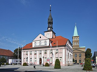
Skwierzyna is a town of 10,339 inhabitants (2005) in Lubusz Voivodeship in western Poland, the administrative seat of the Gmina Skwierzyna. It is located at the confluence of the Obra and Warta rivers, about 18 km (11 mi) north of Międzyrzecz and 23 km (14 mi) south-east of the regional capital Gorzów Wielkopolski. The town is situated in a particularly green part of Poland. Extensive forests and numerous lakes can be found in the vicinity.

Głębokie, Międzyrzecz County Village in Lubusz, Poland

Głębokie is a village in the administrative district of Gmina Międzyrzecz, within Międzyrzecz County, Lubusz Voivodeship, in western Poland. It lies approximately 6 kilometres (4 mi) north-west of Międzyrzecz, 34 km (21 mi) south-east of Gorzów Wielkopolski, and 61 km (38 mi) north of Zielona Góra.

Kalsko Village in Lubusz, Poland

Kalsko is a village in the administrative district of Gmina Międzyrzecz, within Międzyrzecz County, Lubusz Voivodeship, in western Poland. It lies approximately 8 kilometres (5 mi) north of Międzyrzecz, 36 km (22 mi) south-east of Gorzów Wielkopolski, and 64 km (40 mi) north of Zielona Góra.

Kęszyca Village in Lubusz, Poland

Kęszyca is a village in the administrative district of Gmina Międzyrzecz, within Międzyrzecz County, Lubusz Voivodeship, in western Poland. It lies approximately 7 kilometres (4 mi) south-west of Międzyrzecz, 40 km (25 mi) south-east of Gorzów Wielkopolski, and 53 km (33 mi) north of Zielona Góra.

Kursko Village in Lubusz, Poland

Kursko is a village in the administrative district of Gmina Międzyrzecz, within Międzyrzecz County, Lubusz Voivodeship, in western Poland. It lies approximately 11 kilometres (7 mi) west of Międzyrzecz, 36 km (22 mi) south of Gorzów Wielkopolski, and 55 km (34 mi) north of Zielona Góra.

Rojewo, Lubusz Voivodeship Village in Lubusz, Poland

Rojewo is a village in the administrative district of Gmina Międzyrzecz, within Międzyrzecz County, Lubusz Voivodeship, in western Poland. It lies approximately 9 kilometres (6 mi) north of Międzyrzecz, 32 km (20 mi) south-east of Gorzów Wielkopolski, and 65 km (40 mi) north of Zielona Góra.

Święty Wojciech, Lubusz Voivodeship Village in Lubusz, Poland

Święty Wojciech is a village in the administrative district of Gmina Międzyrzecz, within Międzyrzecz County, Lubusz Voivodeship, in western Poland. It lies approximately 4 kilometres (2 mi) south-west of Międzyrzecz, 39 km (24 mi) south-east of Gorzów Wielkopolski, and 55 km (34 mi) north of Zielona Góra.

Wysoka, Międzyrzecz County Village in Lubusz, Poland

Wysoka is a village in the administrative district of Gmina Międzyrzecz, within Międzyrzecz County, Lubusz Voivodeship, in western Poland. It lies approximately 14 kilometres (9 mi) south-west of Międzyrzecz, 43 km (27 mi) south of Gorzów Wielkopolski, and 48 km (30 mi) north of Zielona Góra.

Zamostowo Village in Lubusz, Poland

Zamostowo is a village in the administrative district of Gmina Międzyrzecz, within Międzyrzecz County, Lubusz Voivodeship, in western Poland. It lies approximately 10 kilometres (6 mi) west of Międzyrzecz, 34 km (21 mi) south-east of Gorzów Wielkopolski, and 58 km (36 mi) north of Zielona Góra.

Bledzew Village in Lubusz, Poland

Bledzew is a village in Międzyrzecz County, Lubusz Voivodeship, in western Poland. It is the seat of the gmina called Gmina Bledzew.

Goruńsko Village in Lubusz, Poland

Goruńsko is a village in the administrative district of Gmina Bledzew, within Międzyrzecz County, Lubusz Voivodeship, in western Poland. It lies approximately 4 kilometres (2 mi) south of Bledzew, 14 km (9 mi) west of Międzyrzecz, 30 km (19 mi) south of Gorzów Wielkopolski, and 61 km (38 mi) north of Zielona Góra.

Nowa Wieś, Międzyrzecz County Village in Lubusz, Poland

Nowa Wieś is a village in the administrative district of Gmina Bledzew, within Międzyrzecz County, Lubusz Voivodeship, in western Poland. It lies approximately 6 kilometres (4 mi) south-west of Bledzew, 16 km (10 mi) west of Międzyrzecz, 30 km (19 mi) south of Gorzów Wielkopolski, and 60 km (37 mi) north of Zielona Góra.

Osiecko, Lubusz Voivodeship Village in Lubusz, Poland

Osiecko is a village in the administrative district of Gmina Bledzew, within Międzyrzecz County, Lubusz Voivodeship, in western Poland. It lies approximately 8 kilometres (5 mi) west of Bledzew, 23 km (14 mi) west of Międzyrzecz, 25 km (16 mi) south of Gorzów Wielkopolski, and 66 km (41 mi) north of Zielona Góra.

Pniewo, Gmina Bledzew Village in Lubusz, Poland

Pniewo is a village in the administrative district of Gmina Bledzew, within Międzyrzecz County, Lubusz Voivodeship, in western Poland. It lies approximately 11 kilometres (7 mi) west of Bledzew, 25 km (16 mi) west of Międzyrzecz, and 23 km (14 mi) south of Gorzów Wielkopolski.

Popowo, Międzyrzecz County Village in Lubusz, Poland

Popowo is a village in the administrative district of Gmina Bledzew, within Międzyrzecz County, Lubusz Voivodeship, in western Poland. It lies approximately 7 kilometres (4 mi) east of Bledzew, 10 km (6 mi) north-west of Międzyrzecz, 30 km (19 mi) south-east of Gorzów Wielkopolski, and 65 km (40 mi) north of Zielona Góra.

Sokola Dąbrowa Village in Lubusz, Poland

Sokola Dąbrowa is a village in the administrative district of Gmina Bledzew, within Międzyrzecz County, Lubusz Voivodeship, in western Poland.

Strużyny Settlement in Lubusz, Poland

Strużyny is a settlement in the administrative district of Gmina Bledzew, within Międzyrzecz County, Lubusz Voivodeship, in western Poland. It lies approximately 3 kilometres (2 mi) south-west of Bledzew, 17 km (11 mi) west of Międzyrzecz, 28 km (17 mi) south of Gorzów Wielkopolski, and 63 km (39 mi) north of Zielona Góra.

Panowice Village in Lubusz, Poland

Panowice is a village in the administrative district of Gmina Trzciel, within Międzyrzecz County, Lubusz Voivodeship, in western Poland. It lies approximately 11 kilometres (7 mi) west of Trzciel, 14 km (9 mi) south-east of Międzyrzecz, 50 km (31 mi) north of Zielona Góra, and 53 km (33 mi) south-east of Gorzów Wielkopolski.

Siercz Village in Lubusz, Poland

Siercz is a village in the administrative district of Gmina Trzciel, within Międzyrzecz County, Lubusz Voivodeship, in western Poland. It lies approximately 11 kilometres (7 mi) north-west of Trzciel, 12 km (7 mi) east of Międzyrzecz, 49 km (30 mi) south-east of Gorzów Wielkopolski, and 56 km (35 mi) north of Zielona Góra.

References


Coordinates: 52°22′N15°31′E / 52.367°N 15.517°E / 52.367; 15.517

Geographic coordinate system Coordinate system

A geographic coordinate system is a coordinate system that enables every location on Earth to be specified by a set of numbers, letters or symbols. The coordinates are often chosen such that one of the numbers represents a vertical position and two or three of the numbers represent a horizontal position; alternatively, a geographic position may be expressed in a combined three-dimensional Cartesian vector. A common choice of coordinates is latitude, longitude and elevation. To specify a location on a plane requires a map projection.