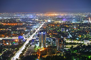
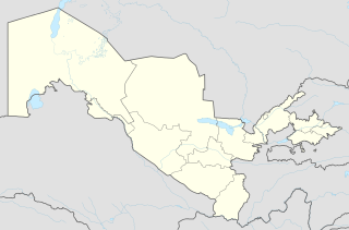
Tashkent, or Toshkent, also historically known as Chach, is the capital and largest city of Uzbekistan, as well as the most populous city in Central Asia, with a population in 2021 of 2,694,400. It is in northeastern Uzbekistan, near the border with Kazakhstan.
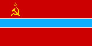
Uzbekistan is the common English name for the Uzbek Soviet Socialist Republic and later, the Republic of Uzbekistan, that refers to the period of Uzbekistan from 1924 to 1991 as one of the constituent republics of the Soviet Union. It was governed by the Uzbek branch of the Soviet Communist Party, the legal political party, from 1925 until 1990. From 1990 to 1991, it was a sovereign part of the Soviet Union with its own legislation. Sometimes, that period is also referred to as Soviet Uzbekistan.

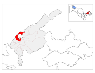
Olmaliq is a district-level city in the Tashkent Region of central Uzbekistan, approximately 65 km east of Tashkent. It is located at latitude 40° 50' 41N; longitude 69° 35' 54E; at an altitude of 585 meters.
Balykchy is a town at the western end of Lake Issyk-Kul in Kyrgyzstan, at an elevation of about 1,900 metres. Its area is 38 square kilometres (15 sq mi), and its resident population was 42,875 in 2021. A major industrial and transport centre during the Soviet era, it lost most of its economic base after the collapse of the Soviet Union and the closure of virtually all of its industrial facilities.

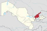
Tashkent Region is a viloyat (region) of Uzbekistan, located in the northeastern part of the country, between the Syr Darya River and the Tien Shan Mountains. It borders with Kyrgyzstan, Tajikistan, Sirdaryo Region and Namangan Region. It covers an area of 15,250 km². The population is estimated 2,975,900 (2021). Its capital is the city Nurafshon. Other cities are Angren, Olmaliq, Ohangaron, Bekabad, Chirchiq, Gʻazalkent, Keles, Parkent, Yangiabad, and Yangiyoʻl.
Nurafshon is a district-level city and the administrative centre of Tashkent Region in Uzbekistan. It is also the seat of the Oʻrtachirchiq District, but not part of it. It has an area of 30 km2 (12 sq mi) and the population of the city is 51,400 (2021).

Soviet Central Asia refers to the section of Central Asia formerly controlled by the Soviet Union, as well as the time period of Soviet administration (1918–1991). Central Asian SSRs declared independence in 1991. In terms of area, it is nearly synonymous with Russian Turkestan, the name for the region during the Russian Empire. Soviet Central Asia went through many territorial divisions before the current borders were created in the 1920s and 1930s.

Gʻijduvon is a city in the Bukhara Region of Uzbekistan and the capital of Gʻijduvon District (tuman). Its population was 38,600 in 2003, and 43,400 in 2016.
Angren is a district-level city in Tashkent Region, eastern Uzbekistan. The city is located on the Angren River 70 mi (110 km) to the east of Tashkent. The City of Angren was created in 1946 from the villages of Jigariston, Jartepa, Teshiktosh, and Qoʻyxona which had emerged in the rich Angren coal basin during World War II. It has an area of 150 km2 (58 sq mi) and the population of the city is 191,300 (2021).

Yangiobod is a city located in the Angren municipality of Tashkent Region, Uzbekistan. Its population is 8,900 (2016).
Burchmullo is an urban-type settlement in the northeast of Tashkent Region, Uzbekistan. It is part of Boʻstonliq District. Its population is 4,100 (2016). It lies by the Koksu River near its inflow into the Charvak Reservoir by the southwestern extremity of the Koksu Ridge, west Tian Shan. It is about 120 km NEE from Tashkent.
Shayxontoxur is one of 12 districts (tuman) of Tashkent, the capital of Uzbekistan.
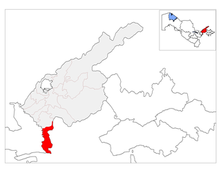
Bekabad is a district of Tashkent Region in Uzbekistan. The capital lies at the town Zafar. It has an area of 760 km2 (290 sq mi) and it had 159,500 inhabitants in 2021.
Yuqorichirchiq is a district of Tashkent Region in Uzbekistan. The capital lies at the town Yangibozor. It has an area of 440 km2 (170 sq mi) and it had 138,900 inhabitants in 2021. The district consists of 4 urban-type settlements and 9 rural communities.
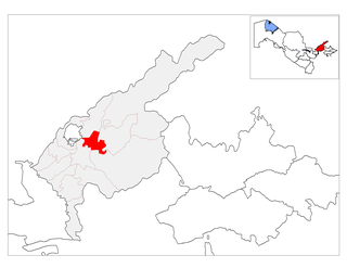
Zangiota is a district of Tashkent Region in Uzbekistan. The capital lies at the town Eshonguzar. It has an area of 210 km2 (81 sq mi) and it had 195,400 inhabitants in 2021. Between 2010 and 2017, the territory of Tashkent District was part of Zangiota District.
Gʻallaorol is a city in Jizzakh Region, Uzbekistan. It is the administrative center of Gʻallaorol District. The town population was 16,623 people in 1989, and 24,700 in 2016. Situated on the Tashkent–Samarkand railway, it became a city in 1973.
Boʻzsuv is an urban-type settlement in Tashkent Region, Uzbekistan. It is part of Yangiyoʻl District. The town population in 1989 was 3673 people.

The Kazakhstan–Uzbekistan border is 2,330 km (1,450 mi) long and runs from the tripoint with Turkmenistan to the tripoint with Kyrgyzstan. It is Uzbekistan's longest external boundary. The Uzbek capital Tashkent is situated just 13 km (8.1 mi) from this border.
Tashkent District is a district of Tashkent Region in Uzbekistan. The seat lies at the city Keles. It was first created in 1975,, merged into Zangiota District in 2010, and re-established in 2017. It has an area of 160 km2 (62 sq mi) and it had 183,200 inhabitants in 2021.