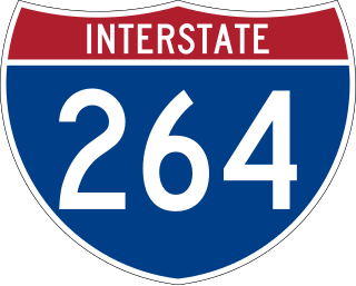
Interstate 264 (I-264) is a partial loop around the city of Louisville, Kentucky, south of the Ohio River. An auxiliary route of I-64, it is signed as the Shawnee Expressway for its first eight miles (13 km) from its western terminus at I-64/US 150 to US 31W/US 60 and as the Watterson Expressway for the remainder of its length from US 31W/US 60 to its eastern terminus at I-71. It is 22.93 miles (36.90 km) in length and runs an open circle around central Louisville. It is the only auxiliary route of I-64 outside of Virginia.
Interstate 265 (I-265) is a 41.71-mile (67.13 km) Interstate Highway partially encircling the Louisville metropolitan area. Starting from I-65 in the southern part of Louisville, it runs through Jefferson County, Kentucky, crosses the Ohio River on the Lewis and Clark Bridge into Indiana, meets I-65 for a second time, and then proceeds westbound to terminate at the I-64 interchange.

Kentucky Route 3005 serves as a northern bypass of Elizabethtown. Locally, it is known as Ring Road. It originates outside the western limits of Elizabethtown at an interchange with Western Kentucky Parkway. The road then takes a wide circuit to the north of the city, eventually entering the city limits. Its eastern terminus is at U.S. 62, here known as Mulberry Street, within the city limits and approximately 1 mile (1.6 km) west of Interstate 65.

U.S. Route 31W is the westernmost of two parallel routes for U.S. Route 31 from Nashville, Tennessee to Louisville, Kentucky.

U.S. Route 60 (US 60) is a major U.S. Highway in the American state of Kentucky. In the early days of the U.S. Highway System, US 60 was originally to be numbered as US 62. Following extensive lobbying and complaints filed by Kentucky governor William J. Fields to the American Association of State Highway Officials, the route was re-designated as US 60 before the system was finalized. In Kentucky, US 60 parallels the Ohio River. US 60 enters Kentucky from Cairo, Illinois, traveling northeast to Louisville, then takes a direct eastward route to rejoin the Ohio River in downtown Ashland, Kentucky. Both US 60 and US 23 run concurrently from Ashland to Catlettsburg where US 60 turns east and enters Kenova, West Virginia. US 60 is the longest route in Kentucky, running 495 miles (797 km) across the width of the state, passing through 22 of Kentucky's counties and through the cities of Paducah, Henderson, Owensboro, Louisville, the state capital of Frankfort, and Lexington.

Kentucky Route 44 is a 70.193 mile (112.965 km) long state highway in the U.S. state of Kentucky managed and maintained by the Kentucky Transportation Cabinet.

Kentucky Route 234 is a 20.033-mile-long (32.240 km) north–south state highway in southern Kentucky. The southern terminus of the route is at KY 101 six miles (10 km) north of Scottsville. The northern terminus is at U.S. Route 68 and KY 80 in downtown Bowling Green.

Kentucky Route 242 is a 10.275-mile-long (16.536 km) long east–west state highway located south of the city limits of Bowling Green in rural Warren County, Kentucky. The western terminus of the route is at US 68 and KY 80 northwest of Rockfield. The eastern terminus is at KY 622 south of Plano.

Interstate 64 (I-64) in the US state of Kentucky travels for 191 miles (307 km), passing by the major towns and cities of Louisville, Frankfort, Lexington, and Ashland. It has several major junctions with other Interstates, including I-65, I-71, I-264, and I-265 in Louisville and I-75 in Lexington.

Kentucky Route 446 is a state highway in the city of Bowling Green in Warren County, Kentucky. The highway runs 0.970 miles (1.561 km) from U.S. Route 31W, US 68, and KY 80 east to Interstate 65 (I-65). KY 446 is a four-lane divided highway that serves as a connector between the Interstate and U.S. Highways east of Bowling Green and provides access to the National Corvette Museum and the Bowling Green Assembly Plant.

U.S. Route 150 (US 150) in Kentucky is a 121.097-mile-long (194.887 km) east–west highway that runs from the Indiana state line above the Ohio River to US 25/KY 1249 at Mount Vernon.

Kentucky Route 526 is a state highway that provides a short rural connecting route between KY 185 and US 31W/US 68/KY 80 north of Bowling Green. Running through the north-central part of Warren County, the route is known locally as Mt. Olivet Road.

Kentucky Route 255 (KY 255) is a 16.977-mile-long (27.322 km) south-north state highway located in south central Kentucky. It provides access to Interstate 65 and Mammoth Cave National park to residents of southern Barren County.
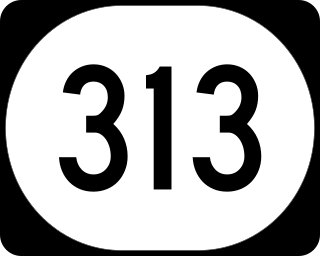
Kentucky Route 313 (KY 313) is a 33.8-mile-long (54.4 km) state highway in the U.S. state of Kentucky. The highway connects rural areas of Hardin and Meade counties with Radcliff and Vine Grove. The stretch from I-65 to Flaherty Road is also known as the Joe Prather Highway.

Kentucky Route 1020 is a 17.806-mile-long (28.656 km) north–south state highway in north central Kentucky, traversing portions of Bullitt and Jefferson counties, including the Louisville metropolitan area.

Kentucky Route 1865 is a 6.193-mile-long (9.967 km) state highway in the U.S. state of Kentucky. Its southern terminus is at KY 2055 in Louisville and its northern terminus is at U.S. Route 60 Alternate in Louisville.

Kentucky Route 1934 is a 11.502-mile-long (18.511 km) state highway in the U.S. State of Kentucky. Its southern terminus is at U.S. Route 31W, US 60 and KY 841 in Louisville and its northern terminus is at KY 2054 in Louisville.

Kentucky Route 2051 is a 6.374-mile-long (10.258 km) state highway in the U.S. State of Kentucky. Its southern terminus is at U.S. Route 31W and US 60 in Louisville and its northern terminus is at KY 1934 in Louisville.

Kentucky Route 907 is a 7.036-mile-long (11.323 km) state highway in the U.S. State of Kentucky. Its southern terminus is at U.S. Route 31W in Louisville and its northern terminus is at KY 1020 in Louisville.

