
Interstate 65 (I-65) is a major north–south interstate highway in the central United States. As with most primary interstates ending in 5, it is a major crosscountry, north–south route, connecting between the Great Lakes and the Gulf of Mexico. Its southern terminus is located at an interchange with I-10 in Mobile, Alabama, and its northern terminus is at an interchange with US 12 (US 12) and US 20 in Gary, Indiana, just southeast of Chicago. I-65 connects several major metropolitan areas in the Midwest and Southern US. It connects the four largest cities in Alabama: Mobile, Montgomery, Birmingham, and Huntsville. It also serves as one of the main north–south routes through Nashville, Tennessee; Louisville, Kentucky; and Indianapolis, Indiana, each a major metropolitan area in its respective state.

U.S. Route 31 or U.S. Highway 31 (US 31) is a major north–south U.S. highway connecting southern Alabama to northern Michigan. Its southern terminus is at an intersection with US 90/US 98 in Spanish Fort, Alabama. Its northern terminus is at an interchange with Interstate 75 (I-75) south of Mackinaw City, Michigan.

U.S. Route 31E (US 31E) is the eastern parallel route for U.S. Highway 31 from Nashville, Tennessee, to Louisville, Kentucky.

U.S. Route 31W is the westernmost of two parallel routes for U.S. Route 31 from Nashville, Tennessee to Louisville, Kentucky.

Kentucky Route 1065 is a 13.856-mile-long (22.299 km) state highway located in Louisville, Kentucky. The western terminus of the route is at Kentucky Route 907 a short distance west of Kentucky Route 841 exit 6 in the Louisville neighborhood of Auburndale. The eastern terminus is at Kentucky Route 1819 in Fern Creek.

Kentucky Route 234 is a 20.033-mile-long (32.240 km) north–south state highway in southern Kentucky. The southern terminus of the route is at KY 101 six miles (10 km) north of Scottsville. The northern terminus is at U.S. Route 68 and KY 80 in downtown Bowling Green.
Interstate 65 (I-65) is part of the Interstate Highway System that runs 887.30 miles (1,427.97 km) north–south from Mobile, Alabama, to Gary, Indiana. The highway crosses Kentucky from south to north, from the Tennessee state line near Franklin to the Indiana state line in Louisville. I-65 passes through three of Kentucky's ten largest cities—Bowling Green, Elizabethtown, and Louisville—and serves Mammoth Cave National Park and Fort Knox. Kentucky was the first state to complete its portion of I-65, with the final section, located near Franklin, opening in 1970.

Kentucky Route 259 is a 95.91-mile-long (154.35 km) state highway that traverses five counties in west-central Kentucky.

Kentucky Route 329 is a state highway located 15 miles (24 km) northeast of downtown Louisville, Kentucky. The western terminus of the route is at U.S. Route 42 in Prospect. The eastern terminus is at KY 146 in Crestwood. An undivided, four lane bypass route of KY 329 exists in the vicinity of Crestwood.

Kentucky Route 21 is a 14.196-mile (22.846 km) west–east highway in Madison County, running from the Garrard County line near Paint Lick to Bighill, east of Berea.

U.S. Route 62 (US 62) in Kentucky runs for a total of 391.207 miles (629.587 km) across 20 counties in western, north-central, and northeastern Kentucky. It enters the state by crossing the Ohio River near Wickliffe, then begins heading eastward at Bardwell, and traversing several cities and towns across the state up to Maysville, where it crosses the Ohio River a second time to enter the state of Ohio.

U.S. Route 150 (US 150) in Kentucky is a 121.097-mile-long (194.887 km) east–west highway that runs from the Indiana state line above the Ohio River to US 25/KY 1249 at Mount Vernon.

Kentucky Route 255 (KY 255) is a 16.977-mile-long (27.322 km) south-north state highway located in south central Kentucky. It provides access to Interstate 65 and Mammoth Cave National park to residents of southern Barren County.

Kentucky Route 914 (KY 914) is a highway in Somerset, Kentucky that encircles the city of Somerset.

Kentucky Route 47 is a 9.851-mile state highway in Kentucky that runs from KY 36 and KY 467 in Sanders to US 42 in Ghent KY 47 mostly stays in Carroll County but makes a short entrance into Gallatin County while passing under Interstate 71.

Kentucky Route 224 (KY 224) is a 27.024-mile-long (43.491 km) state highway in Kentucky that runs from U.S. Route 62 and Vanmeter Street in Clarkson to Kentucky Route 357 west of Magnolia via Upton.

Kentucky Route 220 (KY 220) is a 17.2-mile-long (27.7 km) state highway in the U.S. state of Kentucky. The highway connects mostly rural areas of Hardin County with Radcliff.
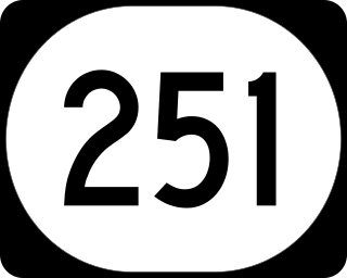
Kentucky Route 251 (KY 251) is an 11-mile-long (18 km) state highway in the U.S. state of Kentucky, split into two sections. The highway connects Elizabethtown and Fort Knox with rural areas of Hardin County; the second section, separated from the first by Fort Knox, is near Belmont in Bullitt County.

Kentucky Route 313 (KY 313) is a 33.8-mile-long (54.4 km) state highway in the U.S. state of Kentucky. The highway connects rural areas of Hardin and Meade counties with Radcliff and Vine Grove. The stretch from I-65 to Flaherty Road is also known as the Joe Prather Highway.

Kentucky Route 1136 is a north–south rural secondary state highway located entirely in Hardin County in north-central Kentucky. The route is 10.655 miles (17.148 km) long and it mainly traverses the southern part of the county.

