Kentucky Route 80 (KY 80) is a 483.55-mile-long (778.20 km) state highway in the southern part of the U.S. state of Kentucky. The route originates on the state's western border at Columbus in Hickman County and stretches across the southern portion of the state, terminating southeast of Elkhorn City on the Virginia state line. It is the longest Kentucky State Highway, though the official distance as listed in route logs is much less due to multiple concurrencies with U.S. Route 68 (US 68) and US 23.

U.S. Route 31W is the westernmost of two parallel routes for U.S. Route 31 from Nashville, Tennessee to Louisville, Kentucky.

Kentucky Route 44 is a 70.193 mile (112.965 km) long state highway in the U.S. state of Kentucky managed and maintained by the Kentucky Transportation Cabinet.

Kentucky Route 880 is a three miles (4.8 km) east–west state highway that forms a connector between U.S. Route 231 (US 231) and KY 234 in the city of Bowling Green, Kentucky. The western terminus of the route is at US 231 in Bowling Green. The eastern terminus is at KY 234 near the community of Indian Hills east of downtown.

Kentucky Route 234 is a 20.033-mile-long (32.240 km) north–south state highway in southern Kentucky. The southern terminus of the route is at KY 101 six miles (10 km) north of Scottsville. The northern terminus is at U.S. Route 68 and KY 80 in downtown Bowling Green.

Kentucky Route 242 is a 10.275-mile-long (16.536 km) long east–west state highway located south of the city limits of Bowling Green in rural Warren County, Kentucky. The western terminus of the route is at US 68 and KY 80 northwest of Rockfield. The eastern terminus is at KY 622 south of Plano.

Kentucky Route 101 (KY 101) is a north–south highway traversing three counties in south central Kentucky.

Kentucky Route 185 is a north–south state highway traversing four counties in west-central Kentucky.

Kentucky Route 446 is a state highway in the city of Bowling Green in Warren County, Kentucky. The highway runs 0.970 miles (1.561 km) from U.S. Route 31W, US 68, and KY 80 east to Interstate 65 (I-65). KY 446 is a four-lane divided highway that serves as a connector between the Interstate and U.S. Highways east of Bowling Green and provides access to the National Corvette Museum and the Bowling Green Assembly Plant.

U.S. Route 79 enters Kentucky from Tennessee in Todd County west of Guthrie and runs northeast into Logan County, terminating at a junction with US 68, US 68 Business, and Kentucky Route 80 in Russellville. US 79 remains a two-lane road throughout Kentucky.
Bristow is an unincorporated community in Warren County, Kentucky, United States. Bristow is part of the Bowling Green Metropolitan Statistical Area.

The original alignment of Kentucky Route 67 (KY 67) was a north–south primary state highway that traversed Edmonson and Warren counties in south central Kentucky. It was one of the original state routes of the state highway system maintained by the Kentucky Transportation Cabinet. It was established in 1929 and was officially decommissioned in 1969. At the time of its removal from the state route system, it was estimated to be 21.491 miles (34.586 km) long as determined by the KYTC's state route logs and county road logs.

Kentucky Route 383 (KY 383) is a 9.513-mile-long (15.310 km) state highway in the U.S. state of Kentucky. The highway connects mostly rural areas of Simpson County with Franklin.

Kentucky Route 434 (KY 434) is a 13.237-mile-long (21.303 km) state highway in the U.S. state of Kentucky. The highway connects mostly rural areas of Hardin and Bullitt counties with Radcliff, Fort Knox, and Lebanon Junction.

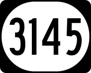
Kentucky Route 3145 is a rural-secondary state highway located entirely in Warren County in South Central Kentucky. The route serves as a connector between U.S. Route 31W and Interstate 65 (I-65) on the far east side of Bowling Green.


