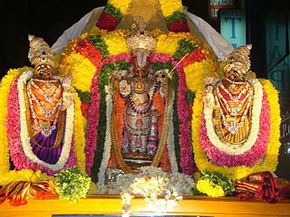
Ranganatha, also known as Ranganathar, Rangan, Aranganathar, SriRanga, and Thenarangathan, is a Hindu deity with his origin in southern India, serving as the chief deity of the Sri Ranganathaswamy Temple, Srirangam. The deity is a resting form of Vishnu, recumbent on the great form of the serpent god Adishesha, the king of the serpents. His primary consort is the goddess Lakshmi, also known as Ranganayaki. The two other consorts seen next to his recumbent figure are Bhudevi and Nila Devi. Most of the deities portray a 'smiling' lord in a sleeping or reclining position over the celestial serpent Adishesha in the sea of cosmic dissolution (pralaya). This is the form in which he is open to listening to all of his devotees' woes, and blesses them. Apart from being worshipped by all Hindus, this form is of particular importance to the Sri Vaishnava community. His name in Sanskrit means "leader of the place of assembly", coined from the two Sanskrit words ranga (place) and natha.
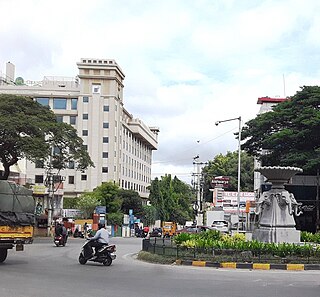
Arsikere is a city and taluka in the Hassan district in the state of Karnataka, India. It is the second largest city in Hassan district, demographically. Arsikere city municipal council consists of 35 wards. This region is known for its coconut production and is also called Kalpataru Nadu. Arsikere Junction is a major railway junction in the South Western Railway which links Mangalore and Mysore to North Karnataka and a central place for tourists who visit nearby places that do not have rail access, such as Belur, Halebidu and Shravanabelagola, Harnahalli, and Kodimata.

Hassan is one of the 31 districts of Karnataka, India. The district headquarter is Hassan. It was part of Manjarabad Faujdari a.k.a Patnada Rayada between 1832-81. In 1882, it was reduced into a sub-division under erstwhile Kadur district. But in 1886, the Hassan district was restored to its current form.

Chunchanakatte Falls is a waterfall on the Kaveri River, near the village of Chunchanakatte in saligrama taluk of Mysore district, Karnataka, India. Water cascades from a height of about 20 meters. It is in the Western Ghats. Here the river falls in two small cascades before joining again to flow as one.

Holenarasipura is a town and taluk in Hassan district of Karnataka. The town is situated on the banks of the Hemavati, one of the tributaries of the Kaveri.
Arkalgud, also known as Arakalagudu is a panchayat town and is one among the eight taluks of Hassan district in the state of Karnataka, India. It is situated 30 km from Hassan, 181 km from Mangalore and 195 km from Bangalore. The river Hemavati forms the entire northern boundary of the Taluk; river Kaveri runs through a portion of the south. It is well connected by road to many towns and cities of Karnataka. Hassan Junction railway station is the nearest major railway station and Kannur International Airport is the nearest airport at 150 kilometres.
Chowlahiriyur is a village and a hobli in Ajjampura taluk of Chikmagalur district, in the state of Karnataka, India.

Ujire is a town near Dharmasthala. It is in Belthangady taluk of Dakshina Kannada district. Ujire is an important junction for travelers in this region. The road at Ujire deviates to Dharmasthala, Kottigehara and Belthangady.
Punacha is a village in the southern state of Karnataka, India. It is located in the Bantwal taluk of Dakshina Kannada district in Karnataka.
Konanur is a mid level town in the southern state of Karnataka, India. It is located in the Arkalgud taluk of Hassan district in Karnataka.
Saligrama is a new sub-district of Mysore district, situated on the northern bank of the river Cauvery [Kaveri]. This place is esteemed as sacred by the Shri Vaishnavas on account of its having been the residence of Sri Ramanujacharya. It is the headquarters of Saligrama Taluk. It was established as a new taluk carving out of K.R.Nagar taluk with effect from 31.12.2020 and become ninth taluk of Mysore district of Karnataka, India.
The Rudrapatnam Brothers are an Indian Carnatic vocal duo, consisting of brothers R. N. Thyagarajan and Dr. R. N. Tharanathan. The brothers come from a family of musicians from Rudrapatna village off the Kaveri banks in Arkalgud Thaluk of Hassan district in the southwest Indian state of Karnataka. Vocalist Tiger Varadachariar, on seeing the musical atmosphere there, once claimed that "Rudrapatnam is the Thanjavur of Karnataka". Music, Veda adhyayana, and studying Sanskrit were integral parts of their family tradition.

Tetagunta is one of the villages in Tuni mandal in Kakinada district in Andhra Pradesh State and is located 14.1 km from its Mandal main town Tuni. It is 44.3 km from its district main city Kakinada. It has a population of 11,967 and people mostly depend on farming. Tetagunta village of Tuni Mandal is having the largest area of 4,033 hectares in the East Godavari District.It is located at a distance of 120 km from the state main city Visakhapatnam. Pincode:533406
Babalad or Muttyna Babalad is a village in the southern state of Karnataka, India. It is located in Bijapur taluk of Bijapur district, Karnataka. It is nearly 25 km from the district headquarters, Bijapur. It's one of several small villages near Bijapur.
Yaragalla is a village in the southern state of Karnataka, India.
Badanaguppe is a village in Chamarajanagar district of Karnataka state, India.

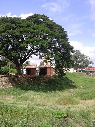
Ramanathapura is a village in Hassan district of Karnataka state, India.
Kadalaveni is a village in the southern state of Karnataka, India. It is located in the Gauribidanur taluk of Chikkaballapura district in Karnataka. It is situated 6 km away from sub-district headquarter Gauribidanur and 44 km away from district headquarter Chikkaballapura
Hanumanthanagar is a locality in Bannimantap, a suburb of Mysore coming on the Northern side of the city. It is part of Mysore district in Karnataka state of India. Hanumanth Nagar is famous for the Jumbo Savari with the golden Howdah, a part of Mysore Dasara, which marks an end of the procession in Bannimantap via Highway Circle of Hanumanth Nagar.

Permude is a village (panchayat) located in the Mangalore taluk, Dakshina Kannada district, in Karnataka state, India. The name, "Permude", derived from Perda Mudde, is a reference to the milk that was once locally produced in large quantities. Permude is located approximately 360 kilometers from the state capital, Bangalore. Nearby villages include Bajpe and Kinnigoli. According to 2011 census information, Permude's location code or village code is 617478. The village comprises an area of 742.69 hectares. Permude falls under the Mangalore Special Economic Zone (MSEZ).

