
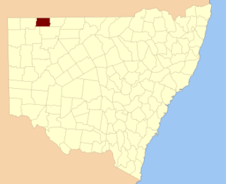
Kerrininna, New South Wales is a remote rural locality and civil Parish, of the Thoulcanna County [1] a cadasteral division of New South Wales. [2] Kerrininna Parish is on the Paroo River south of Hungerford, Queensland.
Kerrininna, New South Wales is a remote rural locality and civil Parish, of the Thoulcanna County [1] a cadasteral division of New South Wales. [2] Kerrininna Parish is on the Paroo River south of Hungerford, Queensland.
The topography is the flat and arid with a Köppen climate classification of BSh (Hot semi arid). [3]
The economy in the parish is based on broad acre agriculture, mainly Cattle. There are no towns in the parish and the nearest settlement is Hungerford, Queensland, upstream.
The parish is on the traditional land of the Karrengappa and Barundji people, and in the 1890s it was included in the Albert Goldfields.
Korri Parish is a remote civil Parish, of the County of Delalah a cadasteral division of New South Wales.
Cullamulcha, New South Wales is a civil Parish, of the County of Delalah, a cadasteral division of New South Wales.
Thoulcanna, New South Wales is a remote civil Parish, of the County of Delalah, a cadasteral division of New South Wales.
Killen, New South Wales is a civil Parish, of the County of Delalah, a cadasteral division of New South Wales.
Berawinia, New South Wales is a remote civil Parish, of the County of Delalah, a cadasteral division of New South Wales.
Elsinora, in New South Wales, Australia, is a civil parish of the county of Delalah, a cadasteral division of New South Wales.
Catombal Parish, New South Wales is a civil Parish, of the County of Delalah, a cadasteral division of New South Wales.
Border, New South Wales is a remote civil Parish, of the County of Delalah a cadasteral division of New South Wales.

Currabenya, New South Wales is a remote rural locality and civil Parish, of Thoulcanna County, a cadasteral division of New South Wales.
Flood Parish, New South Wales is a remote rural locality and civil Parish, of Thoulcanna County, a cadasteral division of New South Wales.
Waverley Parish, New South Wales is a remote civil Parish, of the Thoulcanna County, a cadasteral division of New South Wales.
Talyeale, New South Wales is a remote rural locality and civil Parish, of the Thoulcanna County, a cadasteral division of New South Wales.
Kelly Parish is a remote rural locality on the Paroo River and a civil Parish, of the Thoulcanna County a cadasteral division of New South Wales.
Evelyn Parish, on the Paroo River, is a remote civil Parish, of Thoulcanna County, a cadasteral division of New South Wales.
Stoney Ridge is a remote rural locality on the Paroo River and a civil Parish, of the Thoulcanna County a cadasteral division of New South Wales.
Yernca is a rural locality of Bourke Shire located at 29°34′09″S 144°23′49″E and a remote civil Parish, of the Thoulcanna County a cadasteral division of New South Wales.
Talyealye Parish, New South Wales is a remote civil Parish, of Irrara County, a cadasteral division of New South Wales.
Thurnapatcha, New South Wales is a rural locality of Burke Shire and a remote civil Parish, of Irrara County, a cadasteral division of New South Wales.
Moolort Parish is a remote civil Parish, of Irrara County, a cadasteral division of New South Wales. Moortlort is on te Queensland-New South Wales border just east of Hungerford, Queensland.
Warroo Parish is a remote civil Parish, of Irrara County, a cadasteral division of New South Wales. Warroo Parish is on the Queensland-New South Wales border just east of Hungerford, Queensland.
| This Far West geography article is a stub. You can help Wikipedia by expanding it. |