
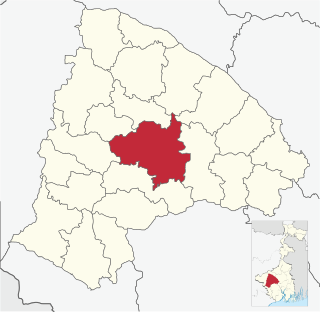
Mohanpur is a community development block that forms an administrative division in the Kharagpur subdivision of Paschim Medinipur district in the Indian state of West Bengal.

Arsha is a community development block that forms an administrative division in the Purulia Sadar subdivision of the Purulia district in the Indian state of West Bengal.

Bandwan is a community development block that forms an administrative division in the Manbazar subdivision of the Purulia district in the Indian state of West Bengal.

Hura is a community development block that forms an administrative division in the Purulia Sadar subdivision of the Purulia district in the Indian state of West Bengal.
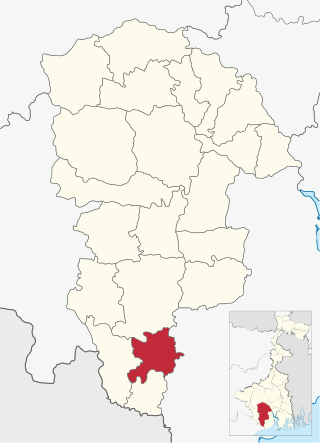
Onda is a community development block that forms an administrative division in the Bankura Sadar subdivision of the Bankura district in the Indian state of West Bengal.

Pingla is a community development block that forms an administrative division in the Kharagpur subdivision of Paschim Medinipur district in the Indian state of West Bengal.

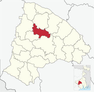
Narayangarh is a community development block that forms an administrative division in the Kharagpur subdivision of Paschim Medinipur district in the Indian state of West Bengal.

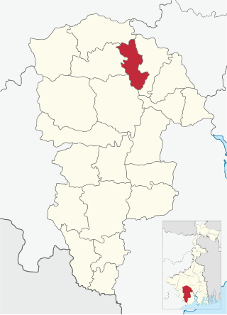
Ranibandh is a community development block that forms an administrative division in Khatra subdivision of Bankura district in the Indian state of West Bengal.
Bankura II is a community development block that forms an administrative division in the Bankura Sadar subdivision of the Bankura district in the Indian state of West Bengal.

Garhbeta I is a community development block that forms an administrative division in Medinipur Sadar subdivision of Paschim Medinipur district in the Indian state of West Bengal.

Garhbeta III is a community development block that forms an administrative division in Medinipur Sadar subdivision of Paschim Medinipur district in the Indian state of West Bengal.

Chandrakona I is a community development block that forms an administrative division in Ghatal subdivision of Paschim Medinipur district in the Indian state of West Bengal.
Chandrakona II is a community development block that forms an administrative division in Ghatal subdivision of Paschim Medinipur district in the Indian state of West Bengal.

Daspur II is a community development block that forms an administrative division in Ghatal subdivision of Paschim Medinipur district in the Indian state of West Bengal.
Dantan II is a community development block that forms an administrative division in the Kharagpur subdivision of Paschim Medinipur district in the Indian state of West Bengal.

Kharagpur I is a community development block that forms an administrative division in the Kharagpur subdivision of Paschim Medinipur district in the Indian state of West Bengal. It is located 14 km from Midnapore, the district headquarters.

Kharagpur II is a community development block that forms an administrative division in the Kharagpur subdivision of Paschim Medinipur district in the Indian state of West Bengal. Kharagpur police station serves this block. Headquarters of this block is at Madpur.

Contai III is a community development block that forms an administrative division in Contai subdivision of Purba Medinipur district in the Indian state of West Bengal.

Barabazar is a community development block that forms an administrative division in the Manbazar subdivision of the Purulia district in the Indian state of West Bengal.

Raghunathpur II is a community development block that forms an administrative division in the Raghunathpur subdivision of the Purulia district in the Indian state of West Bengal.
