
Kabul is the capital city of Afghanistan. Located in the eastern half of the country, it is also a municipality, forming part of the Kabul Province. The city is divided for administration into 22 municipal districts. In 2023 its population was estimated to be 4.95 million people. In contemporary times, Kabul has served as Afghanistan's political, cultural and economical center. Rapid urbanisation has made it the country's primate city and the 75th-largest city in the world.

The population of Afghanistan is around 43.4 million as of 2024. The nation is composed of a multi-ethnic and multilingual society, reflecting its location astride historic trade and invasion routes between Central Asia, South Asia, and Western Asia. Ethnic groups in the country include Pashtun, Tajik, Hazara, Uzbek, as well as smaller groups such as Baloch, Nuristani, Turkmen, Aimaq, Mongol and some others which are less known. Together they make up the contemporary Afghan people.
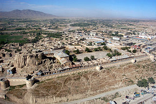
Gardez is the capital of the Paktia Province of Afghanistan. The population of the city was estimated to be ca. 10,000 in the 1979 census and was estimated to be 70,000 in 2008. The majority of the city's native population is Pashtun. The city of Gardez is located at the junction between two important roads that cut, through a huge alpine valley. Surrounded by the mountains and deserts of the Hindu Kush, which boil up from the valley floor to the north, east and west, it is the axis of commerce for a huge area of eastern Afghanistan and has been a strategic location for armies throughout the country's long history of conflict. Observation posts built by Alexander the Great are still crumbling on the hilltops just outside the city limits. The city of Gardez has a population of 70,641. It has 13 districts and a total land area of 6,174 hectares (23.84 sq mi). The total number of dwellings in this city is 7,849.

Kunduz is one of the 34 provinces of Afghanistan, located in the northern part of the country next to Tajikistan. The population of the province is around 1,136,677, which is mostly a tribal society; it is one of Afghanistan's most ethnically diverse provinces with many different ethnicities in large numbers living there. The city of Kunduz serves as the capital of the province. It borders the provinces of Takhar, Baghlan, Samangan and Balkh, as well as the Khatlon Region of Tajikistan. The Kunduz Airport is located next to the provincial capital.

Kabul, situated in the east of the country, is one of the thirty-four provinces of Afghanistan. The capital of the province is Kabul city, which is Afghanistan's capital and largest city. The population of the Kabul Province is over 5.5 million people as of 2022, of which over 85 percent live in urban areas. The current governor of the province is Qari Baryal.

Kapisa is the smallest of Afghanistan's thirty-four provinces and is located in the north-east of the country. It has an estimated population of 496,840 people and an area of 1,842 km2 (711 sq mi), making it the most densely populated province apart from Kabul Province. It borders Panjshir Province to the north, Laghman Province to the east, Kabul Province to the south and Parwan Province to the west. Mahmud-i-Raqi is the provincial capital, while the most populous city and district of Kapisa is Nijrab.

Logar is one of the 34 provinces of Afghanistan located in the eastern section of the country. It is divided into 7 districts and contains hundreds of villages. Puli Alam is the capital of the province. As of 2021, Logar has a population of approximately 442,037 people, most of whom are ethnic Pashtuns and Tajiks.

Wardak, also called Wardag is one of the 34 provinces of Afghanistan, located in the central region of Afghanistan. It is divided into eight districts and has a population of approximately 500,000. The capital of the province is Maidan Shar, while the most populous district in the province is Saydabad District. Wardak is known for one of its famous high peak mountain known as. In 2021, the Taliban gained control of the province during the 2021 Taliban offensive.

Paktika is one of the 34 provinces of Afghanistan, located in the eastern part of the country. Forming part of the larger Loya Paktia region, Paktika has a population of about 789,000, mostly ethnic Pashtuns. The town of Sharana serves as the provincial capital, while the most populous city is Urgun.

Paghman (Dari/Pashto:پغمان) is a town in the hills near Afghanistan's capital of Kabul. It is the seat of the Paghman District which has a population of about 120,000, mainly Pashtuns and Tajiks. The gardens of Paghman are a major tourist attraction, and why the city is also known as the garden capital of Afghanistan. The neighboring town of Qargha is to the southeast, which can be reached by several roads.

Habibullah Kalakani, derided by the Pashtuns as "Bacha-ye Saqao", was the ruler of Afghanistan from 17 January to 13 October 1929, as well as a leader of the Saqqawists. During the Afghan Civil War (1928–1929), he captured vast swathes of Afghanistan and ruled Kabul during what is known in Afghan historiography as the "Saqqawist period". He was an ethnic Tajik. No country recognized Kalakani as ruler of Afghanistan.

Qarabagh District is located 50 kilometers north of Kabul City in Afghanistan, and 20 kilometers southeast of Bagram Airbase. The district is part of Kabul Province and is on the route between Kabul and Parwan Province. It has a population of 15,000, with an expected 19,000 more people to return from Pakistan and Iran in the future. As of 2002 around 60% of the population are Tajiks and 40% Pashtuns.

Afghanistan is a multiethnic and mostly tribal society. The population of the country consists of numerous ethnolinguistic groups: mainly the Pashtun, Tajik, Hazara, and Uzbek, as well as the minorities of Aimaq, Turkmen, Baloch, Pashai, Nuristani, Gujjar, Brahui, Qizilbash, Pamiri, Kyrgyz, Sadat, Moghol, and others. Altogether they make up the Afghan people.
Shinḍanḍ District is located in the southern part of Herat Province in Afghanistan, bordering Adraskan District to the north, Ghor Province to the east and Farah Province to the south and west. It is one of the 16 districts of Herat Province. The name Shindand is Pashto and relates to lush green farming area. In Persian language it translates to Sabzwār.

Deh Sabz District, also romanized Dih Sabz District, is situated northeast of Kabul city in Afghanistan. It has a population of 100,136 people. About 70% are Pashtuns and 30% are Tajiks.

Kalakan District is located in the northern part of Kabul Province, Afghanistan. It borders Guldara District to the west, Qarabagh District to the north, Dih Sabz District to the east and Mir Bacha Kot District to the south. The population is 26,800 (2006). Tajiks form the majority of population. The center is the village of Kalakan, situated in the central part of the district. The district has been seriously affected by war. Most infrastructure was destroyed. The reconstruction and the return of the displaced families is a slow process.

The Battle of Kabul was a series of intermittent battles and sieges over the city of Kabul during the period of 1992–1996.
Khokhi District is located in the East part of Logar Province, Afghanistan. 80 km away from Kabul and 18 km from Pul-i-Alam centre of Logar Province. Centre of the district is called Khoshi and the population is made up of Pashtuns , Tajiks and Hazara, accounting for 65%, 34%, 1% of the total population respectively.
As a geographically fragmented state, Afghanistan is separated into as many as 14 ethnic groups that have historically faced divisions that devolved into political violence. This conflict reached its culminating point in the 1990s with the rise of the Taliban.

The Shomali Plain, also called the Shomali Valley or Kohistan, is a plateau just north of Kabul, Afghanistan. It is approximately 30 km wide and 80 km long. Shomali means 'windy' or 'northern'. Most of the population is Tajik and some Pashtuns. Charikar, Qarabagh, Istalif, and Bagram are just some of the villages located within the Shomali Plan. It's a fertile area, where fruits and vegetables are cultivated and Kabul's residents picnic on weekends. The area is known for agriculture including grapes, walnuts, apricots, mulberries, pomegranates, and sour cherries. The village of Istalif is especially famous for its deep turquoise and green pottery.

