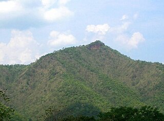
| Khao Nom Sao | |
|---|---|
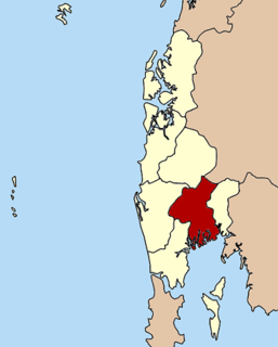
 Khao Nom Sao Location in Thailand | |
| Highest point | |
| Elevation | 1,089 m (3,573 ft) |
| Listing | List of mountains in Thailand Breast-shaped hills |
| Coordinates | 9°48′00″N98°39′06″E / 9.80000°N 98.65167°E Coordinates: 9°48′00″N98°39′06″E / 9.80000°N 98.65167°E |
| Geography | |
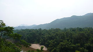
| Location | Ranong, Thailand |
| Parent range | Tenasserim Hills |
| Geology | |
| Mountain type | limestone/granite |
| Climbing | |
| Easiest route | drive |
Khao Nom Sao (เขานมสาว), "female breast mountain", is a land feature located in Ranong Province, Thailand.

The breast is one of two prominences located on the upper ventral region of the torso of primates. In females, it serves as the mammary gland, which produces and secretes milk to feed infants. Both females and males develop breasts from the same embryological tissues. At puberty, estrogens, in conjunction with growth hormone, cause breast development in female humans and to a much lesser extent in other primates. Breast development in other primate females generally only occurs with pregnancy.

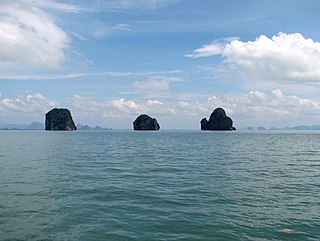
Ranong is one of Thailand's southern provinces (changwat), on the west coast along the Andaman Sea. It has the fewest inhabitants of all Thai provinces. Neighboring Ranong are (clockwise) Chumphon, Surat Thani, and Phang Nga. To the west, it borders Kawthaung, Tanintharyi, Myanmar.

Thailand, officially the Kingdom of Thailand and formerly known as Siam, is a country at the centre of the Southeast Asian Indochinese peninsula composed of 76 provinces. At 513,120 km2 (198,120 sq mi) and over 68 million people, Thailand is the world's 50th largest country by total area and the 21st-most-populous country. The capital and largest city is Bangkok, a special administrative area. Thailand is bordered to the north by Myanmar and Laos, to the east by Laos and Cambodia, to the south by the Gulf of Thailand and Malaysia, and to the west by the Andaman Sea and the southern extremity of Myanmar. Its maritime boundaries include Vietnam in the Gulf of Thailand to the southeast, and Indonesia and India on the Andaman Sea to the southwest. Although nominally a constitutional monarchy and parliamentary democracy, the most recent coup in 2014 established a de facto military dictatorship.