
Rajpipla is a town and a municipality in the Narmada district in the Indian state of Gujarat.

Naldurg is a town and a municipal council in Osmanabad district in the Indian state of Maharashtra.
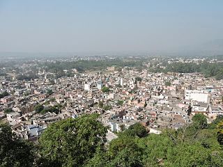
Nalagarh is a city and a municipal committee, near the city of Solan in Solan district in the Indian state of Himachal Pradesh.
Changlang is a census town and headquarters of the Changlang district in the Indian state of Arunachal Pradesh. It has become one of the major districts in the area owing to the presence of crude oil, coal and mineral resources other than tourism and hydro power.
Bilaua is a town and a nagar panchayat in Gwalior district in the state of Madhya Pradesh, India.
Bilsi is a town and a municipal board in Badaun district in the state of Uttar Pradesh, India. It is located to the southwest of Bareilly and has its own tehsil. According to Census 2011 information the sub-district code of Bilsi block is 00780. Total area of Bilsi is 361 km2 including 332.13 km2 rural area and 28.60 km2 urban area. Bilsi has a population of 4,04,198 peoples. There are 67,758 houses in the sub-district. There are about 204 villages in Bilsi bloc
Dhampur is a city and a municipal board in Bijnor district in the state of Uttar Pradesh, India. It is located at 29.51°N 78.50°E, and lies in Northern India.
Karrapur is a census town in Sagar district in the Indian state of Madhya Pradesh.
Kiraoli is a town and a nagar panchayat in Agra district in the Indian state of Uttar Pradesh.
Mahuakhera Ganj is a City, a Nagar Palika Parishad in Udham Singh Nagar district in the Indian state of Uttarakhand. The Mahuakhera Ganj city is divided into 9 wards for which elections are held every 5 years.
Mamit is a census town in Mamit district in the Indian state of Mizoram. Mamit emerged from the regrouping of villages.
Mohgaon is a town and a nagar parishad in Chhindwara district in the Indian state of Madhya Pradesh.
Nallur (Nalloor) is a panchayat town in Kanniyakumari district in the Indian state of Tamil Nadu.
Pratitnagar is a census town in Dehradun district in the Indian state of Uttarakhand.
Salumbar is a District in the Indian state of Rajasthan.
Sindagi is a City and Taluk in Vijayapura district in the Indian state of Karnataka, about 60 km to the east of Bijapur.
Uthayendram is a town in Vellore district in the Indian state of Tamil Nadu.
Vengathur is a census town in Thiruvallur district in the Indian state of Tamil Nadu.
Lala is a town and a town area committee in Hailakandi district in the Indian state of Assam.
Tuahzawl is located near Rawpuichhip(3 km) and near to state capital Aizawl which is 40 km away, it is located near Lengpui Airport which is about 20 km and it is located in Mamit district in the Indian state of Mizoram. Pin Code - 796410
