Khetri Nagar is a town in Jhunjhunu district of Rajasthan in India. It is part of the Shekhawati region. Khetri is actually two towns, "Khetri Town" founded by Raja Khet Singhji Nirwan and "Khetri Nagar" which is about 10 km away from Khetri. Khetri Nagar, well known for its Copper Project, was built by and is under the control of Hindustan Copper Limited, a public sector undertaking under the Government of India. Khetri Nagar is also very well known with name of 'Copper'.

Bahadurganj is a Municipality town nestled in the Tarai of Himalaya and a notified area in Kishanganj district in the state of Bihar, India.

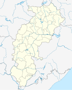
Chhuikhadan is a town and a nagar panchayat in Rajnandgaon District in the state of Chhattisgarh, India.

Chinnasekkadu is a neighbourhood of Chennai in Chennai district in the state of Tamil Nadu, India. Chinnasekkadu used to be a town panchayat in Thiruvallur district. In 2011, Chinnasekkadu town panchayat wss merged with Chennai Corporation. Chinnasekkadu comes under ward 29 in Zone 3(Madhavaram) of Chennai Corporation.

G. Udayagiri, or simply Udayagiri, is a town and a notified area committee in Kandhamal district in the state of Odisha, India.

Handia is a town and a nagar panchayat in the Allahabad district of the Indian state of Uttar Pradesh.

Jemari is a village in Salanpur CD Block in Asansol Sadar subdivision of Paschim Bardhaman district in the state of West Bengal, India.

Khamhria is a town and a nagar panchayat in Bemetara district in the Indian state of Chhattisgarh.

Kiraoli is a town and a nagar panchayat in Agra district in the Indian state of Uttar Pradesh.

Mangawan is a town and a nagar panchayat in Rewa district in the Indian state of Madhya Pradesh. It is 30 km (19 mi) from the District headquarters of Rewa. NH 7 and NH 27 goes through Mangawan. Allahabad is 96 km (60 mi) on NH 27 and Varanasi is 220 km (140 mi) on NH 7.

Naravarikuppam is a town in Thiruvallur district in the Indian state of Tamil Nadu.also called redhills

Panagar is a town with municipality in Jabalpur district in the Indian state of Madhya Pradesh.

Simga is a town and a nagar panchayat in Baloda bazar district in the Indian state of Chhattisgarh.

Tekanpur is a census town in Gwalior district in the Indian state of Madhya Pradesh. The town is also home to the Border Security Force Academy where the Assistant Commandants and the Sub-Inspectors of the BSF train.
Thazhakudy is a panchayat town in Kanniyakumari district in the Indian state of Tamil Nadu. This village is situated between 2 rivers "Puthanaar" and "Palaiyaar". There are also few temples in and around Thazhakudy. Avvaiyar Amman temple is one among them which is 2 km towards East from Thazhakudy.

Raipur is a census town in Dehradun district in the Indian state of Uttarakhand.

Ramnagar is a town in Barabanki district in the state of Uttar Pradesh, India. It is a town, tehsil and a nagar panchayat in Barabanki District in the Indian state of Uttar Pradesh.

Sirmaur is a town and a nagar panchayat in Rewa district in the Indian state of Madhya Pradesh. It is about 42 kilometers from Rewa.

Dewa Sharif or Dewa is a town and a nagar panchayat in Barabanki district in the state of Uttar Pradesh, India. It is famous for the shrine of Haji Waris Ali Shah. This town is also known by the name of Dewa Sharif in respect for the shrine. It is about 26 km north-east of capital Lucknow.

Fatehabad is a town and a municipal committee in Fatehabad district in the state of Haryana, India.


