
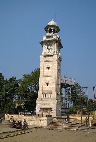
Amethi is a city situated in the Indian state of Uttar Pradesh. Gauriganj is the administrative headquarters of the Amethi district. This district is a part of Ayodhya division in the Awadh region of the state. Amethi was 72nd district of Uttar Pradesh which came into existence on 1 July 2010 by merging three tehsils of the erstwhile Sultanpur district namely Amethi, Gauriganj and Musafirkhana and two tehsils of the erstwhile Raebareli district, namely, Salon and Tiloi. The town is part of the Amethi Lok Sabha constituency and Amethi Assembly constituency, which became reputed as a stronghold of the Indian National Congress party. The Congress leaders belonging to Nehru-Gandhi family won several elections from Amethi during 1980–2014. In 2019, Smriti Irani of Bhartiya Janta Party won this seat. Irani was defeated in 2024 by Kishori Lal Sharma of Indian National Congress.

Faizabad is a city located in Ayodhya district in the Indian state of Uttar Pradesh. It is situated on the southern bank of the River Saryu about 6.5 km from Ayodhya City, the district headquarter, 130 km east of the state capital Lucknow. Faizabad was the first capital of the Nawabs of Awadh and has monuments built by those Nawabs, like the Tomb of Bahu Begum, Gulab Bari. It was also the headquarters of Faizabad district and Faizabad division before November 2018. Faizabad is a twin city of Ayodhya and it is administered by Ayodhya Municipal Corporation.
Bahraich is a city and a municipal board in Bahraich district in the state of Uttar Pradesh, India. Located on the Saryu River, a tributary of the Ghaghara river, Bahraich is 125 kilometres north-east of Lucknow, the state capital. The districts of Barabanki, Gonda, Balrampur, Lakhimpur Kheri, Shravasti and Sitapur share boundaries with Bahraich. A factor which makes this town important is the international border shared with Nepal.

The Ghaghara River, also known as the Karnali River in Nepal, Mapcha Tsangpo in Tibet, and the lower Ghaghara in Awadh is known as the Sarayu River, is a perennial trans-boundary river that originates in the northern slopes of the Himalayas in the Tibetan Plateau, cuts through the Himalayas in Nepal and joins the Sharda River at Brahmaghat in India. Together they form the Ghaghara River, a major left-bank tributary of the Ganges. With a length of 507 km (315 mi), it is the longest river in Nepal. The total length of the Ghaghara up to its confluence with the Ganges at Revelganj in Bihar is 1,080 km (670 mi). It is the largest tributary of the Ganges by volume and the second largest by length after Yamuna.

Bahraich district is one of the districts of Uttar Pradesh state of India, and Bahraich town is the district headquarters. Bahraich District is a part of Devipatan Division.

Barabanki district is one of the five districts of Ayodhya division in the central Awadh region of Uttar Pradesh, India. Barabanki city is the administrative headquarters of Barabanki district. Total area of Barabanki district is 3891.5 Sq. km.

Sitapur district is one of the districts which is situated in Uttar Pradesh state of India, with Sitapur town as the district headquarters. Sitapur district is a part of Lucknow division.
Gonda district is one of the districts of Uttar Pradesh, India. The city of Gonda is the district headquarters, and also the administrative centre for the Devipatan Division. The total area of Gonda district is 4,003 km2 (1,546 sq mi).
Rayagada is a municipality in Rayagada district in the Indian state of Odisha. It is the administrative headquarters of Rayagada district.
Jarwal is a town and a nagar panchayat in Bahraich district in the Indian state of Uttar Pradesh. It has an average elevation of 117 metres (383 feet). This place is 20 km away from historical Lodheshwar Mahadev Mandir located in Mahadeva Ram Nagar, that is well described in old mythological stories.
Mankapur is a town and a nagar panchayat in Gonda district in the Indian state of Uttar Pradesh. It is a constituency of Uttar Pradesh Legislative Assembly currently headed by BJP. It borders Gonda to the West, Rehra bazar to the North, Maskanwa to the East and Nawabganj to the South.
Mohammadi is a town and a municipal board in Lakhimpur Kheri district in the Indian state of Uttar Pradesh. The town and nearby area is known for sugarcane farming. Mohammadi is also known for a special kind of flower known as ‘Ketki Flower’. The fragrance from this flower, only available in Mohammadi, spreads in the whole bagh and nearby areas.
Nanpara is a town & municipal board in Bahraich district in the Indian state of Uttar Pradesh. It is a region along the Nepal Border and includes tracts of dense forests. It is a city surrounded by many villages.
Tanda is a town in Ambedkar Nagar district in the Indian state of Uttar Pradesh situated on the banks of Ghaghara River. It is a nagar palika parishad and is part of Ayodhya division in Uttar Pradesh. The town is situated 20 kilometres (12 mi) north east from district headquarter Akbarpur. Tanda is also a tehsil in the district. It has one of the largest handloom weaving industries for manufacturing varieties like gamchha, lungi, polyester clothing, check-shirt clothes material in state of Uttar Pradesh.
Pichhore is a town and a nagar panchayat in Shivpuri district in the Indian state of Madhya Pradesh.It is Also linked with Train route from Basai railway station situated 35 km from Pichhore.Also it is situated in Bundelkhand region of MP.
Nawabganj is a city in Barabanki district in the state of Uttar Pradesh, India. It is a tehsil and nagar palika for Barabanki town. It is one of the constituent entities of Barabanki city, which is District HQ of Barabanki district.
Balrampur district is one of the district of the Indian state of Uttar Pradesh and is a part of Devipatan division as well as the historic Awadh regions. It has been cut from the adjacent district Gonda in 1997. Located on the banks of the West Rapti River. Balrampur is known for the temple of Pateshwari Devi, a Shakti Pitha, and for the ruins of the nearby ancient city of Sravasti, now a pilgrimage site for Buddhists and Jains. The nearest airport is Shravasti airport 23.3 kilometres (14.5 mi) from the town but it is not an international and regular airport; the nearest international and regular airport is Chaudhary Charan Singh International Airport in Lucknow, 235 kilometres (146 mi) away. Lucknow is the capital city of Uttar Pradesh and is 220 kilometres (140 mi) from Balrampur district headquarters.

Harchandpur is a village and corresponding community development block in Raebareli district, Uttar Pradesh, India. It is located on the Baiti river, which is a tributary of the Sai, and it is northeast from the district headquarters on the road to Lucknow. Particularly since the coming of the railway in the 1800s, Harchandpur serves as one of the main commercial centres for the surrounding region; it is also a major exporter of local goods. As of 2011, its population is 4,348 people, in 833 households.
Goshainganj, also known as Gosainganj, is a town and nagar panchayat in the Ayodhya district of the Indian state of Uttar Pradesh. Located 32 km from the district headquarters Ayodhya, Goshainganj has one of the oldest markets of the district.
Colonelganj is a constituency of the Uttar Pradesh Legislative Assembly covering the town of Colonelganj in the Gonda district of Uttar Pradesh, India.

