The Lynchburg Metropolitan Statistical Area is a United States Metropolitan Statistical Area (MSA) in the state of Virginia, as defined by the Office of Management and Budget (OMB) as of June 2003. As of the 2000 census, the MSA had a population of 228,616. In 2009 this was estimated to have risen to 247,447; as of 2016, the Lynchburg MSA was estimated to have a population of 260,320, making it the fifth-largest metro area in the state.

The Fort Smith Metropolitan Statistical Area, as defined by the United States Census Bureau, is a five-county area including three Arkansas counties and two Oklahoma counties, and anchored by the city of Fort Smith, Arkansas. The total MSA population in 2000 was 273,170 people, estimated by the Bureau to have grown to 289,693 people by 2007.

The Greenwood Micropolitan Statistical Area is a micropolitan area in the northwestern Delta region of Mississippi that covers two counties - Leflore and Carroll. As of the 2000 census, the USA had a population of 48,716.

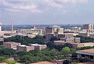
Bryan–College Station is a metropolitan area centering on the twin cities of Bryan and College Station, Texas, in the Brazos Valley region of Texas. The 2010 census placed the population of the three county metropolitan area at 255,519. The 2019 population estimate was 273,101.

The Pampa micropolitan [statistical] area is a micropolitan area in the Texas Panhandle that covers two counties – Gray and Roberts. As of the 2000 census, the region had a population of 23,631.

The Rockford Metropolitan Statistical Area, as defined by the United States Census Bureau, is an area consisting of four counties in north-central Illinois, anchored by the city of Rockford. As of the 2010 census, the MSA had a population of 349,431. The Rockford MSA abuts the southern portions of the Janesville-Beloit MSA and the Chicago MSA. It forms the main part of the larger Rockford–Freeport–Rochelle Combined Statistical Area.

The Burley Micropolitan Statistical Area, as defined by the United States Census Bureau, is an area consisting of two counties in the Magic Valley region of Idaho, anchored by the city of Burley. It is commonly referred to locally as the "Mini-Cassia" area, an amalgam of Minidoka and Cassia Counties.

The Victoria Metropolitan Statistical Area, as defined by the United States Census Bureau, is an area consisting of three counties in the Coastal Bend region of Texas, anchored by the city of Victoria. The area is sometimes referred to as the Golden Crescent Region, though this term is sometimes used to refer to a larger area than just these 3 counties. As of the 2000 census, the MSA had a population of 111,663.

As defined by the U.S. Office of Management and Budget and used by the U.S. Census Bureau for statistical purposes only, the Florence Metropolitan Statistical Area, is an area consisting of two counties in the Pee Dee region of northeastern South Carolina, anchored by the city of Florence. As of the 2000 census, the MSA had a population of 193,155.

The Elizabeth City Micropolitan Statistical Area, as defined by the United States Census Bureau, is an area consisting of two counties in the Inner Banks region of eastern North Carolina, anchored by the area of Elizabeth City. It is part of a bigger Virginia Beach-Norfolk, VA-NC Combined Statistical Area.

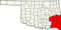
The Ardmore Micropolitan Statistical Area, as defined by the United States Census Bureau, is an area consisting of two counties in South Central Oklahoma, anchored by the city of Ardmore.

The Paducah, KY–IL Metropolitan Statistical Area, as defined by the United States Census Bureau, is an area consisting of five counties – three in the Jackson Purchase region of Kentucky, a fourth Kentucky county bordering the Purchase, and one in Southern Illinois – anchored by the city of Paducah, Kentucky. The Paducah KY-IL Micropolitan Statistical Area was upgraded to Metropolitan Statistical Area (MSA) status on July 21, 2023, by the Office of Management and Budget.. Carlisle County, Kentucky, was added to the area following the 2020 Census of the Population. The total MSA population from the 2020 United States Census was 103,486.
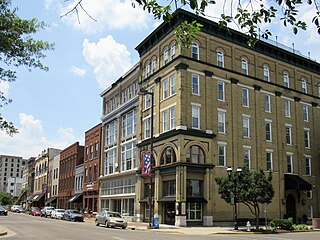
The Frankfort Micropolitan Statistical Area, as defined by the United States Census Bureau, is an area consisting of two counties in central Kentucky, anchored by the city of Frankfort. As of the 2000 census, the Micropolitan Statistical Area (μSA) had a population of 66,798.
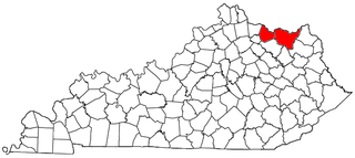
The Mount Sterling Micropolitan Statistical Area, as defined by the United States Census Bureau, is an area consisting of three counties in Kentucky, anchored by the city of Mount Sterling. As of the 2000 census, the μSA had a population of 40,195.

The Mason City Micropolitan Statistical Area, as defined by the United States Census Bureau, is an area consisting of two counties in north central Iowa, anchored by the city of Mason City.

The Muscatine Micropolitan Statistical Area, as defined by the United States Census Bureau, is an area consisting solely of Muscatine County and anchored by the city of Muscatine. The Muscatine Micropolitan Statistical Area is also a part of the Quad Cities Iowa–Illinois Combined Statistical Area (CSA), which has a population of 474,226, making it the 90th-largest CSA in the nation.
The Danville Micropolitan Statistical Area, as defined by the United States Census Bureau, is an area consisting of Boyle and Lincoln counties in Kentucky, anchored by the city of Danville. As of the 2000 census, the μSA had a population of 51,058. A July 1, 2009 estimate placed the population at 54,435.

The Maysville Micropolitan Statistical Area (μSA), as defined by the United States Census Bureau, is coterminous with Mason County, Kentucky, whose county seat and largest city is Maysville. As of the 2010 census, the population of Mason County and the current µSA was 17,490, and 2014 Census Bureau estimates place the population at 17,166.

The South Western Oklahoma Development Authority (SWODA) is a voluntary association of municipalities, counties and conservation districts in Southwestern Oklahoma.

The Hilton Head Island–Bluffton metropolitan area, officially the Hilton Head Island-Bluffton, SC Metropolitan Statistical Area as defined by the United States Census Bureau, is a metropolitan statistical area consisting of the two southernmost counties in the Lowcountry region of South Carolina, centered on the resort town of Hilton Head Island. As of the 2020 census, the MSA had a population of 215,908. Prior to March 2013, the region was considered a micropolitan statistical area.


