
Coevorden is a city and municipality in the province of Drenthe, in the east of the Netherlands. During the 1998 municipal reorganisation in the province, Coevorden merged with Dalen, Sleen, Oosterhesselen and Zweeloo, retaining its name. In August 2017, it had a population of 35,267.
Vossebelt is a hamlet in the Netherlands and it is part of the Coevorden municipality in Drenthe.

Vlieghuis is a hamlet in the Netherlands and is part of the Coevorden municipality in Drenthe.
Valsteeg is a hamlet in the Netherlands and is part of the Coevorden municipality in Drenthe.
Veenhuizen is a hamlet in the Netherlands and it is part of the Coevorden municipality in Drenthe. North of Veenhuizen is Oosterhesselen and east is Dalen.

Schoonoord is a village in the Netherlands and it is part of the Coevorden municipality in Drenthe. It has an altitude of about 20 meters (65 feet). The population was 2,219 with 970 households in 2004.
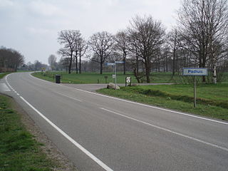
Padhuis is a hamlet in the Netherlands and is part of the Coevorden municipality in Drenthe.
Nieuwe Krim is a hamlet in the Netherlands and is part of the Coevorden municipality in Drenthe.
Klooster is a hamlet in the Netherlands and is part of the Coevorden municipality in Drenthe.
Hoogehaar is a hamlet in the Netherlands and is part of the Coevorden municipality in Drenthe.
Grevenberg is a hamlet in the Netherlands and is part of the Coevorden municipality in Drenthe. North of Grevenberg lies Oosterhesselen and south lies Wachtum.
Eldijk is a hamlet in the Netherlands and is part of the Coevorden municipality in Drenthe.

Diphoorn is a hamlet in the Netherlands and it is part of the Coevorden municipality in Drenthe.
Langerak is a hamlet in the Netherlands and is part of the Coevorden municipality in Drenthe.

Eldersloo is a hamlet in the Netherlands and is part of the Aa en Hunze municipality in Drenthe.

The Molen van Schoonoord is a smock mill in Schoonoord, Netherlands. The mill was built in 1903 and is listed as a Rijksmonument, number 33784. It is now used as living accommodation.

Schoonoord is a tower mill in Alverna, Gelderland, Netherlands, which was built in 1887 and is in working order. The mill is listed as a Rijksmonument.

The Dokkum class was a ship class of eighteen minesweepers that were built in the Netherlands for the Royal Netherlands Navy. They were paid for by the United States under the Mutual Defense Assistance Program (MDAP).
HNLMS Wamandai (A870) was a tugboat of the Royal Netherlands Navy (RNN). She was built in the Netherlands and served between 1962 and 1985 in the RNN.
HNLMS Thetis (A887) was a accommodation ship of the Royal Netherlands Navy. It was used as a diving and disassembly school.


