
Drenthe is a province of the Netherlands located in the northeastern part of the country. It is bordered by Overijssel to the south, Friesland to the west, Groningen to the north, and the German state of Lower Saxony to the east. As of January 2023, Drenthe had a population of about 502,000, and a total area of 2,680 km2 (1,030 sq mi).

Overijssel is a province of the Netherlands located in the eastern part of the country. The province's name comes from the perspective of the Episcopal principality of Utrecht, which held the territory until 1528. The capital city of Overijssel is Zwolle and the largest city is Enschede. The province had a population of about 1,184,000 as of January 2023. The land mostly consists of grasslands and some forests ; it also borders a small part of the IJsselmeer to the west.

Coevorden is a city and municipality in the province of Drenthe, in the east of the Netherlands. During the 1998 municipal reorganisation in the province, Coevorden merged with Dalen, Sleen, Oosterhesselen and Zweeloo, retaining its name. In August 2017, it had a population of 35,267.

De Wolden is a municipality in the northeastern Netherlands in the province of Drenthe.
Steenwijkerland is a municipality in the province of Overijssel, in the eastern Netherlands. Prior to a name change in 2003, it was known as Steenwijk.

Steenwijk, datedly known in English as Stenwick, is a city in the Dutch province of Overijssel. It is located in the municipality of Steenwijkerland. It is the largest town of the municipality.
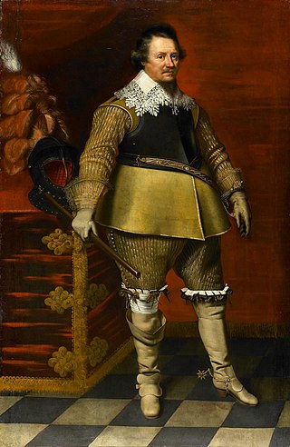
George de Lalaing count Rennenberg, was stadtholder of Friesland, Groningen, Drenthe and Overijssel in the service of Philip II of Spain from 1577 to 1581. The Lalaing family came from Hainaut and had a tradition of governing. His father was Philip de Lalaing, count of Hoogstraten; his mother, Anna of Rennenberg.

Nijensleek is a village in the Dutch province of Drenthe. It is a part of the municipality of Westerveld, and lies about 5 km north of Steenwijk.

Oosterhesselen is a village in the Dutch province of Drenthe. It is located in the municipality of Coevorden, about 9 km north of the city. Oosterhesselen was a separate municipality between 1819 and 1998, when it was merged with Coevorden.

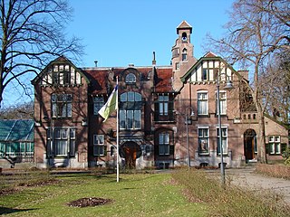
De Wijk is a village in the Netherlands province of Drenthe. It is located in the municipality of De Wolden, and is about 7 km southeast of Meppel. It is home to Rijksmonument 39657, De Wieker Meule.

Steenwijkerwold is a village in the Dutch province of Overijssel. It is located in the municipality of Steenwijkerland, about 5 km northwest of Steenwijk. Steenwijkerwold was a separate municipality until 1973, when it became a part of Steenwijk.

Wanneperveen is a village in the Dutch province of Overijssel. It is located in the municipality of Steenwijkerland, about 4 km west of Meppel.

Ronde van Drenthe is an elite men's and women's professional road bicycle racing event held annually in the Drenthe, Netherlands and sanctioned by the Royal Dutch Cycling Union. The women's event is part of the UCI Women's World Tour, and the men's event is part of the UCI Europe Tour.
Ernest Casimir I was a Count of Nassau-Dietz and Stadtholder of Friesland, Groningen and Drenthe.

The Kop van Overijssel is a region in the very northwestern part of the Dutch province of Overijssel. It consists of the municipality of Steenwijkerland and matches the historical region of the Land van Vollenhove. In past times it comprised a wider area, the municipalities of Kampen, Zwartewaterland and Staphorst also belonging to it.

Jan Arend Godert, Baron de Vos van Steenwijk was a Dutch politician. He was president of the senate of the Netherlands from 1874 until 1880.

Windlust is a smock mill in Noordwolde, Friesland, Netherlands which was built in 1860 and is in working order. The mill is listed as a Rijksmonument.

The siege of Steenwijk was a siege that took place between 30 May and 5 July 1592 as part of the Eighty Years' War and the Anglo–Spanish War by a Dutch and English force under Maurice of Orange. By taking Steenwijk the Republic's army would take out one of the two main transport routes overland to the Drenthe capital of Groningen, the other lay at Coevorden. After a failed bombardment, an assault was made in conjunction with the detonation of mines under important bastions, and with two out of three successfully assaulted, the Spanish troops surrendered on 5 July 1592 and handed over the city to the Dutch and English army. This siege was one of the first in history to make use of pioneers as a separate military unit although they were still at the time regarded as soldiers.

Carel de Vos van Steenwijk was a Dutch politician and diplomat.


