
The Dark Peak is the higher and wilder part of the Peak District in England, mostly forming the northern section but also extending south into its eastern and western margins. It is mainly in Derbyshire but parts are in Staffordshire, Cheshire, Greater Manchester, West Yorkshire and South Yorkshire.

Moorland or moor is a type of habitat found in upland areas in temperate grasslands, savannas, and shrublands and montane grasslands and shrublands biomes, characterised by low-growing vegetation on acidic soils. Moorland, nowadays, generally means uncultivated hill land, but also includes low-lying wetlands. It is closely related to heath, although experts disagree on what precisely distinguishes these types of vegetation. Generally, moor refers to highland and high rainfall zones, whereas heath refers to lowland zones which are more likely to be the result of human activity.

The West Pennine Moors is an area of the Pennines covering approximately 90 square miles (230 km2) of moorland and reservoirs in Lancashire and Greater Manchester, England. It is a Site of Special Scientific Interest.

Cairnsmore of Fleet is an isolated mountain in the Southern Uplands of Scotland. The mountain forms an unafforested granite massif, whose highest point is about ten kilometres east of Newton Stewart. It is the highest of the "Solway Hills" sub-range, and the southernmost of Scotland's 219 Grahams, thus making it, or rather its subsidiary top, Knee of Cairnsmore, the most southerly mountain in Scotland. The view to the south takes in the Cree Estuary and Wigtown Bay, and extends as far as the Lake District, the Isle of Man and Snowdonia. The highest summits of the Galloway Hills can be seen to the north, and Ireland is in the view to the west.
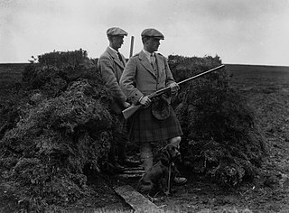
Driven grouse shooting is a field sport in the United Kingdom involving the shooting of red grouse. It is one of two forms of the sport; the other is walked-up shooting. Driven grouse shooting involves grouse being driven to fly over people with shotguns in fixed positions. In walked-up shooting the participants walk forward in a line and flush the birds as they go. Walked-up shooting is more physically demanding than a driven shoot and typically involves fewer birds being shot.

Cotherstone Moor is a Site of Special Scientific Interest in the Teesdale district in south-west County Durham, England. It is an extensive area of moorland which extends almost the entire length of Baldersdale, from the confluence of the River Balder with the Tees at Cotherstone. It runs parallel to Bowes Moor SSSI, which lies a short distance to the south.

Hexhamshire Moors is a Site of Special Scientific Interest covering an extensive area of moorland in the Wear Valley district of north-west County Durham and the Tynedale district of south-west Northumberland, England.

Moorhouse and Cross Fell is a Site of Special Scientific Interest covering an extensive area of moorland in the Wear Valley district of west County Durham and the Eden district of Cumbria, England. It is contiguous with Upper Teesdale SSSI to the east and Appleby Fells SSSI to the south. The area covered extends roughly from an arc through the villages of Gamblesby, Leadgate and Garrigill southward as far as Milburn in the west and Cow Green Reservoir in the east. It includes the whole of Cross Fell, the summit of which, at 893 metres asl, is the highest point in the Pennines and in England outside the Lake District.
Lune Forest is a Site of Special Scientific Interest covering an extensive area of moorland in the Teesdale district of west Durham, England. In the north, where it adjoins the Upper Teesdale and Appleby Fells SSSIs, it extends from Mickle Fell eastward almost as far as Harter Fell, above the hamlet of Thringarth. Its southern limit is marked by the River Balder, upstream from Balderhead Reservoir, where it shares a boundary with Cotherstone Moor SSSI to the south. Grains o' th' Beck Meadows and Close House Mine SSSIs are entirely surrounded by Lune Forest, but do not form part of it.
Muggleswick, Stanhope and Edmundbyers Commons and Blanchland Moor is a Site of Special Scientific Interest in County Durham and Northumberland, England. It consists of two separate areas, the larger—encompassing the upland areas of Muggleswick, Stanhope and Edmundbyers Commons—in the Derwentside and Wear Valley districts of north Durham, the smaller—Blanchland Moor—in the Tynedale district of south-west Northumberland.

Allendale Moors is a Site of Special Scientific Interest (SSSI) in Northumberland, England. The upland moorland ridge site is listed for its heath, flush and upland grassland which provide a habitat for a nationally important assemblage of moorland breeding birds.
Barrow Burn Meadows is a Site of Special Scientific Interest (SSSI) in north Northumberland, England. The site is a species-rich hay meadow of a sort now rare in Northumberland.
Barrow Meadow is a Site of Special Scientific Interest (SSSI) in north Northumberland, England. The site is a species-rich hay meadow of a sort now rare in Northumberland.

Bewick and Beanley Moors is the name given to a Site of Special Scientific Interest (SSSI) in north Northumberland, in the north-east of England. The moors are asserted to be of national importance by Natural England for the extent, quality and diversity of upland types including heaths, fens, wet grassland, flushes, mires and blanket bogs, together creating an extensive mosaic habitat supporting an exceptional community of amphibians. The moors are important, too, for their relict juniper woodland and scrub.

Geltsdale & Glendue Fells is a Site of Special Scientific Interest in the North Pennines, England. The site has an area of 8059 ha, partly in Cumbria and partly in Northumberland.

Whitelee Moor is nature reserve of the Northumberland Wildlife Trust, in Northumberland, England, near Carter Bar. A large part of the moor is blanket bog.
Leek Moors is a Site of Special Scientific Interest (SSSI) within Staffordshire Moorlands, England, near the villages Leek and Upper Hulme. This protected area includes the former SSSI called Oliver Hill. The site was designated because of its outstanding assemblage of upland breeding birds and the populations of golden plover and snipe that occur here. There are populations of cloudberry on Oliver Hill.

Harbottle Moors is a Site of Special Scientific Interest (SSSI) within Northumberland National Park, in Northumberland, England. It is located near the village of Alwinton. The River Coquet forms the northern border of this protected area.
Whitfield Moor, Plenmeller and Asholme Commons is a Site of Special Scientific Interest in the North Pennines in Northumberland, England. This protected area is located south of Haltwistle and includes part of the Bellister Castle estate and parts of the Williamston estate and Whitfield estate.
