
The Louisiade Archipelago is a string of ten larger volcanic islands frequently fringed by coral reefs, and 90 smaller coral islands in Papua New Guinea.

The 1932 United States House of Representatives elections were elections for the United States House of Representatives to elect members to serve in the 73rd United States Congress. They were held for the most part on November 8, 1932, while Maine held theirs on September 12. They coincided with the landslide election of President Franklin D. Roosevelt.

Papua New Guinea elects on the national level a legislature. The National Parliament has 111 members, elected for a five-year term in single-seat constituencies. Papua New Guinea has a multi-party system, with numerous parties in which no one party often has a chance of gaining power alone, and parties must work with each other to form coalition governments. The first-past-the-post voting system was previously used, but in 2002 the limited instant-runoff voting system was enacted into law and first used during the 2007 national election and 2008 local elections.

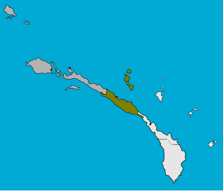
Gulf Province is a province of Papua New Guinea located on the southern coast. The provincial capital is Kerema. The 34,472 km2 province is dominated by mountains, lowland river deltas, and grassland flood plains. In Gulf Province, the Kikori, Turama, Purari, and Vailala rivers meet the Papuan Gulf. The province has the second-smallest population of all the provinces of Papua New Guinea with 106,898 inhabitants. The province shares land borders with Western Province to the west, Southern Highlands, Chimbu, and Eastern Highlands to the north, Morobe Province to the east, and Central Province to the southeast.

Southern Highlands is a province in Papua New Guinea. Its provincial capital is the town of Mendi. According to Papua New Guinea's national 2021 census, the total population of Southern Highlands province is 927,306.

East Sepik is a province in Papua New Guinea. Its capital is Wewak. East Sepik has an estimated population of 450,530 people and is 43,426 km square in size. Its density is 10.4 people per square kilometer.
Mendi, Papua New Guinea, is the provincial capital of the Southern Highlands Province, and the capital of Mendi-Munihu District. The Lai River flows by the town. It is served by Mendi Airport. The town falls under Mendi Urban LLG.

Porome, also known as Kibiri, is a Papuan language of southern Papua New Guinea.
Sentral Niu Ailan Rural LLG is a local government area in New Ireland Province, Papua New Guinea. The LLG administers the central area of the island of New Ireland especially the people of Barok, Mandak, Kuot, Notsi, and the Tabar Group. The LLG is located in Namatanai District and the LLG headquarters is Konos.
This page is a list of districts of Papua New Guinea.
Mount Hagen District is a district of the Western Highlands Province of Papua New Guinea. Its capital is Mount Hagen.
Tambul-Nebilyer District is a district of the Western Highlands Province of Papua New Guinea. Its capital is Tambul. The population of the district was 75,499 at the 2011 census. it has 3 LLG wards, they are Nebilyer Rural LLG, Mt. Giluwe Rural LLG and Lower Kaguel Rural LLG. In these district the most beautiful and the second largest mountain called Mt Giluwe is found there.
Ipiko is a Papuan language of Papua New Guinea, the most divergent of the Inland Gulf languages. Despite being spoken by only a few hundred people, language use is vigorous. It is spoken in Ipiko and Pakemuba villages, with Ipiko village being located in Amipoke ward, Baimuru Rural LLG, Kikori District, Gulf Province.
Marangis a.k.a. Watam is a Ramu language of Papua New Guinea. Like Bosmun, it shares a number of irregular plural markers with the Lower Sepik languages, supporting the proposal of a Ramu – Lower Sepik language family.
Foia Foia (Foyafoya), or Minanibai, is a Papuan language of Papua New Guinea, spoken in an area near Omati River mouth in Ikobi Kairi and Goaribari Census districts.
Gorovu is a nearly extinct Ramu language of Papua New Guinea.

General elections were held in Papua New Guinea between 24 June and 8 July 2017. The writs for the election were issued on 20 April, and candidate nominations closed on 27 April.
West Kikori Rural LLG is a local-level government (LLG) of Gulf Province, Papua New Guinea. Kiwaian languages are spoken in the LLG.
East Kikori Rural LLG is a local-level government (LLG) of Gulf Province, Papua New Guinea.
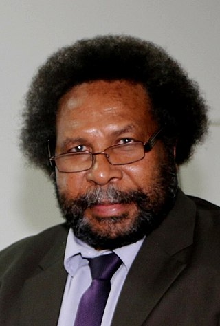
Soroi Marepo Eoe CMG is a Papua New Guinea politician. He has been a Member of the Papua New Guinea National Parliament since 2017, representing the electorate of Kikori Open. On 7 June 2019, he was appointed Minister for Foreign Affairs and Trade and held the position for five months before being replaced, and later returning to the same position on 20 December 2020 serving until 23 August 2022. He was later appointed as Minister for Provincial and Local Level Government Affairs on 24 August 2022 following the formation of the Marape-Rosso Cabinet after the 2022 National General Elections. He is the Southern Region Leader of the Pangu Pati since 11 August 2022.
