
Megara is a historic town and a municipality in West Attica, Greece. It lies in the northern section of the Isthmus of Corinth opposite the island of Salamis, which belonged to Megara in archaic times, before being taken by Athens. Megara was one of the four districts of Attica, embodied in the four mythic sons of King Pandion II, of whom Nisos was the ruler of Megara. Megara was also a trade port, its people using their ships and wealth as a way to gain leverage on armies of neighboring poleis. Megara specialized in the exportation of wool and other animal products including livestock such as horses. It possessed two harbors, Pagae to the west on the Corinthian Gulf, and Nisaea to the east on the Saronic Gulf of the Aegean Sea.

Greek National Road 8a was a toll road in the Attica, Peloponnese and West Greece regions. It connected Athens with the cities of Corinth and Patras. It was built in the 1960s as a replacement for the old National Road 8 as the major route to the Peloponnese, and bypasses most towns. The National Road 8a has gradually been upgraded to a motorway, the A8. Since April 2017, the complete length of the A8 motorway has been operational.

Agioi Theodoroi is a town and a former municipality in Corinthia, Peloponnese, Greece. Since the 2011 local government reform, it is part of the municipality Loutraki-Perachora-Agioi Theodoroi, of which it is a municipal unit. The municipal unit has an area of 98.030 km2 (37.850 sq mi).
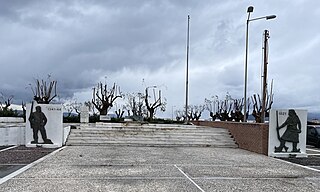
Kiato is a town in the northern part of Corinthia in the Peloponnese, Greece. It is the seat of the municipality of Sikyona. Kiato is situated on the Gulf of Corinth, near the mouth of the river Asopos. It has much tourist activity mainly in the summer. The ancient city Sicyon was located 4 km southwest of present Kiato. Kiato is 4 km northwest of Velo, 13 km southeast of Xylokastro and 18 km northwest of Corinth. The Greek National Road 8A passes southwest of the town. It had a station on the now decommissioned Piraeus-Patras railway. The new Kiato railway station is an interchange station of Proastiakos lines to Athens and to Aigio.
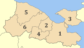
Corinthia is one of the regional units of Greece. It is part of the region of Peloponnese. It is situated around the city of Corinth, in the north-eastern part of the Peloponnese peninsula.
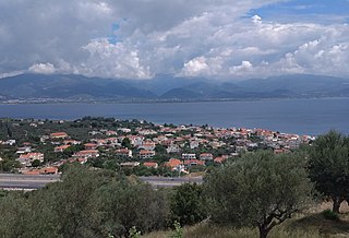
Psathopyrgos is a tourist village and community in the municipal unit of Rio in the northern part of Achaea, Greece. Psathopyrgos is located on the Gulf of Corinth, south east of Cape Drepano, the northernmost point of the Peloponnese peninsula. The village has a small pebble beach and it is known to the locals and tourists for its fish taverns and nice views of the green mountains south of the village.

Agia Varvara is a suburban town in the western part of the Athens agglomeration in Attica, Greece and a municipality in the West Athens regional unit.

Oropos is a small town and a municipality in East Attica, Greece.

Kropia is a municipality in East Attica, Greece and has a land area of 102.0 km2. The soil is very fertile and many crops are grown on it, most importantly vineyards, olives, figs, pistachios, honey and vegetables. Its population was 30,817 at the 2021 census. The seat of the municipality is in the town of Koropi. In descending order of population, its other villages are Kítsi, Agía Marína (3,765), Karellás (1,579), and Ágios Dimítrios (1,011).

Pallini is a suburban town in Greater Athens Area and a municipality in East Attica, Greece. The seat of the municipality is the town Gerakas. It is the seat of administration of the East Attica regional unit.

Anoixi is a suburb of Athens in East Attica, Greece. Since the 2011 local government reform it is part of the municipality Dionysos, of which it is a municipal unit. The municipal unit has an area of 4.582 km2.

Artemida is an Eastern suburb of Athens. Since the 2011 local government reform it is part of the municipality Spata-Artemida, of which it is a municipal unit. The municipal unit has an area of 18.653 km2.
Perachora is an inland settlement in Loutraki-Perachora-Agioi Theodoroi, Corinthia, in the region of Peloponnese in Greece. In Antiquity it was called Peiraion.

Anthousa is a suburban town in Athens East Attica regional unit, Greece. Since the 2011 local government reform it is part of the municipality Pallini, of which it is a municipal unit. The municipal unit has an area of 3.865 km2.

Nea Palatia is a community in East Attica, Greece. Since the 2011 local government reform it is part of the municipality Oropos, of which it is a community. It is part of Athens metropolitan area.

Skala Oropou is a community in East Attica, Greece, on the South Gulf of Euboea, due north of Athens city center. Since the 2011 local government reform it is part of the municipality Oropos, of which it is a community. It is part of Athens metropolitan area.
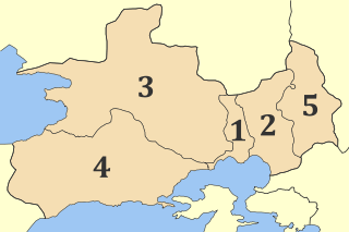
West Attica is one of the regional units of Greece. It is part of the region of Attica. The regional unit covers the western part of the agglomeration of Athens, and the area to its west.
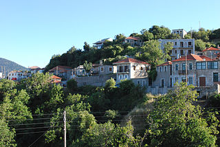
Kosmas is a mountain village and a former community in Arcadia, Peloponnese, Greece. It is considered a traditional settlement. Since the 2011 local government reform it is part of the municipality South Kynouria, of which it is a municipal unit. The municipal unit has an area of 85.220 km2. Kosmas is situated in the southeastern part of the Parnon mountains, at about 1150 m elevation, on the road from Skala (Laconia) to Leonidio. It is 13 km southwest of Leonidio, 28 km east of Sparti, 28 km northeast of Skala, 35 km south of Argos and 57 km southeast of Tripoli. Kosmas has a school, a church and a library.

Kamares is a village and a community in the east-northeastern part of Achaea, Greece. Kamares was an independent commune until 1994 when it became part of the municipality of Erineos. Erineos became part of the municipality Aigialeia in 2011. The community Kamares consists of the villages Kamares, Bouka and Pefka. Kamares is situated near the Gulf of Corinth, 9 km northwest of Aigio. The Greek National Road 8A and the railway from Patras to Corinth run through the village.

Evrotas is a municipality in the Laconia regional unit, Peloponnese, Greece. It is named after the river Eurotas. The seat of the municipality is the town Skala. The municipality has an area of 811.734 km2.


