
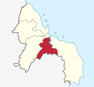
Kinondoni is one of five districts in Dar es Salaam, Tanzania, others being Temeke, Kigamboni, Ubungo and Ilala. To the east is the Indian Ocean, to the north and west the Pwani Region of Tanzania. The area of Kinondoni is 537 km2 (207 sq mi).
Temeke District is one of five district in Dar es Salaam, Tanzania, with Kinondoni to the far north of the city, and Ilala in the downtown of Dar es Salaam. To the east is the Indian Ocean and to the south and west is the coastal region of Tanzania. The 2012 Tanzania National Census reported that the population of Temeke District was 1,368,881. The area is 729 km2.

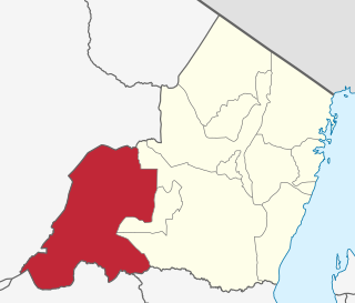
Biharamulo District is one of the eight districts of the Kagera Region of Tanzania. It is bordered to the north by Karagwe District and Muleba District, to the east and south by Geita Region, to the west by Ngara District, and to the southwest by the Kigoma Region. Its administrative seat is Biharamulo town. Biharamulo Game Reserve is located within the borders of the district.

Tarime District is one of the seven districts of the Mara Region of Tanzania, East Africa. It was previously known as the "North Mara District". Its district capital is Tarime town. It is bordered from the north to east by the Kenyan districts of Migori, Trans Mara and Kuria East and West Districts, and to the east by the Maasai Mara game reserve. To the south it is bordered across the Mara River by the Serengeti and Butiama districts, and to the west by Rorya District.
Mwanga is one of the seven districts of the Kilimanjaro Region of Tanzania. The district covers an area of 1,831 km2 (707 sq mi), It is bordered to the northeast by Kenya, to the northwest by the Moshi Rural District, to the southwest by Simanjiro District of Manyara Region, and to the south by the Same District. Its administrative seat is the town of Mwanga. The tallest peak in the district is Kindoroko at 2,100m in the North Pare Mountains that are located entirly within the district. According to the 2012 Tanzania National Census, the population of Mwanga District was 131,442.

Handeni District is one of the 11 districts of Tanga Region in Tanzania. The District covers an area of 6,534 km2 (2,523 sq mi). It is bordered to the west by the Kilindi District and the Handeni Urban District, to the north by the Korogwe District, to the east by the Pangani District, and to the south by the Pwani Region. In 2002 Kilindi District was formed out of the district. The administrative capital of the district is Mkata town. According to the 2002 Tanzania National Census, the population of the Handeni District was 248,633. According to the 2012 census, the population had increased to: 276,646.

Muheza is one of eleven administrative districts of Tanga Region in Tanzania. The District covers an area of 1,498 km2 (578 sq mi). It is bordered to the north by Mkinga District, to the east by Tanga and the Indian Ocean, to the south by the Pangani District and Handeni District, and to the west by the Korogwe District. The administrative capital of the district is Muheza town. According to the 2002 Tanzania National Census, the population of the Muheza District was 279,423. According to the 2012 Tanzania National Census, the population of Muheza District had decreased to 204,461; this is less than ten years before, because Mkinga District was created that same year. The highest point in Muheza District is Kimbo Peak at 1,063m.
Kilindi is one of eleven administrative districts of Tanga Region in Tanzania. The District covers an area of 6,444 km2 (2,488 sq mi). It is bordered to the east by the Handeni District and Handeni Town Council, to the south west by the Kiteto District and north west by the Simanjiro District of Manyara Region. Kilindi District is bordered to the south by Gairo District and Kilosa District of Morogoro Region. The district created from Handeni District in 2002. The district seat (capital) is the town of Songe. According to the 2012 census, the district has a total population of 236,833.

Rungwe is a District in Mbeya Region, Tanzania. It is bordered to the north by Mbeya Rural District, to the east by Iringa Region, to the southeast by Kyela District, to the southwest by Ileje District and to the west by Mbeya District.
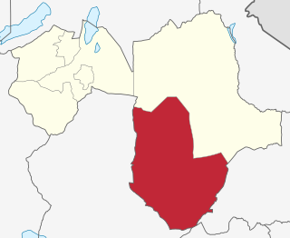
Kiteto District is one of the six districts of the Manyara Region of Tanzania. It is bordered to the north by the Simanjiro District, to the east by the Tanga Region and to the south and west by the Dodoma Region. The district headquarters are located in Kibaya.
Zanzibar West District is one of the two districts of the Zanzibar Urban/West Region of Tanzania. It is bordered to the north by the Zanzibar North Region, to the east by the Zanzibar Central/South Region, to the south by Kiwani Bay, and to the west by the Zanzibar Urban District.
Olbalbal is an administrative ward in the Ngorongoro District of the Arusha Region of Tanzania. The ward is home to the famous Olduvai Gorge. The ward covers an area of 7.893 square kilometres (3.048 sq mi) with an average elevation of 1,405 metres (4,610 ft).
Moivo is an administrative ward in the Arumeru district of the Arusha Region of Tanzania. According to the 2002 census, the ward has a total population of 20,562. The ward is the second most populous ward in the district after Sokon II.
Nduruma, is a administrative ward in Arusha Rural District in the east Arusha Region of Tanzania. It is bordered to the north by Mlangarini, to the south by Bwawani, and to the east by Kikwe ward of the Meru District. The ward covers an area of 62.72 square kilometres (24.22 sq mi) with an average elevation of 1,041 metres (3,415 ft).
Ngarenanyuki is an administrative ward in the Meru District of the Arusha Region of Tanzania. The ward is the largest ward in Meru district. It is located in far north side of the distric. According to the 2002 census, the ward has a total population of 16,988.
Nkoarisambu is an administrative ward in the Meru District of the Arusha Region of Tanzania. The ward is the least populous ward in the distric. According to the 2002 census, the ward has a total population of 6,497.
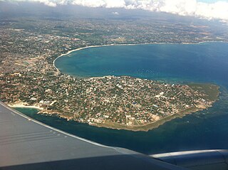
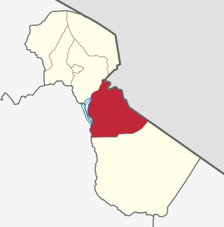
Msasani is an administrative ward in the Kinondoni District of the Dar es Salaam Region of Tanzania. The ward is located north west of Dar es Salaam central business district. According to the 2002 census, the ward has a total population of 43,457.
Mbagala is an administrative ward in the Temeke district of the Dar es Salaam Region of Tanzania. The ward lies south of the Dar es Salaam central business district. According to the 2002 census, the ward has a total population of 70,290. It is also the site of an army base, which was hit by a deadly ammunition dump explosion on April 29, 2009.
Hai Mjini is an administrative ward in Hai District of Kilimanjaro Region in Tanzania. The ward covers an area of 54 km2 (21 sq mi), and has an average elevation of 1,388 m (4,554 ft). According to the 2012 census, the ward has a total population of 34,098.

Mafia is one of the 6 districts of the Pwani Region of Tanzania. It covers Mafia Island and its associated archipelago.