
Whyjonta is a parish of Yantara County in far north west New South Wales.

Pinaroo is a remote civil parish of Poole County in far north west New South Wales, located at 29°08′04″S 141°06′55″E.
Nantomoko is a remote civil parish of Poole County in far North West New South Wales. located at 29°21′43″S 141°08′05″E.
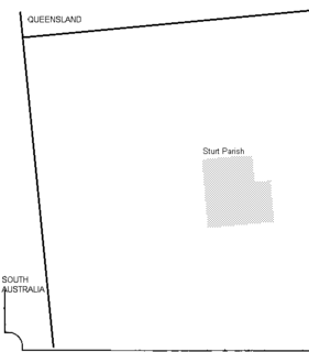
Sturt Parish is a remote civil parish of Poole County in far North West New South Wales, located at 29.433056°S 141.519722°E.
Utah Parish, New South Wales is a remote rural locality and civil parish of Evelyn County in far northwest New South Wales. located at 30°04′48″S 142°03′23″E.

Scott, New South Wales is a remote rural locality and civil parish of Evelyn County in far northwest New South Wales. located at 29°38′31″S 142°01′00″E.
Wirratcha Parish is a remote rural locality and civil parish of Evelyn County in far northwest New South Wales. located at 29°38′31″S 142°01′00″E.
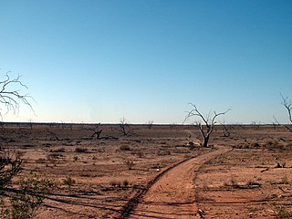
Mount Blackwood, New South Wales located at 29°48′37″S 141°31′10″E, is a remote rural locality and civil parish of Evelyn County in far northwest New South Wales. located at 30°04′42″S 142°45′50″E, east of the Silver City Highway . The geography of the parish is mostly the flat, arid landscape of the Channel Country. The parish has a Köppen climate classification of BWh.
Milring Parish is a remote rural locality and civil parish of Evelyn County in far northwest New South Wales. located at 29°54′29″S 141°40′53″E.
Coally is a remote rural locality and civil parish of Evelyn County, New South Wales in far northwest New South Wales located at 29°51′00″S 141°50′39″E.
Whitty is a remote rural locality and civil parish of Evelyn County in far northwest New South Wales. located at 30°12′34″S 141°05′06″E.
Mouloonk is a remote rural locality and civil parish of Evelyn County in far northwest New South Wales. located at 30°09′04″S 141°07′08″E.

Haynes is a remote civil parish of Evelyn County in far northwest New South Wales, located at 30°24′24″S 141°04′48″E.
Quintyambi is a remote rural locality and civil parish of Evelyn County in far northwest New South Wales. located at 30°18′40″S 141°05′05″E.
Bimpia located at 30°47′21″S 142°03′46E is a remote civil parish of Mootwingee County in far North West New South Wales.

Booraboonara located at 31°25′02″S 141°44′53″E is a remote civil parish of Mootwingee County in far North West New South Wales.
Gooruba, New South Wales, located at 30°23′56″S 142°11′53″E, is a remote civil parish of Mootwingee County in far North West New South Wales.
The Parish of Essie, New South Wales is a remote civil parish of Evelyn County, New South Wales in far northwest New South Wales, located at 29.839722°S 141.134722°E, on the border with South Australia.

Parish of Paradise, New South Wales is a remote civil parish of Evelyn County, New South Wales in far northwest New South Wales. located at 29.850000°S 141.844167°E on the border with South Australia.
Wonominta, New South Wales is a remote rural locality and civil parish of Evelyn County in far northwest New South Wales. located at 30°18′40″S 141°05′05″E.
