
The Falkland Islands are located in the South Atlantic Ocean between 51°S and 53°S on a projection of the Patagonian Shelf, part of the South American continental shelf. In ancient geological time this shelf was part of Gondwana, and around 400 million years ago split from what is now Africa and drifted westwards from it. Today the islands are subjected to the Roaring Forties, winds that shape both their geography and climate.
The Falkland Islands currently has three primary means of transport - road, sea and air. However, in 1946, when Sir Miles Clifford arrived as governor, there were no air services, no roads outside Stanley and an indifferent sea service. Sir Miles was instrumental in starting the Falkland Islands Government Air Service in December 1948. The inaugural flight involved a mercy flight from North Arm Settlement to Stanley to bring a girl with peritonitis to life-saving medical help in Stanley. There is now an international airport, a domestic airport, a number of airstrips, a growing road network and a much-improved ferry service between the two main islands.

Weddell Island is one of the Falkland Islands in the South Atlantic, lying off the southwest extremity of West Falkland. It is situated 1,545 km (960 mi) west-northwest of South Georgia Island, 1,165 km (724 mi) north of Livingston Island, 606 km (377 mi) northeast of Cape Horn, 358 km (222 mi) northeast of Isla de los Estados, and 510 km (320 mi) east of the Atlantic entrance to Magellan Strait.

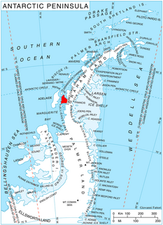
Adelaide Island is a large, mainly ice-covered island, 139 kilometres (75 nmi) long and 37 kilometres (20 nmi) wide, lying at the north side of Marguerite Bay off the west coast of the Antarctic Peninsula. The Ginger Islands lie off the southern end. Mount Bodys is the easternmost mountain on Adelaide Island, rising to over 1,220 m. The island lies within the Argentine, British and Chilean Antarctic claims.
Martin Glacier is a glacier, 3 nautical miles (6 km) wide and 9 nautical miles (17 km) long, which flows west and then northwest from the south side of Mount Lupa to the southeast corner of Rymill Bay where it joins Bertrand Ice Piedmont, on the west coast of Graham Land, Antarctica. It was first surveyed in 1936 by the British Graham Land Expedition (BGLE) under John Riddoch Rymill, and was resurveyed in 1948–1949 by the Falkland Islands Dependencies Survey. The glacier was named for James Hamilton Martin, a member of the British Australian and New Zealand Antarctic Research Expedition (1929–1931) under Sir Douglas Mawson, and first mate of the Penola during the BGLE.
North Arm is a settlement in Lafonia, the southern part of East Falkland, in the Falkland Islands, It is on the south coast, on the shore of the Bay of Harbours, and overlooks Sea Lion Island in the distance. In 2007, the population was 25 people, six of them children. It is the largest settlement on East Falkland south of Goose Green. North Arm is 90 miles (140 km) from Stanley, and it takes four and a half hours to drive there.

San Carlos Water is a bay/fjord on the west coast of East Falkland, facing onto the Falkland Sound.
Arrowsmith Peninsula is a cape about 40 miles (64 km) long on the west coast of Graham Land, west of Forel Glacier, Sharp Glacier and Lallemand Fjord, and northwest of Bourgeois Fjord, with Hanusse Bay lying to the northwest. It was surveyed by the Falkland Islands Dependencies Survey (FIDS) in 1955-58 and named for Edwin Porter Arrowsmith, Governor of the Falkland Islands.

The Argentine Sea is a marginal sea of the Atlantic Ocean adjacent to the southern tip of South America. It ranges from the mouth of the estuary of the Río de la Plata in the north to the Isla de los Estados in the south, and from the Argentine coast to the 200 meters isobath. Its width varies between 210 km in front of Mar del Plata and 850 km at the latitude of the Falkland Islands. The coastline extends for 4,725 km. To the east of the Argentine Sea extends much deeper and more extensive Argentine Basin.
Hummock Island is the largest of a group of islands in King George Bay in the Falkland Islands. It has a land area of 3.03 square kilometres (1.17 sq mi) and is about 4.0 miles (6.4 km) long in a north-west to south-east direction. Hummock Island is off the western coast of West Falkland, in a bay that leads to the estuary of the Chartres River. The highest point on the island is in the north-east and is 190 metres (620 ft). There are cliffs which often reach over 60 metres (200 ft) high.
Rabbit Island is one of the Falkland Islands in the Hummock Island group. It is near West Falkland, to its west, at the mouth of King George Bay. With a land area of 0.69 square miles (1.78 km2) it is the second largest of the three main islands in the bay, lying 2.8 miles (4.5 km) west of Hummock Island and Middle Island. It is east of the Passage Islands and south east of Split Island.

Drygalski Glacier is a broad glacier, 18 nautical miles long and 15 miles (24 km) wide at its head, which flows from Herbert Plateau southeast between Ruth Ridge and Kyustendil Ridge, and enters Solari Bay immediately north of Sentinel Nunatak on Nordenskjöld Coast, the east coast of Graham Land, Antarctica. It was discovered in 1902 by the Swedish Antarctic Expedition, under Otto Nordenskiöld, and named "Drygalski Bay" after Professor Erich von Drygalski. The feature was determined to be a glacier by the Falkland Islands Dependencies Survey in 1947.

Stonehouse Bay is a bay in Antarctica on the west side of Laubeuf Fjord, indenting the east coast of Adelaide Island between Hunt Peak and Sighing Peak. The bay is 5 nautical miles (9 km) wide. It was first sighted and surveyed in January 1909 by the French Antarctic Expedition under Jean-Baptiste Charcot. The bay was named for Bernard Stonehouse of the Falkland Islands Dependencies Survey (FIDS), a meteorologist in 1947-48 and biologist in 1949 at Stonington Island and leader of the FIDS sledge party which resurveyed the bay in 1948.

Forbes Glacier is a glacier which flows from Hemimont Plateau west into the northeast corner of Square Bay, on the west coast of Graham Land, Antarctica. It is 10 nautical miles (19 km) long, 4 nautical miles (7 km) wide in its central part, and narrows to 2 nautical miles (4 km) at its mouth. The lower reaches of the glacier were first surveyed in 1936 by the British Graham Land Expedition under John Rymill. The survey was completed in 1946–48 by the Falkland Islands Dependencies Survey who named the glacier for James David Forbes, a Scottish physicist who was noted for his pioneer works on glaciology.
Forel Glacier is a glacier 1.5 nautical miles (3 km) wide and 4 nautical miles (7 km) long, flowing southwest into Blind Bay, on the west coast of Graham Land, Antarctica. It was first roughly surveyed in 1936 by the British Graham Land Expedition under John Rymill. Its lower reaches were surveyed in 1949 by the Falkland Islands Dependencies Survey, and the glacier named by them for François-Alphonse Forel, a noted Swiss glacier physicist and author, and first President of the International Commission of Glaciers in 1894.

Tait Glacier is a glacier about 4 nautical miles (7 km) long on the southwest coast of James Ross Island, flowing southwest into Carlsson Bay. Probably first seen by Dr. Otto Nordenskjold in 1903. Surveyed by Falkland Islands Dependencies Survey (FIDS) in 1945. Named by United Kingdom Antarctic Place-Names Committee (UK-APC) for Murdo F. Tait, FIDS meteorological observer at Hope Bay in 1952 and 1953.
Matheson Glacier is a glacier 11 nautical miles (20 km) long, lying 2 nautical miles (4 km) south of Ashton Glacier, which it parallels, and flowing in an easterly direction to the west side of Lehrke Inlet, on the east coast of Palmer Land, Antarctica. It was first sighted by members of the United States Antarctic Service who explored this coast by land and from the air in December 1940, and was first charted by a joint party consisting of members of the Ronne Antarctic Research Expedition and Falkland Islands Dependencies Survey (FIDS) in 1947. The glacier was named by the FIDS for J. Matheson, a member of the FIDS at the Port Lockroy and Hope Bay bases, 1944–46.
McClary Glacier is a glacier 10 nautical miles (19 km) long and 2 nautical miles (4 km) wide on the west coast of Graham Land, Antarctica. It flows southwest along the north side of Butson Ridge into Marguerite Bay between Cape Calmette and the Debenham Islands. The glacier was first roughly surveyed by the British Graham Land Expedition, 1936–37, and resurveyed by the Falkland Islands Dependencies Survey, 1946–50. It was named by the UK Antarctic Place-Names Committee for George B. McClary, father of Nelson McClary, mate on the Port of Beaumont during the Ronne Antarctic Research Expedition, 1947–48.
Romulus Glacier is a glacier, 7 nautical miles (13 km) long and 2 nautical miles (3.7 km) wide, which flows from the north slopes of Mount Lupa westward to Rymill Bay between the Blackwall Mountains and Black Thumb, on the west coast of Graham Land. First surveyed in 1936 by the British Graham Land Expedition (BGLE) under Rymill. Resurveyed in 1948-49 by the Falkland Islands Dependencies Survey (FIDS), who so named it for its association with Remus Glacier, whose head lies near the head of this glacier.

French Harbour is the 500 m wide bay indenting for 3.1 km the west coast of Weddell Island in the Falkland Islands. It is entered 5.5 km north of Weddell Point, and centred at 51°51′03″S61°06′50″W.
