
The Pembrokeshire Coast Path, often called the Pembrokeshire Coastal Path, is a designated National Trail in Pembrokeshire, southwest Wales. Established in 1970, it is a 186-mile (299 km) long-distance walking route, mostly at cliff-top level, with a total of 35,000 feet (11,000 m) of ascent and descent. At its highest point – Pen yr afr, on Cemaes Head – it reaches a height of 574 feet (175 m), and at its lowest point – Sandy Haven crossing, near Milford Haven – it is just 6 feet (2 m) above low water. Whilst most of the coastline faces west, it offers – at varying points – coastal views in every direction of the compass.

Exmoor is loosely defined as an area of hilly open moorland in west Somerset and north Devon in South West England. It is named after the River Exe, the source of which is situated in the centre of the area, two miles north-west of Simonsbath. Exmoor is more precisely defined as the area of the former ancient royal hunting forest, also called Exmoor, which was officially surveyed 1815–1818 as 18,810 acres (7,610 ha) in extent. The moor has given its name to a National Park, which includes the Brendon Hills, the East Lyn Valley, the Vale of Porlock and 55 km (34 mi) of the Bristol Channel coast. The total area of the Exmoor National Park is 692.8 km2 (267.5 sq mi), of which 71% is in Somerset and 29% in Devon.
South Staffordshire is a local government district in Staffordshire, England. Its council is based in Codsall. Other notable settlements include Brewood, Cheslyn Hay, Coven, Essington, Featherstone, Four Ashes, Great Wyrley, Huntington, Kinver, Landywood, Penkridge, Perton, Wedge Mills, Weston-under-Lizard and Wombourne. The district covers a largely rural area lying immediately to the west and north-west of the West Midlands conurbation.

Ashwood is a small area of Staffordshire, England.

The Clent Hills lie 10 miles (16 km) south-west of Birmingham city centre in Clent, Worcestershire, England. The closest towns are Stourbridge and Halesowen, both in the West Midlands conurbation. The Clent Hills range consists of, in order from north-west to south-east: Wychbury Hill, Clent Hill, and Walton Hill. The north Worcestershire range of hills continues eastwards to include Romsley Hill, Waseley Hills and the Lickey Hills.

Kinver Edge is a high heath and woodland escarpment just west of Kinver, about four miles west of Stourbridge, and four miles north of Kidderminster, and is on the border between Worcestershire and Staffordshire, England. It is now owned by the National Trust.
The Tarka Trail is a series of footpaths and cyclepaths around north Devon, England that follow the route taken by the fictional Tarka the Otter in the book of that name. It covers a total of 180 miles (290 km) in a figure-of-eight route, centred on Barnstaple.
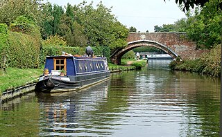
Kinver is a large village in the District of South Staffordshire in Staffordshire, England. It is in the far south-west of the county, at the end of the narrow finger of land surrounded by the counties of Shropshire, Worcestershire and the West Midlands. The nearest towns are Stourbridge, West Midlands, Kidderminster in Worcestershire and Bridgnorth, Shropshire. The Staffordshire and Worcestershire Canal passes through, running close to the course of the meandering River Stour. According to the 2011 census Kinver ward had a population of 7,225.

Walking is a popular recreational activity in London, despite traffic congestion. There are many streets that provide interesting walks, especially within historic central London, In addition there are attractive commons, parks, canals, and disused railway tracks that provide space for walks. This includes Wimbledon Common, Epping Forest, Hampstead Heath, and the eight Royal Parks: Hyde Park, Regent's Park, Richmond Park, etc. In recent years access to canals and rivers, including the Regent's Canal, and the River Thames has been greatly improved, and as well a number of long-distance walking routes have been created that link green spaces.

At 316 metres (1,037 ft) above sea level, Walton Hill is the highest point in the range of hills in northern Worcestershire known as the Clent Hills. It is the highest point for 21 miles (34 km) in all directions, and as such commands an excellent panorama. Its neighbours include Clent Hill, Wychbury Hill, Calcot Hill, and Romsley Hill.

The Staffordshire Way is a long-distance walk in Staffordshire, England. The path links with the Cheshire Gritstone Trail, the Heart of England Way and the North Worcestershire Path.

Lamentation Mountain, or Mount Lamentation, 720 feet (220 m), is a traprock mountain located 2.5 miles (4.0 km) north of Meriden, Connecticut. It is part of the narrow, linear Metacomet Ridge that extends from Long Island Sound near New Haven, Connecticut, north through the Connecticut River Valley of Massachusetts to the Vermont border. Lamentation Mountain is known for its scenic vistas, extensive cliff faces, unique microclimate ecosystems, and rare plant communities. It rises steeply 550 feet (170 m) above the city of Meriden to the south with west-facing cliffs of 200 feet (61 m) or more. The cliff line, described by the Connecticut Forest and Park Association as "perhaps the most scenic traprock ridge walk in the state" is a prominent landscape feature visible for miles. The mountain is traversed by the 50-mile (80 km) Mattabesett Trail.
Kingsford is a large hamlet in Worcestershire, England.

The Worcestershire Way is a waymarked long-distance trail within the county of Worcestershire, England. It runs 31 miles (50 km) from Bewdley to Great Malvern.

The North Worcestershire Path is a waymarked long-distance trail within the historic county of Worcestershire in England. It runs 37 miles (60 km) from Bewdley to Major's Green, Birmingham.
Macclesfield Forest is an area of woodland, predominantly conifer plantation, around 3 mi (5 km) south east of Macclesfield in the civil parish of Macclesfield Forest and Wildboarclough, in Cheshire, England.

The Colne Valley Regional Park is 43 square miles (110 km2) of parks, green spaces and reservoirs alongside the often multi-channel River Colne and parallel Grand Union Canal, mainly in Hertfordshire and Buckinghamshire, with parts in the London Borough of Hillingdon, Berkshire and a small area in Surrey.

Highgate Common is a Staffordshire Wildlife Trust reserve containing a mix of heathland and woodland. It is about 116 hectares or 286 acres in size. The common is a popular leisure destination and a Site of Special Scientific Interest, located in Southern Staffordshire, England.

Drakelow is a hamlet in Worcestershire, England. It is one of the ancient townships of the manor of Wolverley, whose extent was similar to that of the modern civil parish of Wolverley & Cookley. It is located approximately 1 mile (1.6 km) northwest of Wolverley and the same distance southwest of Blakeshall.

The Peak District Boundary Walk is a circular 190-mile (310 km) walking trail, starting and finishing at Buxton and broadly following the boundary of the Peak District, Britain's first national park. The route was developed by the Friends of the Peak District and was launched on 17 June 2017.

