| Kingsford | |
|---|---|
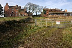 Castle Hill Farm | |
 Kingsford Location within Worcestershire | |
| OS grid reference | SO822816 |
| Civil parish |
|
| District | |
| Shire county | |
| Region | |
| Country | England |
| Sovereign state | United Kingdom |
| Post town | KIDDERMINSTER |
| Postcode district | DY11 |
| Police | West Mercia |
| Fire | Hereford and Worcester |
| Ambulance | West Midlands |
| UK Parliament | |
Kingsford is a large hamlet in Worcestershire, England.