The Norfolk Wildlife Trust (NWT) is one of 46 wildlife trusts covering Great Britain, Northern Ireland, Isle of Man and Alderney. Founded in 1926, it is the oldest of all the trusts. It has over 35,500 members and eight local groups and it manages more than fifty nature reserves and other protected sites. It also gives conservation advice to individuals and organisations, provides educational services to young people on field trips and organises entertainment and information events at nature reserves. The NWT reserves include twenty-six Sites of Special Scientific Interests, nine national nature reserves, twelve Nature Conservation Review sites, sixteen Special Areas of Conservation, twelve Special Protection Areas, eleven Ramsar sites, two local nature reserves, four Geological Conservation Review sites and five which are in Areas of Outstanding Natural Beauty.
Christchurch is a town and civil parish on the south coast of Dorset, England. The parish had a population of 31,372 in 2021. It adjoins Bournemouth to the west, with the New Forest to the east. Part of the historic county of Hampshire, Christchurch was a borough within the administrative county of Dorset from 1974 until 2019, when it became part of the new Bournemouth, Christchurch and Poole unitary authority.

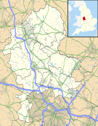
Stafford is a market town and the county town of Staffordshire, England. It is located about 15 miles (24 km) south of Stoke-on-Trent, 15 miles (24 km) north of Wolverhampton, and 24 miles (39 km) northwest of Birmingham. The town had a population of 71,673 in 2021, and is the main settlement within the larger Borough of Stafford, which had a population of 136,837 in 2021.

Pevensey is a village and civil parish in the Wealden district of East Sussex, England. The main village is located five miles (8 km) north-east of Eastbourne, one mile (1.6 km) inland from Pevensey Bay. The settlement of Pevensey Bay forms part of the parish. It was here that William the Conqueror made the landing in his invasion of England in 1066 after crossing the English Channel from Normandy.

Thornaby-on-Tees, commonly referred to as Thornaby, is a town and civil parish on the River Tees's southern bank. It is in the Borough of Stockton-on-Tees, North Yorkshire, England. The parish had a population of 24,741 at the 2011 census, in the Teesside built-up area.
Hackney Marshes is an area of open space in London's Lower Lea Valley, lying on the western bank of the River Lea. It takes its name from its position on the eastern boundary of Hackney, the principal part of the London Borough of Hackney, and from its origin as an area of true marsh.
Langstone Harbour is a 2,085.4-hectare (5,153-acre) biological Site of Special Scientific Interest in Hampshire. It is an inlet of the English Channel in Hampshire, sandwiched between Portsea Island to the south and west, Hayling Island to the south and east, and Langstone to the north. It is part of the Ramsar site of Langstone and Chichester Harbour Special Protection Area and Nature Conservation Review site. Parts are Special Areas of Conservation, or Local Nature Reserves, and some areas by the Hampshire and Isle of Wight Wildlife Trust.

RSPB Dearne Valley Old Moor is an 89-hectare (220-acre) wetlands nature reserve in the Dearne Valley near Barnsley, South Yorkshire, run by the Royal Society for the Protection of Birds (RSPB). It lies on the junction of the A633 and A6195 roads and is bordered by the Trans Pennine Trail long-distance path. Following the end of coal mining locally, the Dearne Valley had become a derelict post-industrial area, and the removal of soil to cover an adjacent polluted site enabled the creation of the wetlands at Old Moor.

Rainham Marshes is an RSPB nature reserve in the east of London, adjacent to the Thames Estuary in Purfleet, Thurrock and the London Borough of Havering.

Moses Gate Country Park, part of which is also known as Crompton Lodges, is a 750 acre site situated at Moses Gate in the Croal and Irwell Valleys 3 miles (4.8 km) south of Bolton town centre on the A6053 road which connects Farnworth to Little Lever. It is a Local Nature Reserve.

Epsom Common is a 177.4-hectare (438-acre) Local Nature Reserve in Epsom, Surrey, England. It is owned and managed by Epsom and Ewell Borough Council. It is part of Epsom and Ashtead Commons, a Site of Special Scientific Interest.

Ruislip Woods is a Site of Special Scientific Interest and national nature reserve covering 726 acres (294 ha) in Ruislip in the London Borough of Hillingdon. The woods became London's first national nature reserve in May 1997. Ruislip Local Nature Reserve at TQ 090 899 is part of the national nature reserve.
Aberbargoed Grasslands is a Site of Special Scientific Interest in the Rhymney Valley in Mid & South Glamorgan, South Wales. The area was designated a national nature reserve in 2012 largely due to its population of marsh fritillary butterflies. It is managed by Caerphilly County Borough.

Farlington Marshes is a 119.7-hectare (296-acre) Local Nature Reserve in Portsmouth in Hampshire. It is owned by Portsmouth City Council and managed by Hampshire and Isle of Wight Wildlife Trust. It is part of Langstone Harbour, which is a Site of Special Scientific Interest and a Nature Conservation Review site, Grade I. It is also part of Solent Maritime Special Area of Conservation and of Chichester and Langstone Harbours Ramsar site and Special Protection Area.

Singlers Marsh is a 6.3 hectare Local Nature Reserve in Welwyn in Hertfordshire It is owned and managed by Welwyn Hatfield Borough Council.
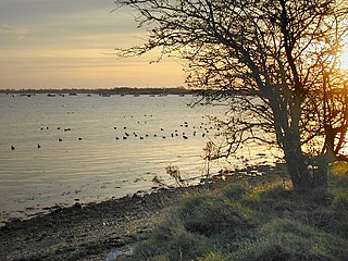
Astonfields Balancing Lakes is a local nature reserve on the north-eastern edge of Stafford, in Staffordshire, England.

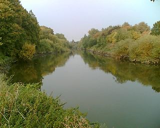
Stone Meadows is a local nature reserve adjacent to Stone, in Staffordshire, England. There are three separate meadows by the River Trent. Goodall Meadow and Southern Meadow are reserves of Stafford Borough Council; Crown Meadow is a reserve of Stone Town Council.