
Brierley is a town and former civil parish in the Metropolitan Borough of Barnsley in South Yorkshire, England. The civil parish was abolished in 2016. The settlement is tightly clustered and green buffered on a modest escarpment close to the border with West Yorkshire, it is almost wholly in population south of the A628 road, and is less than 2 miles (3 km) to the south west of Hemsworth.
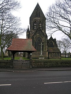
Carlton is a village in the Metropolitan Borough of Barnsley in South Yorkshire, England. It is situated between the villages of Athersley and Royston. The village is split in two with one half in the Monk Bretton ward and the rest in the Royston ward of the Barnsley MBC. It was built up on coking and coal mining industries and now has one of the largest industrial estates within the surrounding area. In the industrial estate lies a glass recycling plant, called Rexam. To its east stands the Mr Kipling cake factory, owned by Premier Foods.
Gawber is an area of Barnsley in South Yorkshire, England. The area falls within the Darton West ward of the Barnsley MBC. There is a primary school, Gawber Primary School, a preschool, Gawber Pre-School, and a church, St Thomas.
Wilthorpe is an area of Barnsley in South Yorkshire, England.

Ingleton is a village and civil parish in County Durham, England. The population of the parish as taken at the 2011 census was 420. It is situated about eight miles to the west of Darlington, and a short distance from the villages of Langton, Hilton and Killerby. The Church of St John the Evangelist in Ingleton was built in 1843 by Ignatius Bonomi and J.A. Cory., and is a Grade II listed building.

The Islington Branch Canal was a short canal branch at Ancoats in north-west England, which joined the main line of the Ashton Canal between locks 1 and 2.

Skidby is a small village and civil parish in Yorkshire Wolds of the East Riding of Yorkshire, England. It is situated about 6 miles (10 km) north-west of Hull city centre, 2.2 miles (3.5 km) west of Cottingham and 5 miles (8 km) south of Beverley.

Denton Holme is an inner city district in Carlisle, Cumbria, England. The population of this ward was 6,383 taken at the 2011 census.

Ingrow is a suburb of Keighley, West Yorkshire, England that lies on the River Worth. The name Ingrow comes from Old Scandinavian which means 'corner of land in the meadow.' The suburb is located on the A629 road and is 0.93 miles (1.5 km) south west of Keighley town centre.
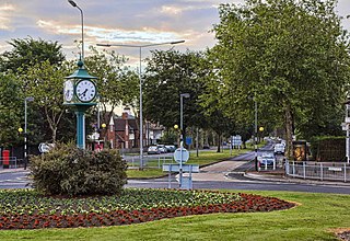
Willerby is a village and civil parish located on the western outskirts of the city of Kingston upon Hull in the East Riding of Yorkshire, England.

Middlecliffe is a small hamlet in South Yorkshire, England. It straddles the road between Darfield and Great Houghton, close to Barnsley, where Middlecliff Lane joins the B6273 road. The hamlet falls within the Darfield Ward of Barnsley MBC. It is mostly a collection of current and former council houses, small corner shop, a Working Mans Club and a sports ground. Middlecliffe is the birthplace of footballer Wilf Copping, who played for Leeds United, Arsenal and was capped 20 times for England.
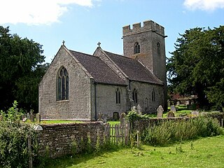
Thruxton is a small rural village and civil parish in Herefordshire, England. It is located within the historic area of Archenfield, near the Welsh border and the city of Hereford. The village lies west of the A465 road and just south of the B4348 road between Kingstone and Much Dewchurch.

Newland is a suburb of Kingston upon Hull, East Riding of Yorkshire, England, in the north-west of the city, a former village on the Hull to Beverley turnpike.
Marfleet is an area of Kingston upon Hull, East Riding of Yorkshire, England, in the east of the city, near King George Dock.
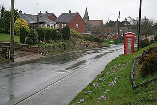
Kingstone is a village and civil parish within the English county of Staffordshire.

Tregidden is a hamlet south of Manaccan in Cornwall, England, United Kingdom. A little further south is Tregidden Farm. Tregidden is located in the parish of St Martin-in-Meneage and also partly in the parish of Manaccan.

Wilmington is an industrial area east of the River Hull in Kingston upon Hull, England.

Locke Park is a 47-acre public open space and one of the largest outdoor green spaces in the Borough of Barnsley, South Yorkshire, England.
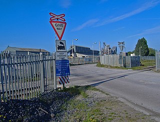
Dairycoates is an area of Kingston upon Hull, East Riding of Yorkshire, England, a former hamlet.

St Botolph's Church is a church building in Ruxley, in the London Borough of Bromley, southest London, England. It was constructed in the thirteenth century and dedicted to Botwulf of Thorney. St Botolph's was used as a church for around 300 years but was deconsecrated in 1557. The church was then used a farm building for over 400 years and the remains of an oast house are still adjacent to it. In the 1960s archaeological work was carried out on the site and found evidence of an older wooden building, suggesting there may have been an older Saxon church in the same location. Today the church is a Grade II listed building and a scheduled ancient monument on the grounds of Ruxley Manor Garden Centre, although many features are still intact, the church is in disrepair and English Heritage have agreed to pay a grant to help preserve the building.


